Embudo New Mexico Stream Gauging Station
36 12 18.4 N, 105 57 49.2 W
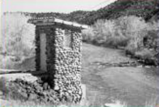 Embudo, NM Stream Gauging System
The stream gauging system at Embudo, New Mexico, the first of its kind undertaken, led to the development of techniques that have been used extensively to collect essential data for water resources projects, land use, and urban planning.
A tiny village on the Rio Grande River in northern New Mexico became the training center for the first American hydrographers and provided the first stream-gauging operations of the U.S. Geological Survey. To plan any water system, it is necessary to know the amount of water flowing in the stream or river at all times - including low, normal, and flood conditions.
To create streamflow measurement techniques, engineers designed gauging equipment and brought hydrographers to Embudo to learn to use these tools. The activities performed at Embudo led to the gauging of many of the nation's waterways, providing nationally consistent, prescribed standards for the scientific evaluation of surface-water resources and crucial data for land use and urban planning decisions.
Facts
- To measure their first section of the Rio Grande, engineers built a raft, using four empty barrels for floats, and stretched a rope across the river to secure the raft for soundings and velocity measurements.
- Since no current meters were available, the engineers initially designed various float measurement tools. Later, levels were run along the river to determine its slope and formulas were used to compute the discharge.
- Each day a student would gather meteorological data. He would take barometer readings each hour, take the temperature of the river twice and day, and determine the amount of water evaporation by checking the level in the cook's bread pan.