
United States-Canadian Boundary Survey
Yukon Territory and Maine to Washington to
Alaska
44° 49’ 34” N, 66° 56’ 00” W to
69° 38’ 48” N, 141° 00’ 00” W
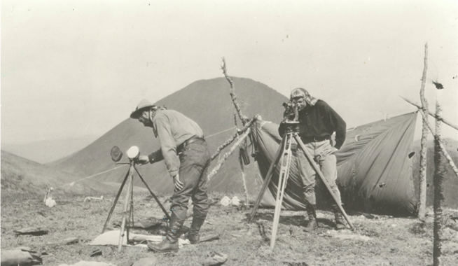
The US/Canadian boundary, stretching between the Atlantic and the Pacific Oceans and north to the Beaufort Sea, is the longest in the world at 5525 miles (8892 km). Nine formal treaties and many field survey projects established the boundary over the course of 131 years between 1794 and 1925. This was the first instance of a boundary drawn first on paper then traced on the ground. Surveyors developed new methods to improve accuracy and accelerate work in regions of harsh climate and topography.
The many geographical and logistical challenges surveyors overcame included:
• Identifying the St. Croix River in 1798 by discovering remains of Samuel de Champlain’s 1604 settlement
• Clearing the line through the Maine/New Brunswick forest
• Determining the line from the northwesternmost point of Lake of the Woods to the 49th Parallel, through a mixture of forest and muskeg
• Conducting the survey through the extremely remote and rugged terrain of the Cascade and Rocky Mountains
The Alaska Panhandle was the most challenging of the boundary survey. Access to the border corridor was usually by treacherous rivers susceptible to flash flooding. The season for field work was short and weather was unpredictable, at times delaying work for weeks. A global mountaineering challenge to this day, Mt. St. Elias, served as the hinge point between the Alaska Panhandle segment and the 141st Meridian.
The Boundary Surveys adopted the Talcott/Horrebow Method and the zenith telescope to accurately and efficiently determine latitude. Celestial observations initially supported the accurate determination of local time for longitudinal observations. By the time of the Alaska/Yukon boundary survey, accurate time signals could be received from southern astronomical observatories by telegraph. “Phototopography,” an early form of photogrammetry, developed for surveys for the Canadian Pacific Railway through the Rocky Mountains, was adopted to mitigate the challenging terrain and typically poor weather conditions on the Alaska Panhandle.
The accuracy of the boundary surveys is remarkable given the limitations of the available technology. This is demonstrated by the decision to locate the Grand Coulee Dam by triangulation using the 49th parallel monuments. Longitudinal observations made on the Alaska/Yukon boundary in the 1880s were shown to be within 240 ft (73 m) of the 141st Meridian.
Politicians completely ignored long-existing tribal boundaries when negotiating the location of the boundary. The border beneficially demarcated the westward-expanding settlements that enriched the growth of the United States and Canada, but wreaked harm on the Indigenous cultures. In contrast, the surveyors treated indigenous peoples with respect to avoid hostile confrontations, often employing them to take advantage of their well-developed guiding and packing skills.
Surveyors of the United States, Great Britain, and Canada displayed at all times a remarkable spirit of cooperation.
References
Baker, Marcus, Survey of the Northwestern Boundary of the United States, 1857-1861. United States Geological Survey, Government Printing Office, Washington, 1900.
Baldwin, Asa C., Photographs Collection 1909-1942. Alaska State Library Historical Collections
Carroll, Francis M., A Good and Wise Measure: The Search for the Canadian-American Boundary, 1783-1842. Toronto: University of Toronto Press, 2001.
Green, Lewis, The Boundary Hunters: Surveying the 141st Meridian and the Alaska Panhandle, Vancouver: University of British Columbia Press, 1982.
International Boundary Commission (IBC), Joint Reports upon the Survey and Demarcation of the Boundary between the United States and Canada... Washington D.C.: United States Government Printing Office, 1916, 1918, 1921, 1924, 1931, 1934, 1937, 1952