By Sarah Derouin, Ph.D.
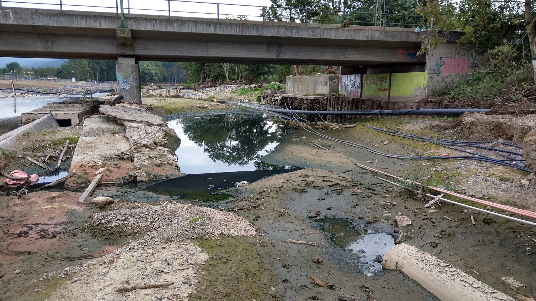
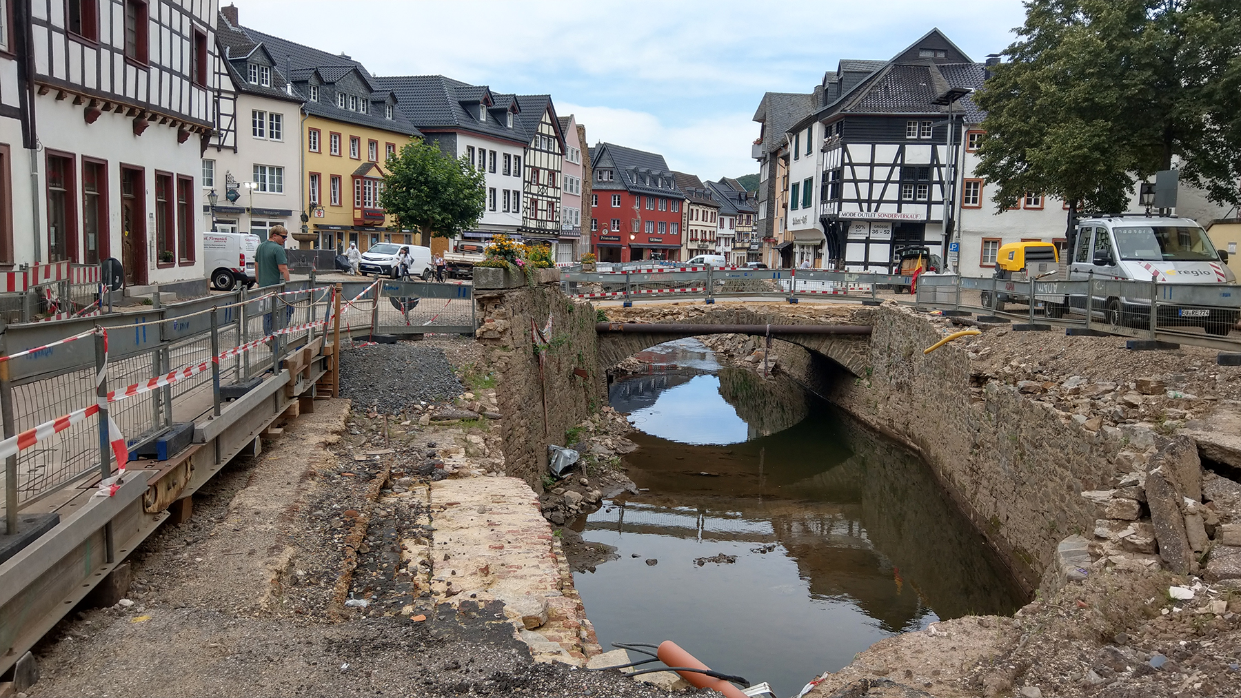
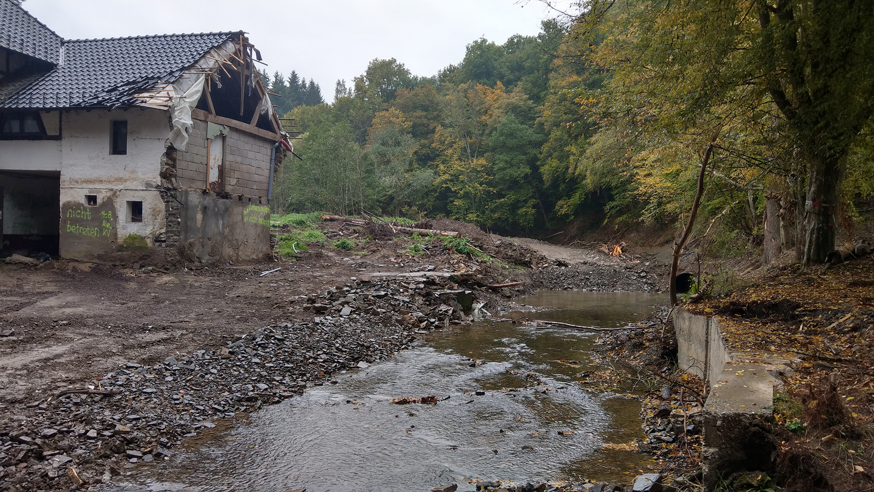
For three days in July 2021, a weather system stalled over the Eifel mountains in Germany and Belgium dropping up to 250 mm of rain. The influx of water quickly morphed into a flash flooding event, inundating mountain valleys.
The Ahr Valley in Germany is a popular destination for wine and tourism. Villages crop up within the valley, nestled near the riverbanks. During the 2021 event, floodwaters ripped through the villages, wiping out bridges, damaging buildings, and depositing mud and debris in streets and homes. In the Ahr Valley alone, 134 people were killed.
Alpine flooding is a real concern in European countries — about 10% of Europe is made of narrow upland valleys. While flooding isn’t a new hazard, there is concern that climate change may usher in more frequent, slow-moving weather systems like the one that stalled in 2021.
Predicting floods often depends on measuring water height with stream gauges. But for sudden and profound flooding events, gauging stations can be drowned early on, leaving nearby residents and city managers in the dark.
In a new paper, “A Seismic Approach to Flood Detection and Characterization in Upland Catchments,” published last month in Geophysical Research Letters, researchers looked at an alternative to stream measurements during floods. They turned to a seismic monitoring instrument, or seismometer, to reconstruct the signatures of the flood — not just the height of the water but the velocity, amount of sediment and debris the water was carrying, and the path of the flood through the valley.
These seismic signatures can be modeled to create a “footprint” of a flood. The researchers note that by using seismic monitoring for flooding events, downstream cities can get real-time updates on the nature of floods and information on evacuation timelines.
Seismic stations can outlast stream gauges
During the historic flood of the Eifel mountain region, Michael Dietze, Ph.D., a postdoctoral researcher and geographer at Germany’s University of Göttingen and the German Research Center for Geosciences in Potsdam, Germany, was standing in the rain. He and his students were on a field trip looking at the geology of the region.
It wasn’t until they were home watching the news that they saw the magnitude of the flooding. Wanting to see the details, Dietze got online to look at the stream gauges. These gauges are used to measure water heights but are susceptible to damage because they sit at the hazardous channel. “Many gauges drown early on” in a flood, he says. In contrast, “seismic instruments sit at a safe distance, hundreds of meters away.” He has been working with colleagues to use seismometers to characterize flooding to collect near real-time information on the behavior of rivers.
The team found a seismometer in the Ahr River catchment, near Ahrweiler. While seismometers do not give direct measurements of a flood, processing the data can give a robust, useful, and timely picture of one. “We've developed algorithms that basically turn the seismic data stream into a time series of discharge, water level, and debris transport,” says Dietze.
Seismic data allow them to “see” a lot of processes that simple stream gauges cannot capture. For example, the Earth’s surface actually tilts toward the flood from the weight of the water, allowing the researchers to detect the tilting and track the flood as it winds down the valley. They can also convert seismic amplitudes into flood velocities and determine how much debris is being carried downstream.
They found the Ahr River was flowing at about 1.1 m/second, the equivalent of an average walking pace. They also saw pulses of the flood, where water velocities in the river would slow as bridges acted much like dams, followed by a burst of flooding when the water broke free.
“This would have been precious information for all the downstream villages,” says Dietze. Time is of the essence in flood hazards. Based on other work on European catchments, a 12-hour warning time can lead to a 65% reduction in risk, while a six-hour lead time can reduce risk by half.
Gillian Beck, a certified floodplain manager in Florida and owner of Dancing Waters Consulting, based in Venice, Florida, knows all about the value of lead time with flood mitigation. “If you know that certain rivers will flood their banks, it gives you time to mitigate,” says Beck, who was not affiliated with the project. The more lead time, the better buffer you have to prep houses and businesses and trigger flood mitigation measures.
Beck says the researchers’ use of seismic sensor data was an interesting and clever approach to flood monitoring. “They considered that you could use that ground movement because, yes, the water moving over that ground is going to show somewhere,” she says.
“I liked the fact that they state that there is a sweet spot,” says Beck. “You can't have (a seismometer) too close, you can’t have it too far — because there are other factors that influence the data that you get.” Beck echoes the researchers’ view that future work is needed to modify and refine their findings and would like to see a follow-up study.
Expanding the test sites for seismic flood monitoring
Dietze points out that seismic monitoring can be an inexpensive way to observe many catchments. “Cheap stations are (about) $1,000-$3,000,” says Dietze, adding that citizen-science grade Raspberry Shake seismographs and infrasound monitors, for example, are about $500. The researchers plan on installing more seismometers in Ahr Valley and other comparable valleys to see how robust their method can be for flood monitoring. They also hope to tap into citizen-science efforts and get even more information.
Dietze says that using seismometers for flood monitoring could be useful in many regions. He explains that interested parties can set up seismometers in many types of catchments, collect data, and fine-tune the measurements for their unique setting. “You don't have to wait for an extreme flood — you can simply monitor a river that's running, and you need some minor floods to calibrate this model,” he says. “So it's site specific, but it's also generic.”
Beck would like to see if the method works in different settings, particularly in landscapes other than mountainous valleys. “I’m in flat, swampland Florida, but the application is still there because it’s still ground movement,” she says.
She recommends reaching out to communities in different terrains and testing how the system can help in their early warning efforts and flood planning. “If the authors wanted to reach out to those communities, they should consider reaching out to the floodplain management community as well as the engineering community,” she says. “Floodplain managers would want to follow up on this.”