By Robert L. Reid
After a series of delays and missteps, Hawaii’s first passenger rail system moves ahead.
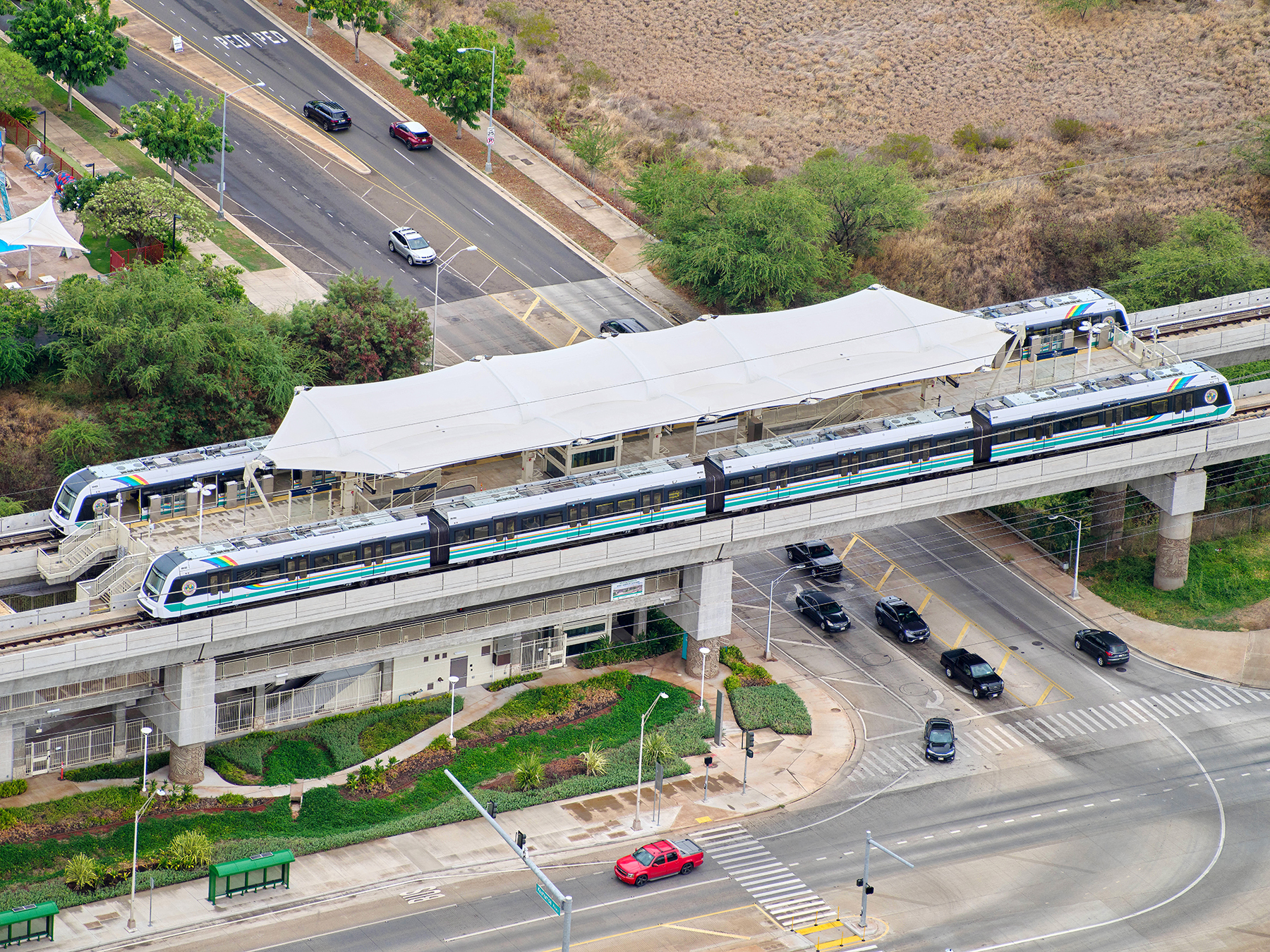
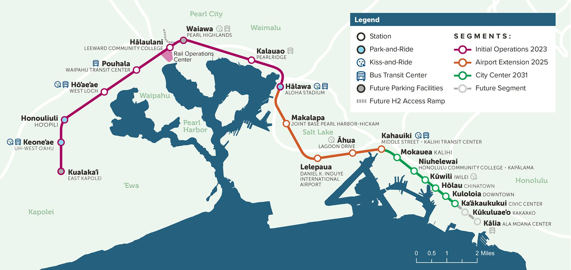
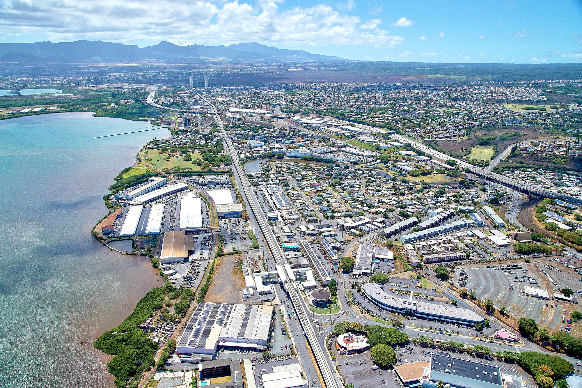
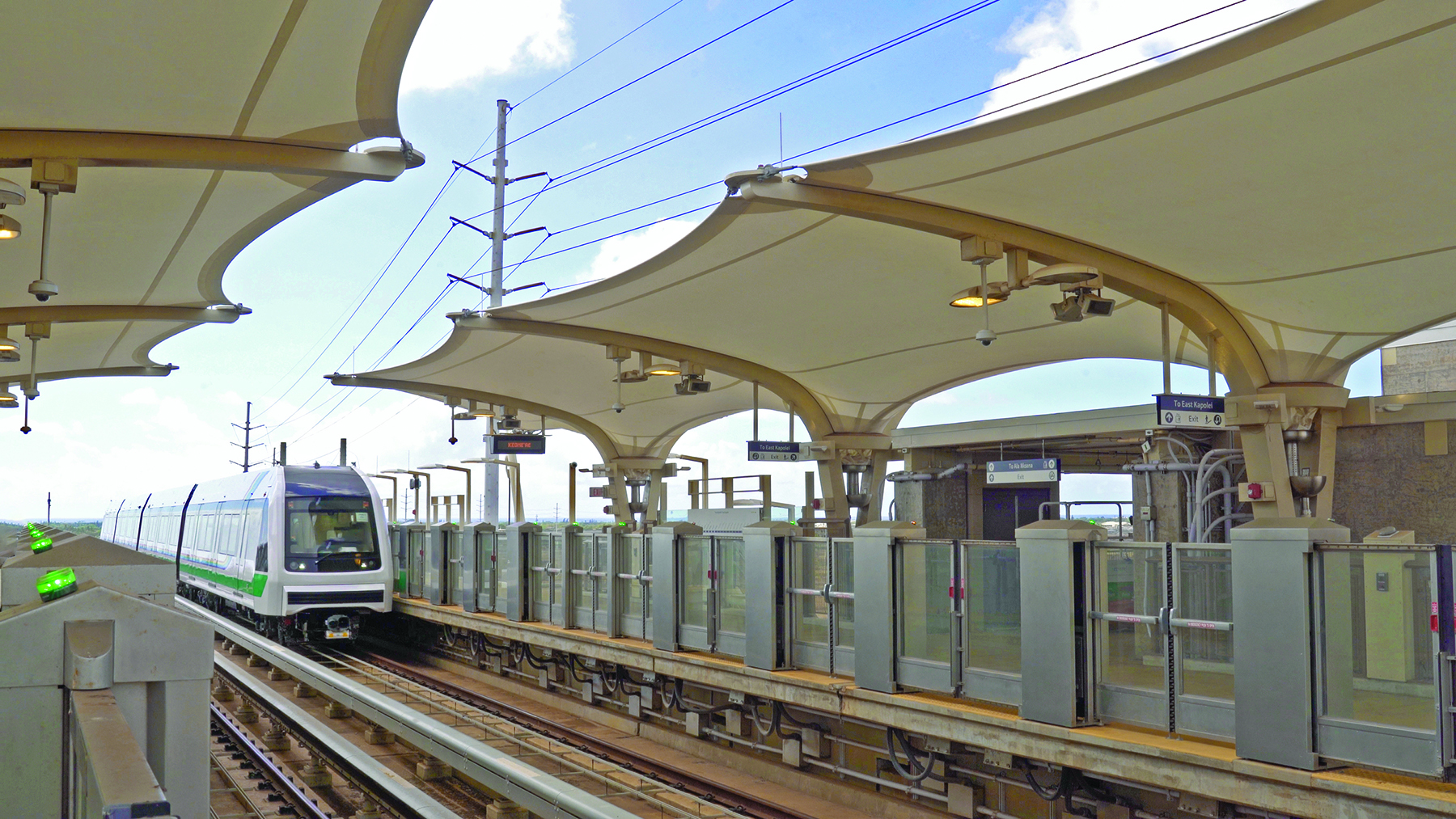
The first segment of the elevated and automated system, dubbed Skyline, opened on the island of Oahu in June over a roughly 11 mi long route to the west of Honolulu that features nine stations, says Matthew Scanlon, P.E., the director of design and construction at the Honolulu Authority for Rapid Transportation. This segment extends from East Kapolei to Aloha Stadium in the western Honolulu suburb of Halawa. The Skyline route mostly follows existing roadway rights of way, Scanlon adds.
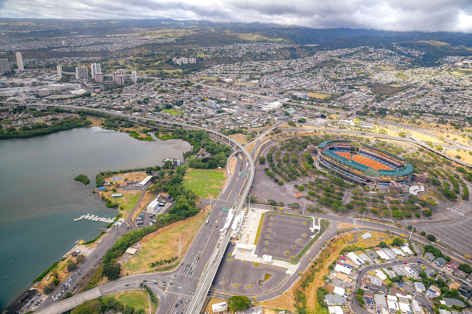
A second segment, scheduled to open in 2025 with four more stations, will extend Skyline service to Daniel K. Inouye International Airport and on through to the Middle Street-Kalihi Transit Center. A third and final segment is expected by 2031 and will pass through Honolulu itself with six additional stations, ending at the civic center.
Kiewit was the main contractor on the first segment of the Skyline project. HDR served as the prime consultant with Jacobs as the general engineering consultant, Stantec as the construction management consultant, and Lea+Elliott as the core systems consultant.
Truncated transit
The project originally included one additional mile of Skyline tracks on the eastern end of the line and two more stations, terminating at Honolulu’s Ala Moana Center. But those plans had to be scaled back because years of turmoil, cost overruns, and missed deadlines had threatened federal funding for the project, Scanlon says. Consequently, the Federal Transit Authority required HART to develop a series of so-called recovery plans — the third of which was accepted by the FTA in September 2022, truncating the scope of the Skyline project but freeing up the remaining $744 million in federal funding from HART’s original Full Funding Grant Agreement with the federal agency.
HART remains committed to constructing the final mile and last two stations on the line but will have to do so without federal funding, Scanlon says.
Scanlon himself worked on the Skyline project from 2012 to 2015 before leaving and then returning in 2021. He credits the completion of Skyline’s first segment and the reinvigorated effort for the second and third segments to new leadership at HART — especially Lori M.K. Kahikina, P.E., the authority’s executive director and CEO. New political leadership in the city and county of Honolulu was also instrumental, including the election of Rick Blangiardi as mayor of Honolulu in 2020; Blangiardi came into office with a commitment to turn the project around, Scanlon adds.
Challenging conditions
Skyline’s problems stemmed, in part, from poor initial planning, Scanlon says, as well as the fact that because it is the first rail project of its type in Hawaii there was “not a lot of institutional knowledge on island about how to build a complex capital program of this nature.”
But various site challenges also had to be overcome.
The elevated guideway measures approximately 30 ft wide to accommodate two sets of tracks. Constructed in precast concrete segments, the guideway is supported on cast-in-place concrete piers founded on cast-in-place, drilled shafts that vary in depth, depending on specific geotechnical conditions along the line. These foundation elements range in depth from roughly 30 ft to 357 ft, which is considered the deepest cast-in-place shaft in the world, Scanlon says. That especially deep shaft was constructed underneath one of the stations on the second segment of the line, for which much of the civil infrastructure work has already been completed, Scanlon adds.
In addition to varying soil conditions, the project also had to contend with somewhat unpredictable and changeable groundwater. “We deal with a lot of tidal influence,” Scanlon explains. “There’s times where we open up the ground and it’s dry at low tide but wet at high tide.” So the project also relied on extensive dewatering and jet grouting of the foundation shafts.
Utility issues
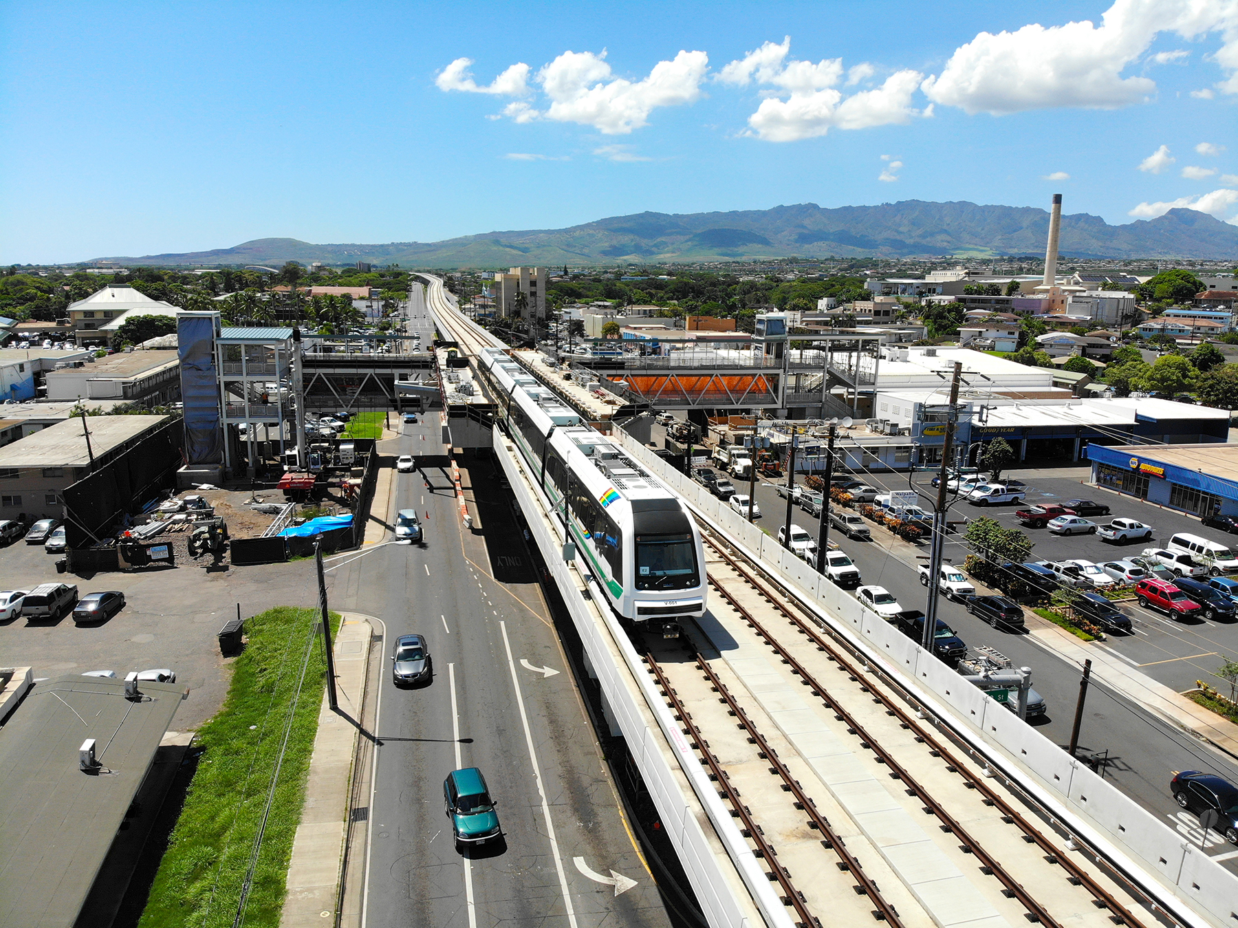
Above- and below-ground utilities also caused continuing issues. Along Dillingham Boulevard, east of the airport, a series of overhead electric lines on both sides of the street were going to be relocated underground to accommodate the planned guideway in the median of the roadway — an expensive proposition, Scanlon notes. Fortunately, the design team determined that relocating the guideway itself to the Mauka, or mountain, side of the route would mean the Makai, or ocean, side of the electric lines could stay in place, saving time and money for the project.
Elsewhere, poor or nonexistent documentation of underground utilities caused ongoing headaches. Even when as-built plans were available and thousands of test boreholes were drilled, the actual utilities only rarely turned out to be where they were expected, Scanlon notes. Consequently, HART is assuming the risks and taking charge of the utility work to “clear the path” for the design-build contractors who are constructing the guideways and piers.
Other challenges on the project include the need in some locations to erect the guideways high above certain obstacles — such as two locations in the first segment that cross over Interstate H-1 in west Oahu and along the Kamehameha Highway. Although the height of the guideways generally ranges between roughly 30 ft and 40 ft, at those interstate sections the height soared to about twice the norm, Scanlon says. Meanwhile, at a location just past the airport, for the project’s second segment, a station that will still be within the airport’s flight path will require an especially low height for the guideway — only about 16 ft to provide the minimum clearance for vehicular traffic without encroaching on airport operations, he notes.
No-frills, pro-planning
Although the initial Skyline stations featured beautiful decorations and large tensile fabric canopies over much of their platforms, those designs proved expensive and difficult to construct and will likely be hard to maintain, Scanlon says. Going forward, the stations in the second and third segments will be scaled back, with smaller canopies made of easier-to-work-with materials and a general no-frills approach, Scanlon explains.
For Scanlon, one of the keys lessons learned during the chaotic, early days of the Skyline project was the need for upfront planning. “Some of the struggles we encountered and continue to encounter were because before we even started engineering, we didn’t really have a solid plan. So as engineers, before you start crunching numbers and deciding what size beam you need and how much rebar, you’ve got to get up to that 40,000 ft level first and make sure you really have a good plan for what you’re going to implement and what steps you need to take. That planning work upfront is really critical!”
This article is published by Civil Engineering Online.