By Leslie Nemo
When the first section of the Pennsylvania Turnpike opened in 1940, it set a new standard for highway design — a surprising result for a project that involved, in part, resurrecting unfinished tunnels full of water and covered in foliage. Cut into the mountains separating Philadelphia and Pittsburgh during an attempt to connect the cities by rail about 55 years earlier, the passages became crucial to the success of the 160 mi turnpike.
From 400 ft above sea level at its eastern terminus (in Carlisle near Harrisburg), the road peaked at 2,500 ft at one of its tunnels, and then descended gradually to 1,000 ft at its western terminus (in Irwin near Pittsburgh), with no more than a 3% grade, explained Charles M. Noble, M.ASCE, the special highway engineer for the Pennsylvania Turnpike Commission, in the 1940 Civil Engineering article “Design Features — Pennsylvania Turnpike.”
The choice to build an easy-to-navigate, four-lane divided highway — without at-grade intersections or traffic signals — was guided by a focus on what modern drivers needed. “The design was attacked from the viewpoint of motor-car operation and the human frailty of the driver, rather than from that of the difficulty of the terrain and methods of construction,” wrote Noble. “This policy of design, based on vehicle operation, is relatively new.”
The earliest work on what would become part of the first section began in 1881, when William H. Vanderbilt bought the South Pennsylvania Railroad Co. The heir to his father Cornelius Vanderbilt’s shipping and rail empire, William made a habit of expanding the family’s monopoly on train travel across the United States. What made this particular rail purchase different was that it came with plans to build a line challenging a major existing operation, the Pennsylvania Railroad, in its own territory.
The specific route the South Penn targeted was originally proposed in 1842, after the state of Pennsylvania hired engineer Charles L. Schlatter to look at possible rail paths to connect Philadelphia to Pittsburgh. One suggestion, which followed the path of an existing canal system, became the Pennsylvania Railroad. Another, dubbed the “southern” route, was one Schlatter deemed the least feasible because it required navigating through or around several mountain passes. It was this tricky, mountainous option that Vanderbilt’s South Penn decided to build despite the opposition and competition.
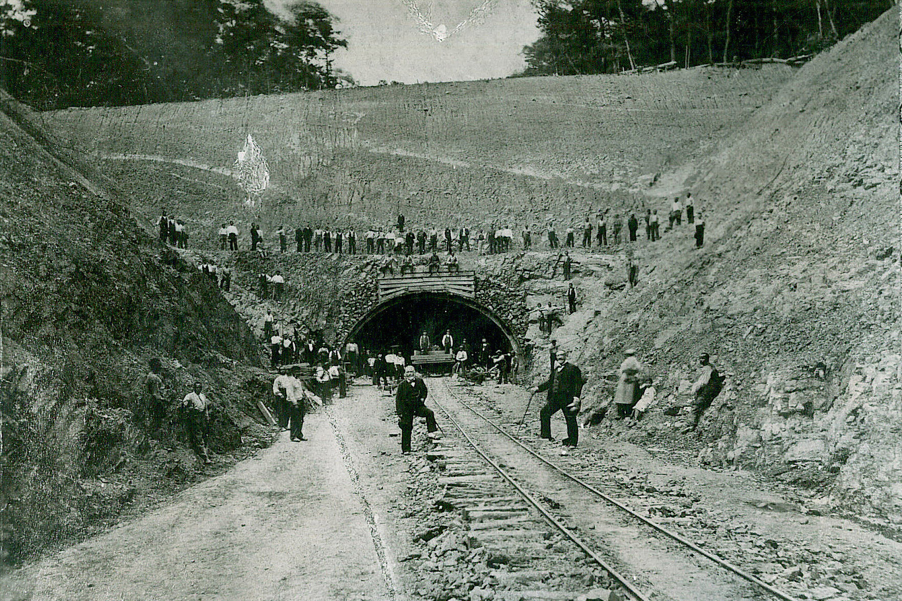
It is possible Vanderbilt bought his way into the region because he thought the Pennsylvania Railroad was encroaching on his New York territory, but records about his intentions are not clear. “The South Penn’s genesis was more complex than the legend would have it,” wrote Herbert H. Harwood in The Railroad That Never Was. No matter the reason, the purchase initiated a two-year survey by Oliver Barnes, a consulting engineer from New York, which was followed by workers excavating tunnels across the Allegheny Mountains along the route. Though accounts of construction progress vary, at least 4.5 mi of tunnel had been excavated by late 1885.
Before that excavation was completed, in the spring of that year, J.P. Morgan intervened in the railroad war. Skeptical of the business case for having two powerful train companies with routes so close to each other, Morgan pushed the New York Central Railroad (a line that operated mainly between New York, Boston, Chicago, and St. Louis) to “reconcile” with the Pennsylvania Railroad.
The reconciliation would have far-reaching consequences for several railroads. Negotiations ended with sections of the South Penn being split between a Pennsylvania Railroad subsidiary and part of the Baltimore and Ohio Railroad. A smaller company — the Pittsburgh, Westmoreland, and Somerset Railroad Co. — turned several miles of the right-of-way that the South Penn had started to build into operable track in order to haul timber. But after the PW&S folded in 1917, the tunnels and grading completed by Vanderbilt’s crews sat untouched.
It was almost 20 years before South Penn’s abandoned tunnels garnered further attention. In 1936, the Works Progress Administration, in partnership with the Pennsylvania State Highway Department, funded surveys looking for a good highway route through the mountains. Surveyors, geologists, and highway engineers traveled the state, looking at and surveying the abandoned construction sites and other routes begun by South Penn.
Despite the vegetation overgrowth and some standing water, the completed tunnel masonry was in good condition, as was some of the graded roadway and drainage culverts. The final recommendation of this survey was “the complete feasibility of building an all-weather, high-speed super-highway over the route of the old South Penn,” according to William H. Shank in Vanderbilt’s Folly: A History of the Pennsylvania Turnpike.
By May 1937, the state legislature created the Pennsylvania Turnpike Commission to finance, build, and operate the road, and on October 10, 1938, the commission finalized two agreements with federal agencies that made much of the New Deal-era construction possible: a $26.1 million grant from the Public Works Administration and a commitment from the Reconstruction Finance Corp. for a $35 million sale of turnpike revenue bonds.
The completion of the PWA agreement meant that the commission had to get started fast. The contract required the roadway to be finished by May 1, 1940, giving the commission about 19 months to execute the plans. The guiding design philosophy behind the roadway was entrenched enough that the commission’s chief engineer, Samuel W. Marshall, and Noble each laid out the 10 design criteria guiding the development of the Pennsylvania Turnpike’s first section in articles they wrote for different publications in 1940.
Driver safety was the number one goal in designing and building the turnpike. Along with dedicated entry and exit points and “wide, smooth, stable shoulders” that were level with the roadway, the commission wanted the “elimination of all highway and railway grade crossings, so that there will be no cross traffic” along the route as well as “moderate rates of grades in order to increase safety during icy weather and to increase the speed of large heavily loaded trucking units so that rear-end collisions between fast and slow vehicles are minimized,” according to Noble. Though individual components of those 10 tenets had been part of other highways in the nation, the turnpike would be the first to put them all together, according to both commission engineers.
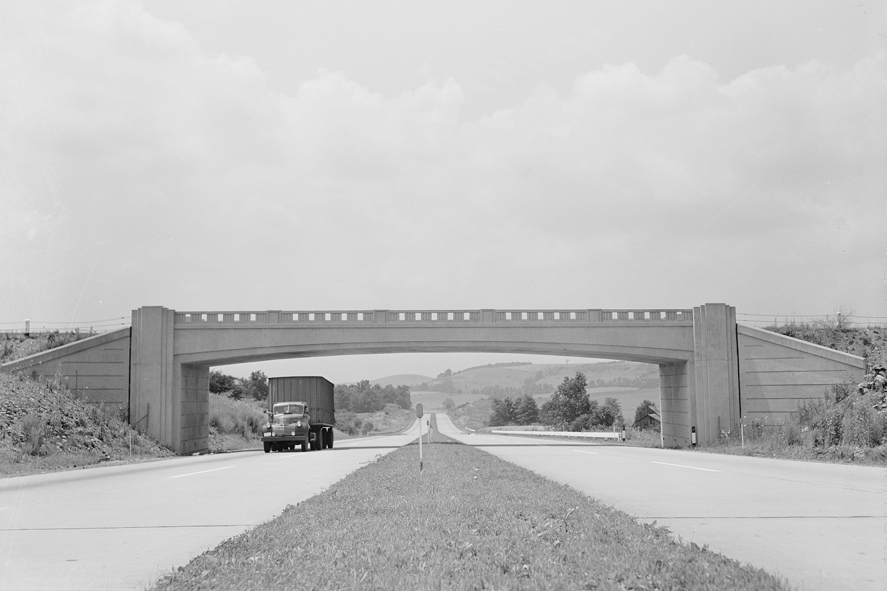
To ensure that there were no at-grade crossings along the turnpike, 163 grade-separation structures were built for a wide range of existing infrastructure, including state highways (75); township roads (60); farm crossings, private lanes, and similar roadways (12); interchanges (11); train tracks (5); and even one trolley route, according to R.F. Graef, chief of bridges for the Pennsylvania Turnpike Commission, in the 1940 Engineering-News Record article “Bridging the Pennsylvania Turnpike.”
Of those 163 structures, 100 would be bridges carrying existing roads over the turnpike. The designs for about 90% of all bridges and culverts had to be completed in a seven-month period, according to Graef. Despite the time pressure, different factions working on the highway design spent months debating how the bridges over the new roadway should be built.
Though the commission asked in early 1938 for its engineering department to design twin-span, reinforced-concrete rigid-frame bridges, one of the consulting engineering firms pushed back and requested steel-stringer and plate-girder structures.
Engineers were confident that a rigid-frame reinforced-concrete design would work when overpasses crossed the turnpike at a right angle. But there was debate about this design when the crossroad passed over at an acute angle. To help resolve the issue, the commission constructed a test bridge to prove that a rigid-frame design at a sharp 30-degree skew was safe.
In the end, it was agreed that rigid-frame bridges would only be built under limited conditions. The foundation had to be poured “neat” into excavated rock and rest on material that was “unyielding in character,” to eliminate various stresses, while the skew had to be moderate (crossing the turnpike at between 60 and 90 degrees), according to Graef in the article, “Selection of Bridge Structures for Economy” for Roads and Streets in June 1940.
Even though the test bridge had proved that a sharp skew was safe, Graef conceded that a more conservative limit might be appropriate. Most if not all contractors working on the turnpike had never built a rigid-frame design before, and there were a number to build before the construction time limit was up.
Ultimately, contractors built a blend of bridge designs, depending upon the crossing angle: 53 single-span rigid frames (8 at interchanges), 24 single-span plate girders, 20 twin-span reinforced-concrete T-beams, 2 twin-span plate girders, and 1 three-span plate girder to carry roadways and other existing travel avenues above the turnpike. For bridges carrying the turnpike above crossings, contractors built a mix of reinforced-concrete T-beams and barrel arches, the type depending on the grade, according to Graef in Roads and Streets.
By November 1939, about $12 million worth of equipment, including power shovels, trucks, graders, and scrapers, was on-site to aid in bridge assembly.
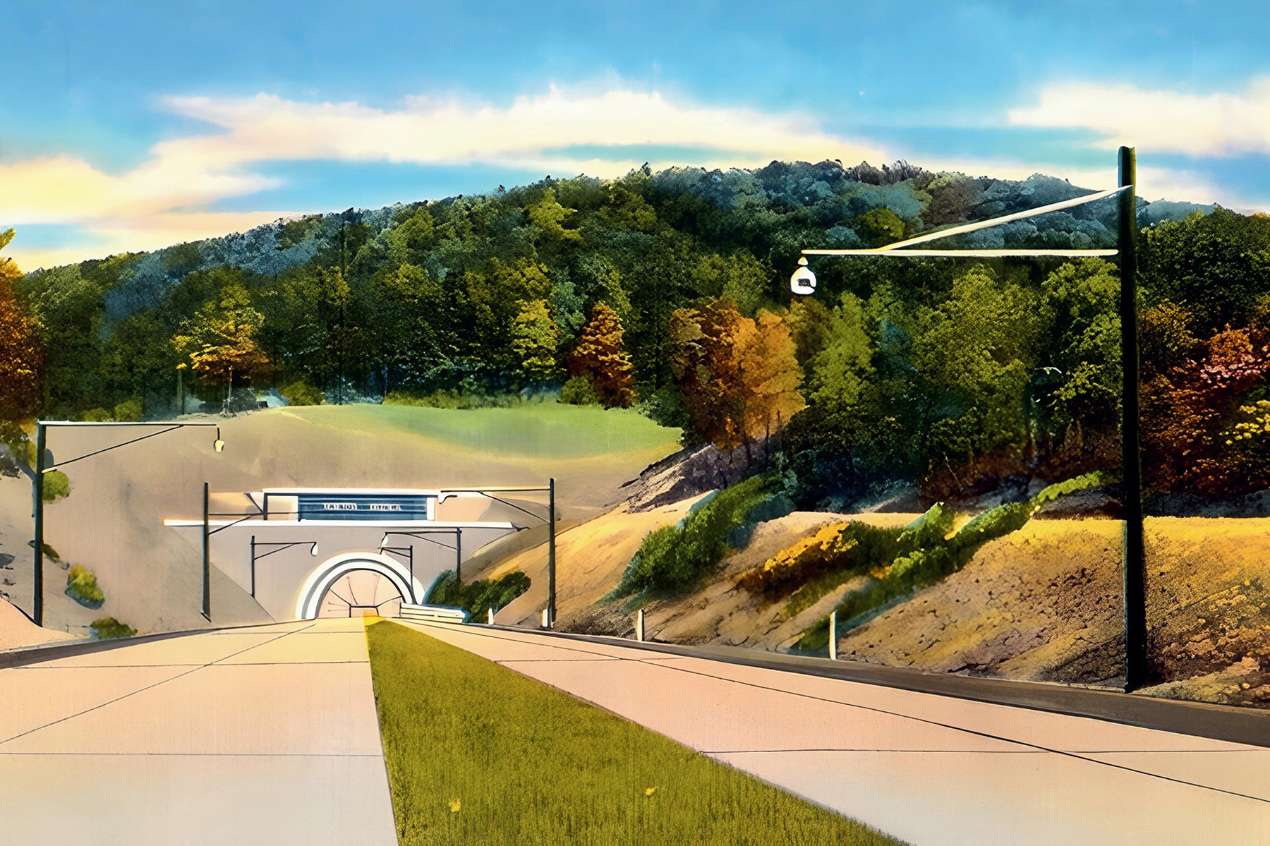
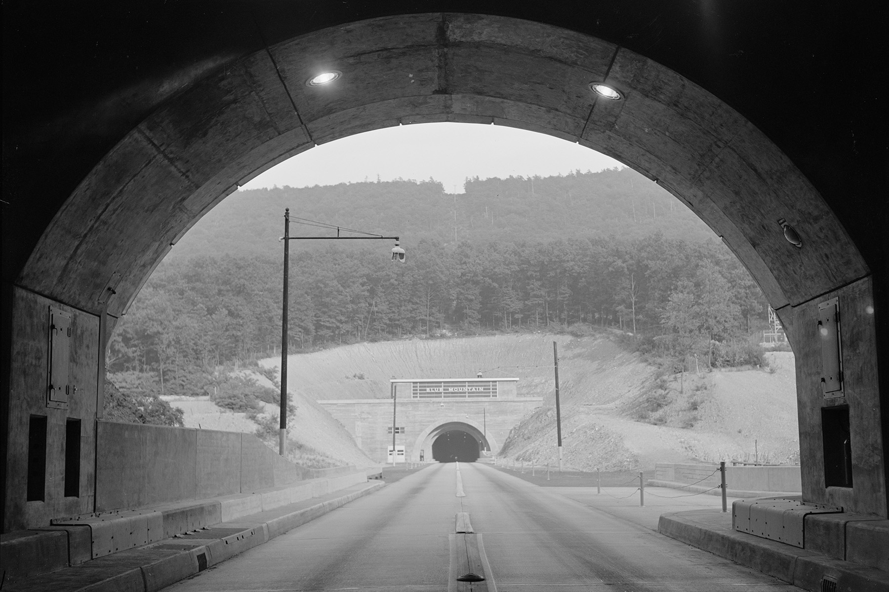
Other contractors dedicated their attention to the tunnels, seven of which became part of the roadway. Those seven two-lane tunnels, from east to west, were Blue Mountain, Kittatinny Mountain, Tuscarora Mountain, Sideling Hill, Rays Hill, Allegheny Mountain, and Laurel Hill. Six came from modifications of tunnels carved as part of Vanderbilt’s trainline attempt, while the seventh (Allegheny Mountain) was excavated at a new site.
The first tunnel driving started in June 1939. Most tunnel contractors chose full-face excavations from both ends and found themselves in similar cycles of drilling, blasting, and mucking. For crews working through hard gray sandstone, it would take 12 hours of drilling and post-blast hauling to clear 10 linear ft of tunnel.
Other teams had it easier: Those carving out soft red or gray shale needed just over six hours to clear as much tunnel space. According to the June 1940 Roads and Streets article “Turnpike Tunnels Holed Through” by William F. Gould, the central office engineer for tunnels for the commission, silicosis prevention amounted to wet drilling and ventilation fans when the rock met certain silicon dioxide thresholds. (Silicosis is a lung disease caused by the inhalation of silica dust.)
Though avoiding lung disease in workers was only a small portion of what Gould included in his writeup about tunnel construction, the topic was growing in national importance. In the 1930s, the Department of Labor had begun to pay more attention to the fatal condition in light of disasters like Hawk’s Nest Tunnel in West Virginia, where more than 700 workers died from silicosis after excavating the structure. The year before turnpike tunnel excavations began, the Department of Labor issued an informational film called Stop Silicosis, which recommended the same safety precautions (wet drilling and fans) that the commission adopted.
Other worker safety concerns arose throughout the tunnel work. One notable example was in the Kittatinny Mountain tunnel, where teams drilled exploratory borings into one of the headings and were shocked when — upon encountering a 10 ft wide seam — 500 cu yd of wet sand poured onto the tunnel floor. “Measurements indicated that this stream of material was under a 200 lb. per square inch pressure,” according to Gould in his Roads and Streets piece.
After more test borings, workers cut an additional 3 ft wide hole, emptying the pocket and letting another 1,000 cu yd of sand onto the ground. The release relieved the high hydrostatic pressure “and emptied the overhead portion of a pocket approximately 20 ft in diameter and 75 ft high,” allowing workers to install wall plates and excavate the tunnel via a top heading, adding I-beam arch ribs as the work progressed, according to Gould.
Once they reached the former sand seam, workers slid in I-beams running parallel to the tunnel itself so that they sat on top of nearby arch ribs. Only with the protection of the temporary I-beams could crews install the permanent arch ribs through the sand deposit.
When all tunnel excavation was completed, workers lined the walls and ceilings with concrete against the excavated rock. In places where the preexisting roof had fallen, contractors had to install steel or wood arch ribs first, depending on the conditions of the collapse. If there was overbreakage, lagging and supports created a frame for concrete, stone chips, or slag to be inserted to fill the gaps. Voids were filled with similar materials. The space between the arch and the ceiling slabs in each tunnel made for a ventilation duct, bookended by fans.
As work wrapped up in the summer of 1940, dates for the rumored official opening of the turnpike came and went. Then, on September 30, the commission chairman announced that the roadway would officially open to the public that night at midnight. Even with the short notice, lines of cars built up on both sides of the turnpike waiting to be ushered forward when the clock struck 12.
The roadway that drivers sailed over in the middle of the night was made possible with the excavation of more than 25,500,000 cu yd of material and the placing of 1,617,000 cu yd of concrete. Thoughtful touches meant that when winter came, ice and snow on the roadway — strategically laid out to maximize southern exposure — would melt in the sunlight. Over 15,000 individuals were working on-site at its peak, and nearly two dozen would die, including four individuals trapped during a cave-in at one of the tunnels.
By the end of 1940, the Pennsylvania Turnpike had earned more than $560,000 in toll revenue, and just after a year of operation, 2.4 million vehicles had driven along it, nearly twice as many as predicted. For years after, states around the country would adopt turnpike practices to build their own highways. As similar highways gained popularity with drivers and traffic levels built up, aspects of the national blueprint disappeared: Widening projects meant that some of the iconic rigid-frame bridges have been torn down, for example. But beneath the changes still lie the design ideas brought to fruition by the original collaborations of work crews, contractors, and more than 1,100 men and women.
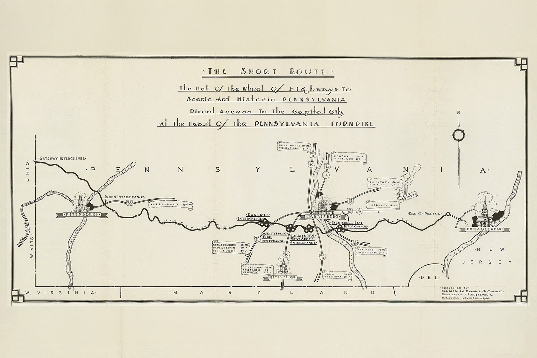
The first section of the Pennsylvania Turnpike described in this article was the 160 mi section between the Carlisle Interchange to the east and the Irwin Interchange to the west. It was designated an ASCE National Historic Civil Engineering Landmark in October 1990.
Today, the turnpike is 360 mi long and going strong.
Leslie Nemo is a journalist based in Brooklyn, New York, who writes about science, culture, and the environment.
This article first appeared in the March/April 2026 issue of Civil Engineering as “A Path through the Mountains.”
To learn more about civil engineering history and ASCE’s Historic Civil Engineering Landmark Program, visit the Historic Landmarks page.