
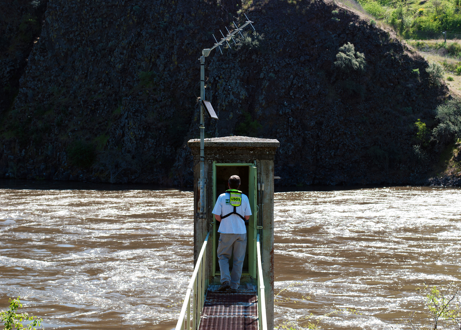
 Tim Merrick, USGS
 A new artificial intelligence tool that provides drought forecasts of up to 90 days is helping farmers, utilities, and water managers better prepare for water shortages.
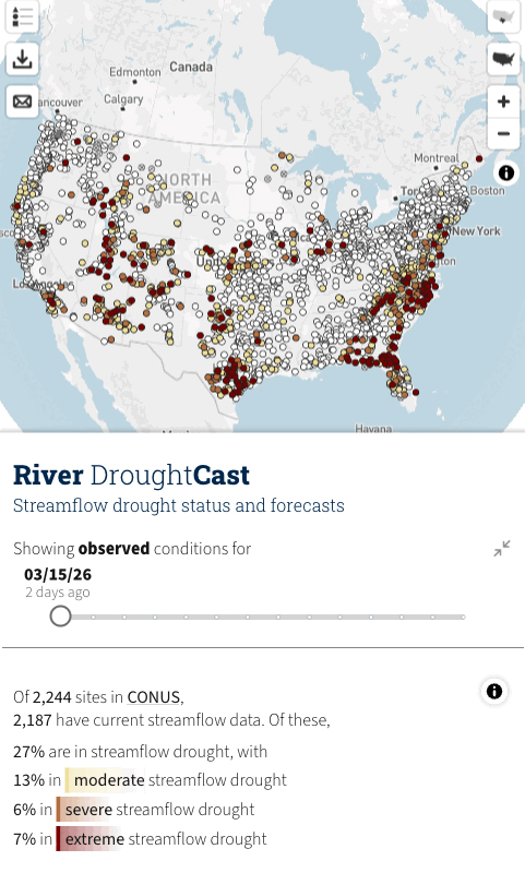
Relying on thousands of streamgages overseen by the U.S. Geological Survey, the USGS River DroughtCast highlights three status levels for droughts throughout the Lower 48 states. The model is free and open to the public.
Measuring river conditions
Since 1889, the USGS has deployed technology to monitor river flows as “a matter of public safety, environmental protection, and wise economic development.” Among the 13,500 streamgages, some are still reporting over 100 years later. DroughtCast was developed using streamgage data collected from 1981 to 2020.
Further reading:
- ASCE leads AI vision in civil engineering with ‘AI RACE’ roadmap
- How artificial intelligence can benefit construction projects
- Engineers monitor Florida bridge with digital twin
“The tool covers two time frames,” explained David Watkins, a machine learning engineer in the USGS Data Science Branch. “We initially built and verified the model using the 40-year retrospective dataset. Current conditions are then pulled from measurements captured in the last 24 hours from those same sources.”
 USGS
USGSThe AI forecast wouldn’t be possible without the USGS hardware network. Primarily positioned on riverbanks in gage houses, a streamgage establishes water levels by measuring gage height. Sites can also include sensors that capture water temperature, quality, velocity, and depth as well as weather equipment.
A mathematical rating curve relates gage height to streamflow, which is measured in cubic feet per second. Because river conditions constantly change, the stage-discharge relationship can be used to estimate streamflow in near real time.
Measurements are taken continuously every 15 minutes, and data is sent via satellite every 1-4 hours. They can even be monitored in five-minute intervals or deployed during emergencies. The stage measurements are “accurate to within ±0.01 foot or 0.2 percent of the effective stage,” according to the USGS.
This precision is the foundation for DroughtCast’s ability to run predictions up to 13 weeks, with the strongest reliability within the first month. This window resulted from community feedback.
“Since most weather services either provide 10-day outlooks or seasonal predictions, DroughtCast’s projections within the three-month range help fill in that gap,” explained Jeremy Diaz, a machine learning specialist with the USGS Water Resources Mission Area.
“The tool’s next phase will continue widening its prediction capabilities by adding data from streamgages with 30-year records,” added Watkins. “This will expand the set of forecasting locations with reliable distributions and provide a better starting point for extrapolating drought into unmonitored watersheds.”
The difficulty of defining droughts
Droughts are harder to pinpoint than meteorological events like tropical storms or floods. They generally unfold in a hidden manner, with the first stress indicators occurring underground rather than being visible to the naked eye. They can also slowly develop over the course of months and have no clear end.
“There are a lot of different ways to characterize drought, including rainfall, plant stress, and soil moisture,” Diaz noted. “Low streamflow has also been identified as a drought indicator. USGS is well positioned to predict where water levels will drop below their normal distribution for extended periods.”
The impacts of a drought can also extend far beyond a return to normal rainfall. For example, one thunderstorm alone may not restore a streamflow to its average level. Precipitation resuming after a dry spell may not restore damaged crops or recharge groundwater either. Having a tool like DroughtCast allows individuals and communities to make strategic pivots ahead of water shortages.

“This is also an important tool because we are having more flash droughts around the country,” stressed Ximing Cai, Ph.D., P.E., M.ASCE, a professor of civil and environmental engineering at the University of Illinois Urbana-Champaign. “These droughts are not only sudden and intense but usually last for 15-60 days, so forecasting is essential preparation.”
Flash droughts are especially difficult to anticipate because they are impacted by “lower-than-normal rates of precipitation, accompanied by abnormally high temperatures, winds, and radiation,” according to the National Integrated Drought Information System, a supporting agency partner.
The associated evapotranspiration hastens the removal of moisture from soil and groundwater. Since this risk factor directly impacts watersheds, DroughtCast’s streamflow monitoring can be used as a possible warning sign that a flash drought is taking shape.
Minimizing the impacts of droughts
DroughtCast is primarily intended for users who have oversight over or are impacted by water allocation. Diaz and Watkins reported engagement from water managers, farmers, public officials, and state hydrologists to researchers, consulting firms, and environmental organizations. Individuals reliant on rivers for recreational activities, such as fishing and boating, could also leverage the information.
“For example, farmers planning their planting or irrigation strategies can benefit from accessing the tool for the upcoming season,” Diaz said. “It gives them better information to make the most informed decisions.”
“This kind of forecast would also be helpful to users who irrigate directly from streams as well as agricultural regions where water supply is heavily dependent on storage,” Cai explained.
For example, upward of 75% of water availability in the western U.S. is replenished by melting snowpack, notes the American Farm Bureau Federation. Rivers are critical to western agriculture because “much of the region does not receive enough in-season rainfall to support consistent production on its own, so irrigation supplied by river systems like the Colorado, Columbia, Sacramento, and San Joaquin is what stabilizes output year to year.”
With snowpack at historic lows, however, the short- and long-term consequences of droughts will ripple out into the food supply chain and grocery stores. Based on production by value, the AFBF documents that 12 states are responsible for producing over 70% of domestic vegetables and melons, including staples like potatoes, leafy greens, and tomatoes.
They also grow nearly 90% of all fruits and nuts (also in production by value). The AFBF reports that as “drought tightens the margin for agricultural production,” farmers, ranchers, and orchard owners are being forced to make tough, even permanent, decisions about scaling back their operations.
“DroughtCast can also support two other entities that heavily rely on stream levels: water utilities and power stations, especially thermal and nuclear energy requiring cooling,” added Cai. “This category of users may need to implement conservation strategies in advance to counteract a water shortage.”
Cai also challenged civil engineers to “consider how they can take a more active role in the face of more frequent drought impacts.” Many drought responses are short-term tactical measures in response to a crisis, but taking a longer view can shift drought management from a reactive to a proactive approach.
Because of their work on dams, water treatment plants, and hydropower sites, civil engineers are uniquely positioned to implement long-term infrastructure improvements to mitigate drought damage.
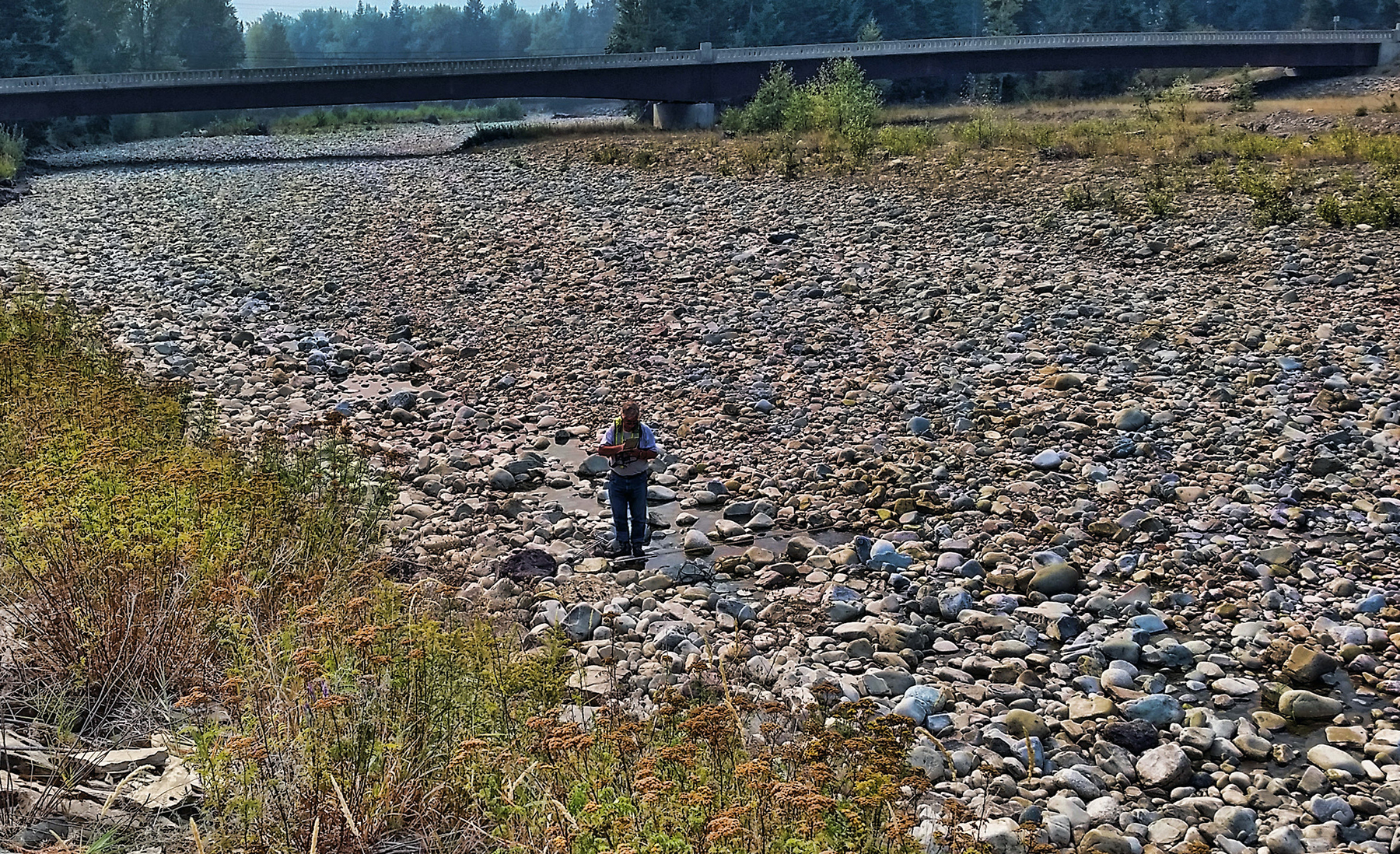 Ryan Smith, USGS

Feed Your Brain
Interested in cutting-edge technology like the one described here? Registration is open for ASCE2027: The Infrastructure and Engineering Experience, a first-of-its-kind event bringing together subject-matter experts from all across the infrastructure space, March 1-5, 2027, in Philadelphia. So, yes, we know you’re excited about the Philly cheesesteaks, but ASCE2027 also is the perfect place to satisfy your appetite for learning.
Technical deep dives. Infrastructure expertise. Come feast!
Learn more about ASCE2027: The Infrastructure and Engineering Experience.
