
For consulting engineers, roads and highways are no longer defined only by plans, profiles, and specifications. They are dynamic systems shaped by traffic demand, environmental conditions, construction phasing, and long-term maintenance strategies. As transportation agencies face aging infrastructure, climate risk, and increased public scrutiny, engineering firms are expected to deliver corridors that perform reliably over decades.
This shift is changing how roadway projects are planned, designed, and delivered. Geographic information system (GIS) technology has become a foundational capability for modern transportation engineering, allowing firms to combine engineering judgment with spatial context and real-world data. When paired with digital twin approaches, GIS enables roads and highways to be managed as living systems that evolve over time.
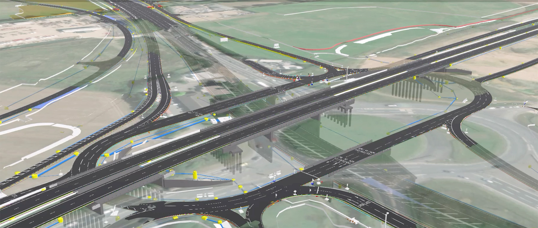
Roadway corridors intersect complex physical, environmental, and regulatory conditions. Utilities, drainage networks, environmental constraints, right-of-way boundaries, and community impacts all converge along the alignment. GIS allows consulting engineers to organize this complexity spatially, creating a shared understanding across planning, design, construction, and operations.
During planning and corridor studies, GIS supports the evaluation of alternatives using terrain, flood risk, land use, environmental data, and existing assets in a single environment. This spatial insight helps teams make better decisions earlier in the project life cycle, when changes are less costly and outcomes can be influenced most effectively. For consulting firms, this translates to reduced risk, stronger recommendations, and clearer communication with clients and stakeholders.
Digital models have long supported roadway design, but a Living Digital Twin represents a more complete evolution. Esri’s Living Digital Twin approach builds on GIS to connect authoritative data, engineering information, and real-world observations into a continuously updated representation of infrastructure.
For civil engineers, this means design data continue to deliver value well beyond construction documents. Design information becomes the foundation for coordination, asset management, and performance monitoring. Traffic volumes, pavement conditions, weather impacts, subsurface systems, and maintenance activities can all be connected through location, allowing engineers and owners to understand how a corridor performs both in real time and over time.
In design, GIS-based digital twins provide engineers with a more complete picture of existing conditions. Survey data, lidar, imagery, CAD and BIM, and geotechnical information can be viewed together, improving accuracy and reducing uncertainty. Potential conflicts can be identified earlier, supporting better constructability reviews and fewer surprises in the field.
This integrated approach strengthens coordination across disciplines. Roadway, drainage, environmental, and utility teams can work from a shared spatial context, reducing rework and improving schedule reliability.
Construction remains one of the highest-risk phases of roadway delivery. GIS-based Living Digital Twins give engineering teams and owners shared visibility into phasing, traffic management, and field conditions. This improves coordination among contractors, inspectors, and project managers, helping projects stay on schedule while enhancing safety.
Beyond construction, consulting firms are increasingly asked to support asset management and life-cycle planning. GIS allows inspection records, condition assessments, and maintenance histories to be tied to specific locations. Engineers can identify trends, prioritize investments, and help agencies move from reactive maintenance to proactive strategies that extend asset life and reduce costs.
As DOTs modernize how they plan and manage roadway infrastructure, expectations for consulting partners continue to rise. Firms that integrate GIS and Living Digital Twins into their transportation practice are better positioned to deliver value beyond traditional design deliverables. They can support better decisions, reduce risk, and help owners manage roads and highways as adaptive, resilient systems.
Treating roads and highways as living systems is becoming a professional expectation rather than an innovation. For consulting engineers, GIS-based Living Digital Twins are increasingly essential to how roadway infrastructure is delivered, operated, and sustained.
Esri is the global market leader in geographic information system (GIS) software, location intelligence, and mapping. Learn more about geospatial digital twins at https://link.esri.com/CEDigitalTwin.