
By Ian H. McKane, P.E., M.ASCE, and Kevin Grim, P.E., M.ASCE
Improvements made at Philadelphia’s Flat Rock Dam and Manayunk Canal create a cleaner, free-flowing waterway and enhance the surrounding urban environment.
Flat Rock Dam and the Manayunk Canal on Pennsylvania’s Schuylkill River once shaped the state’s trade and industrial growth as barges navigated the waterways transporting anthracite coal and other goods. Barges and boats ceded their places to railroads and trucks as a means of transporting cargo, and over time, the dam, canal, and other once-critical infrastructure fell into disrepair. Fast-forward to 2022, when the Philadelphia Water Department set out to rehabilitate the dam and reconnect the canal to the Schuylkill River.
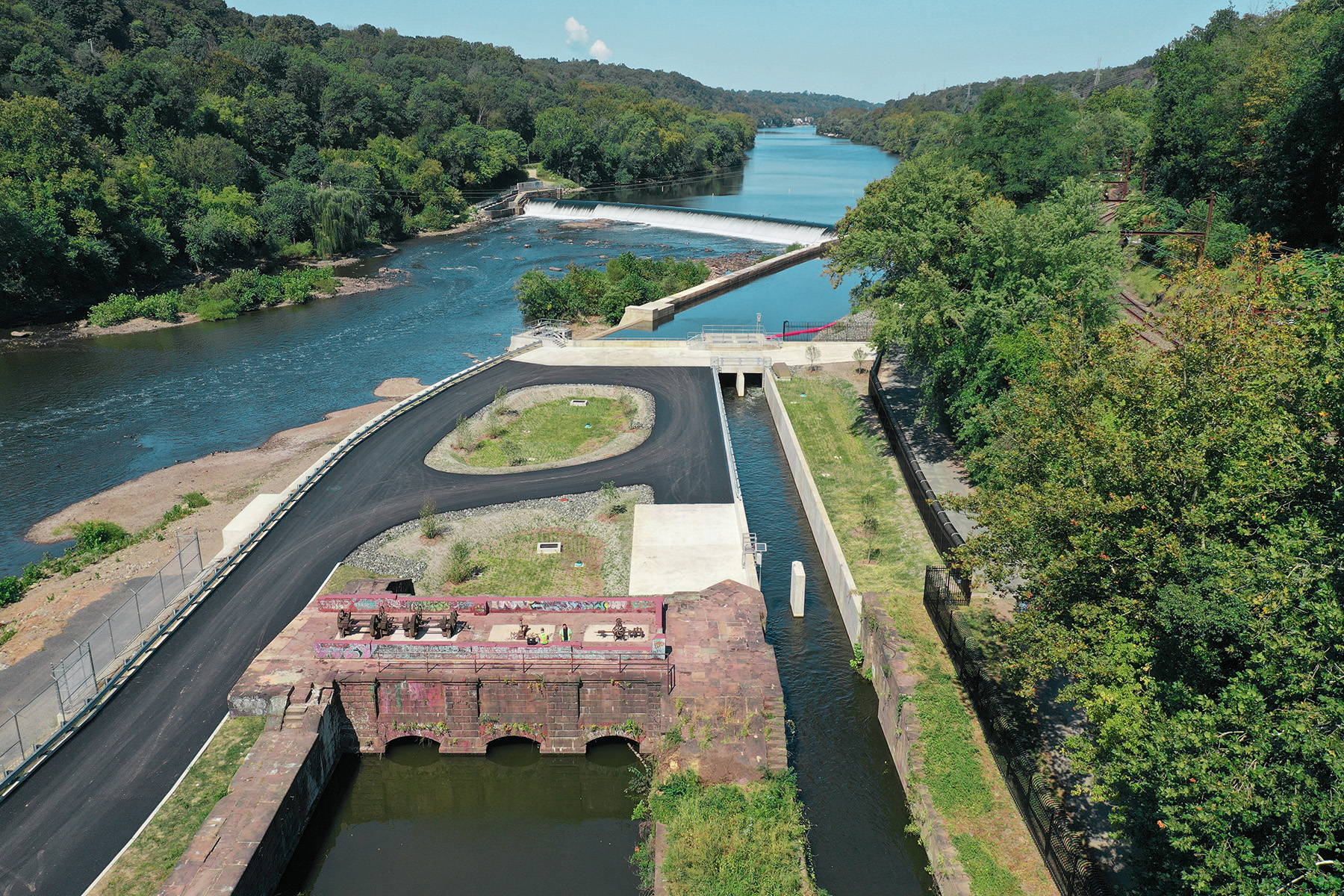
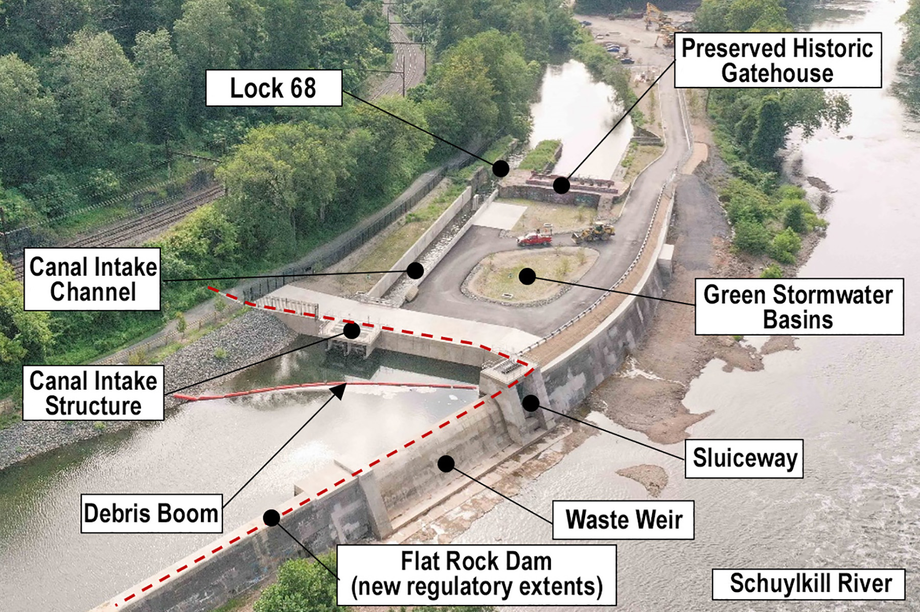
Working closely with Ramboll Americas Engineering Solutions Inc., a global architecture and engineering company, PWD prioritized improvements that would protect historically significant parts of the dam and bring aging infrastructure up to modern standards. With this in mind, Ramboll developed an economical and sustainable solution for PWD that included construction of a new canal intake structure, in-kind replacement of the waste weir, construction of an adjacent sluiceway, and construction of a concrete intake channel connecting the new intake structure to the historic Lock 68, which is the entrance to Manayunk Canal.
Additional design elements included retaining wall rehabilitation, stormwater conveyance, green stormwater features, landscaping, maintenance access, debris control, site security, and historic preservation. Key design and construction considerations included construction sequencing, temporary cofferdams, seasonal work restrictions, drilled anchors, bulk excavation, structural concrete, masonry restoration, and overall site improvements.
All these upgrades at Flat Rock Dam enhance the surrounding urban environment and return a cleaner, free-flowing canal to the neighborhood of Manayunk and the greater Philadelphia area.
The Schuylkill Navigation and Flat Rock Dam
The issue of inland navigation in Pennsylvania dates to its earliest days. For instance, Benjamin Franklin advocated for improving navigation on the Schuylkill (“SKOO-kill”) River in a 1772 letter to Samuel Rhoads, who would eventually serve as the mayor of Philadelphia. Franklin wisely observed: “Rivers are ungovernable things, especially in hilly countries. Canals are quiet and very manageable.”
After years of planning, failed efforts, and — at last — construction, the Schuylkill Navigation (also known as Schuylkill Canal) was officially opened on May 20, 1825. The Schuylkill Navigation Co.’s 108 mi. long canal system consisted of a series of dams, slackwater pools, locks, canals, and aqueducts, and a single tunnel. Spanning the river at the present-day city limits of Philadelphia, Flat Rock Dam and Lock 68 form the upstream end of the Manayunk Canal, and locks 69 and 70 were built downstream where the canal returns to the river.
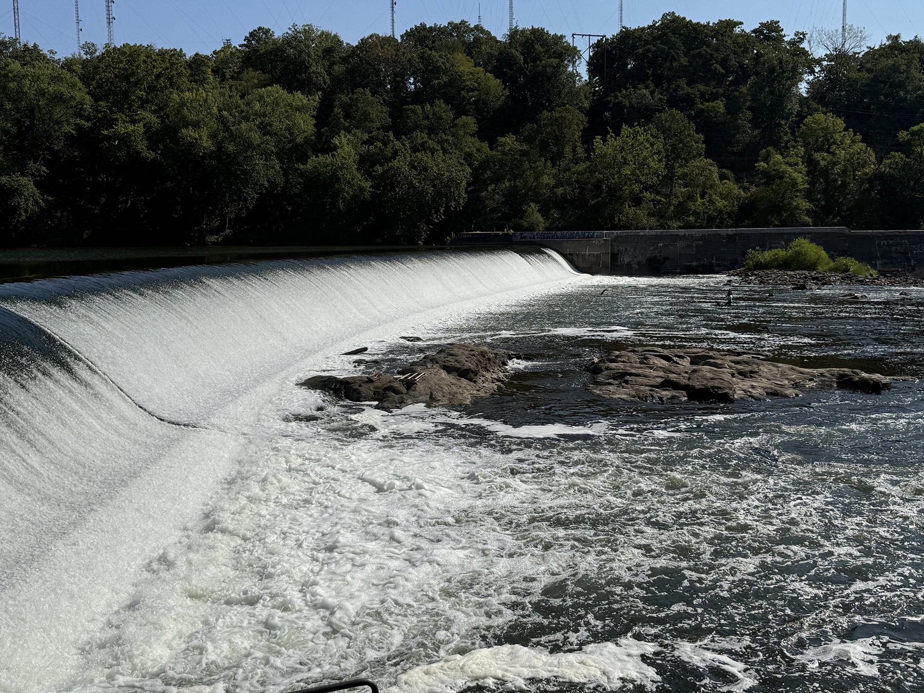
The dam consists of a 525 ft long ogee-shaped concrete spillway that traverses nearly the entire width of the Schuylkill River, tying out to a fish ladder at the western abutment (on the right, looking downstream). The spillway’s left abutment is at a canal wall, which — prior to this project — ran parallel to the river about 900 ft downstream, where it tied out to the historic canal feeder structure. The canal wall creates a forebay upstream of the historic gatehouse structure, which is adjacent to Lock 68. Today, the canal wall ties out to natural grade at the towpath and is now part of the Schuylkill River Trail system.
Ownership of the dam is shared between the city of Philadelphia and the Commonwealth of Pennsylvania. The ogee spillway, the fish ladder at the western abutment, and the upstream portion of the canal wall (about 400 ft) are owned by the commonwealth. The city owns the downstream portion of the canal wall as well as the waste weir, the historic gatehouse, and Lock 68. This project focused only on the structures owned by the city.
The Flat Rock Dam Betterment Project
The project was created with four goals in mind. The first was to improve water quality in the Manayunk Canal by reintroducing flow. With the bulkheading of Lock 68 following the closure of the Schuylkill Navigation, the canal lost its primary source of inflow. Instead, it received only urban stormwater runoff from the Manayunk neighborhood. The canal became an eyesore, and the impacts to water quality were measurable: Dissolved oxygen levels were low, dissolved solids levels were high, and alkalinity was high. In the period between 2003 and 2012, three fish kills occurred.
The second goal was to bring the dam into compliance with regulations. Stability analyses revealed that the waste weir and canal wall did not meet required factors of safety for both sliding and overturning load cases. Factors of safety were less than 1.0 during some extreme cases. The waste weir additionally had a significant deficiency due to a deteriorated joint causing a weak horizontal plane.
Third, sediment in the canal intake channel needed to be managed. The project sought to remove more than 10,000 cu yd of sediment that had accumulated upstream of the historic gatehouse and Lock 68 following its closure.
Finally, the project needed to preserve the dam’s historic features. Recognizing its significance to the history of the Schuylkill Navigation, the city prioritized historic preservation/stabilization. The dam is within the Manayunk Main Street Historic District, listed on the National Register of Historic Places, located within the Schuylkill River Greenways National Heritage Area, and inside a designated Pennsylvania Heritage Area.
Design considerations
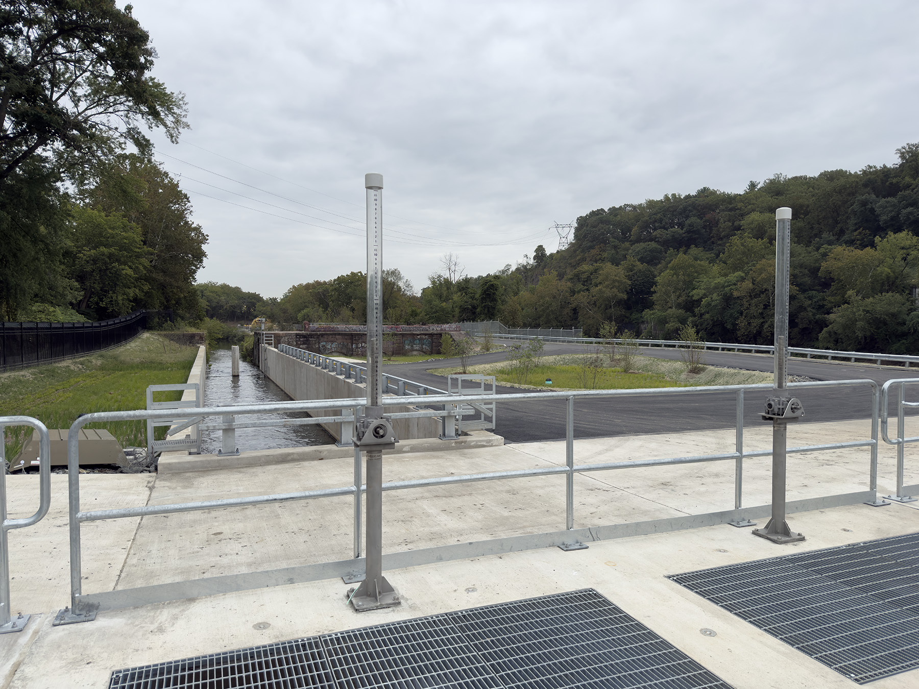
A key consideration in the design was the lack of electric utilities available at the site. For this reason, the new intake structure contains two 4 ft square sluice gates and associated equipment that are operated either manually or with portable hydraulic operators. The gates are intended to be “set and forget,” requiring minimal operation during typical conditions and balancing water quality flows, while preventing flooding during significant rainfall events. The gates are protected by trash racks that have openings designed to limit large debris from damaging the gates or entering the canal but allowing smaller debris like leaves and trash to pass safely without requiring frequent cleaning.
Next, the team worked through the 205 ft long concrete channel design, which would connect the new structure to the lock. With the understanding that it needed to be easy to maintain, the channel was designed with stoplog guides and access ladders at the upstream and downstream ends, along with an adjacent concrete lot for parking or storing equipment. The channel has a shallow slope (1%) to provide positive flow while avoiding the creation of erosive velocities in Lock 68.
A central feature of the overall design is the new bulkhead wall next to the canal intake structure. Together, these elements now define and function as Flat Rock Dam for regulatory purposes. This change removed the historical gatehouse and Lock 68 from the dam’s regulatory limits, allowing them to be stabilized and preserved as historical features rather than upgraded to meet modern dam design standards.
The existing waste weir had significantly deteriorated. It was replaced in kind with a reinforced-concrete ogee weir, along with a new sluiceway. The sluiceway provides a means to control bypass flow and was designed to be suitable for future retrofitting of hydropower at the site. A new debris boom stretches from the waste weir to the left channel bank to provide debris management.
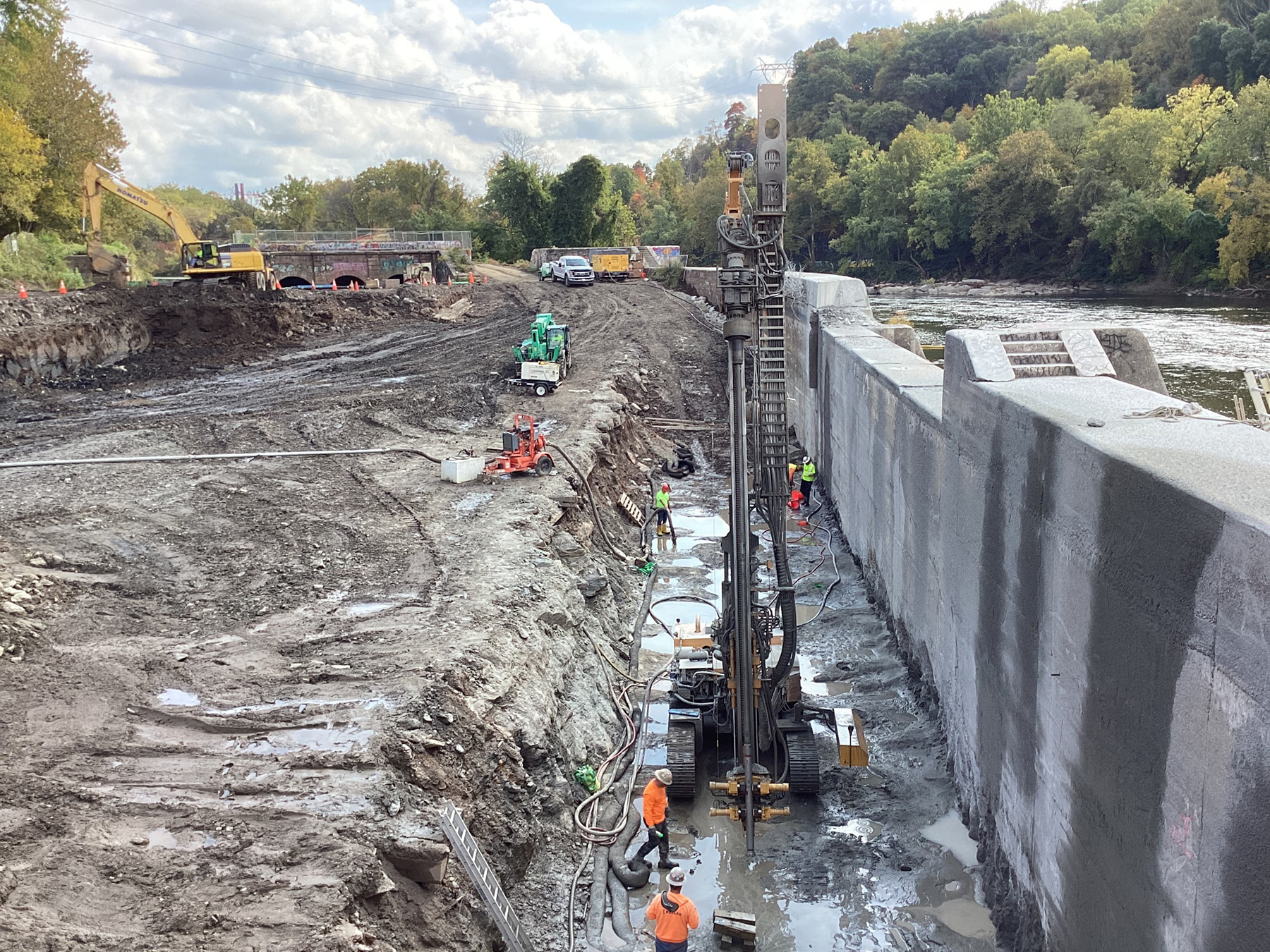
The project also included lowering the city’s portion of the canal wall by 11 ft and capping it with a new reinforced-concrete parapet. With the legal extent of Flat Rock Dam now following the new intake structure and bulkhead wall, the portion of the canal wall downstream of the sluiceway was no longer considered part of the regulated dam structure, so it effectively became a retaining wall, as it did not need to meet the more stringent dam safety requirements. This allowed the top elevation of this portion of the former canal wall to be lowered and for reinforcement with post-tensioned rock anchors to be installed spaced at 10 ft on center, helping improve the structure’s stability as a retaining wall.
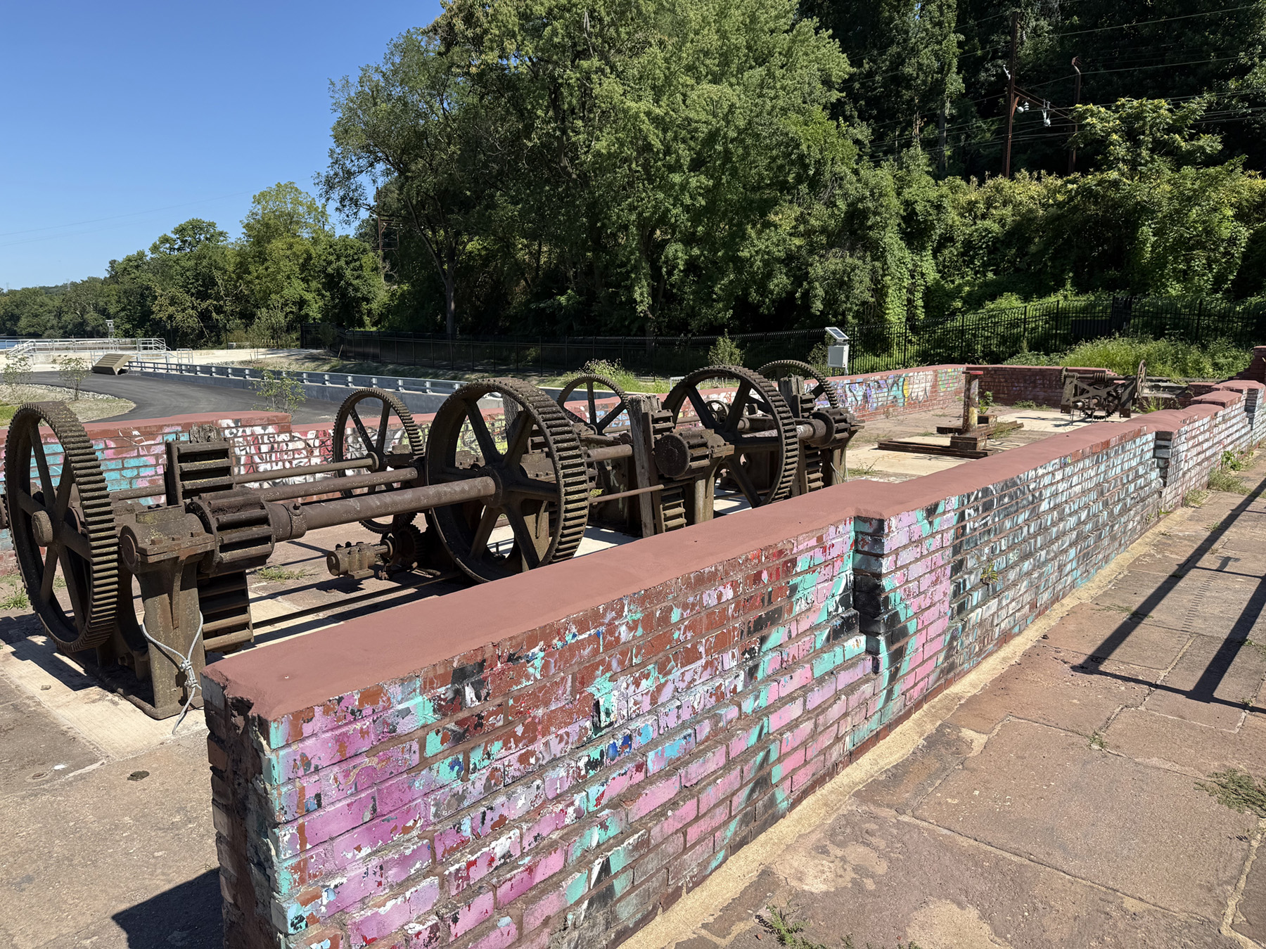
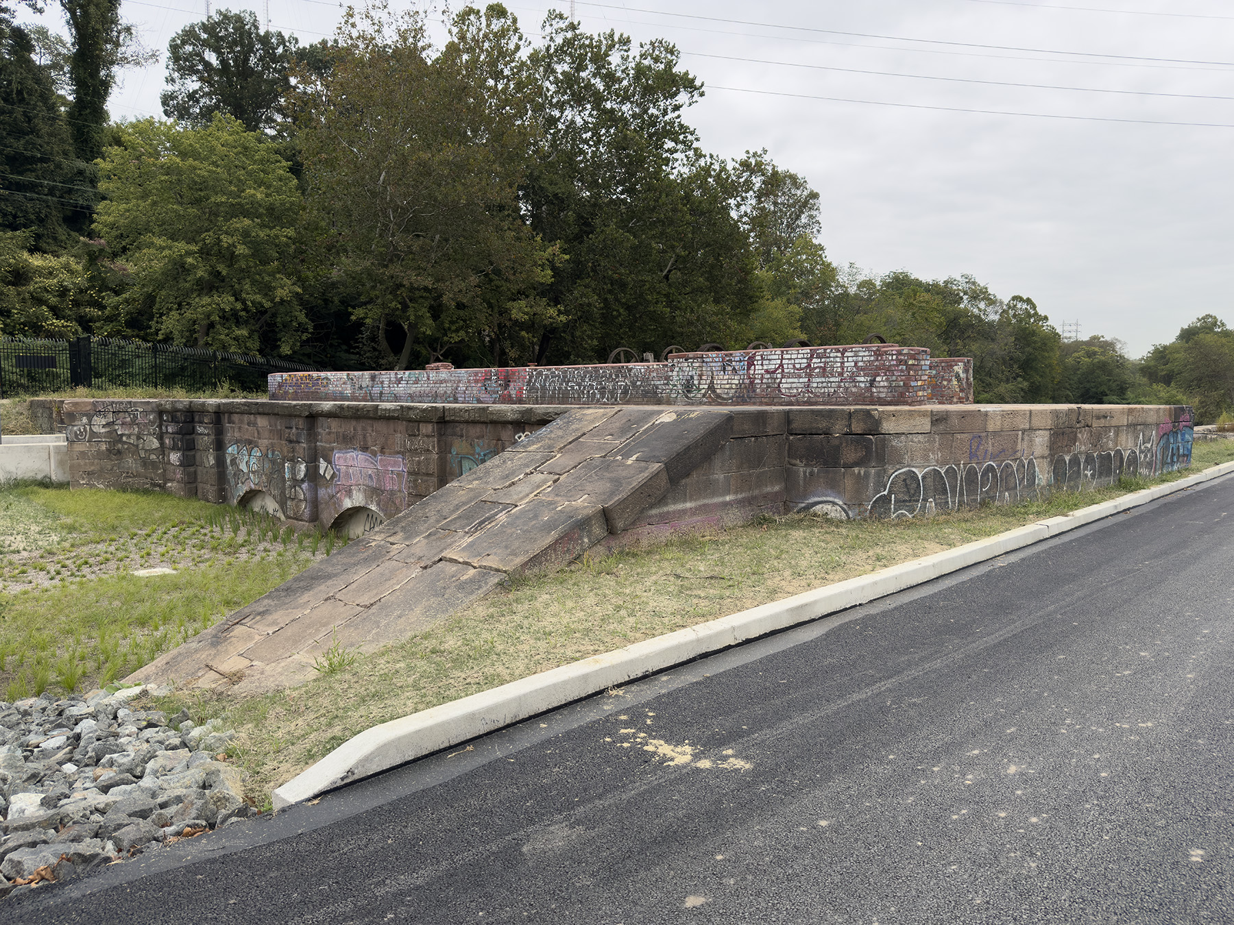
Another important aspect of the project was the stabilization and preservation of the historic gatehouse, which was conducted by J&M Preservation Studio. The gatehouse’s intake openings were infilled with a cementitious grout and concrete cap, and the masonry portions of the structure were repointed and stabilized. Due to safety and stability concerns, the brick walls of the former building were lowered to 3 to 4 ft in height. Historical mechanical equipment was set aside at the outset of the project and replaced on top of the gatehouse within view of recreational users on the Schuylkill River Trail.
As mentioned above, the project included numerous site improvements. PWD requested the design of three green stormwater infrastructure basins to manage stormwater created by the new impervious surfaces. The basins include 4 ft of vegetated stormwater soil with underdrains surrounded by clean stone and sand layers. The design team improved site access for future maintenance needs by adding a paved roadway and a large turnaround. A security fence surrounds the site, with a high ornamental iron fence along the Schuylkill River Trail.
Construction elements
The city of Philadelphia issued its notice to proceed for the project on March 14, 2022, through the traditional design-bid-build process. PWD oversaw construction for the project with assistance for special inspection and general inspection services from Pennoni and JBC Associates Inc., respectively. Ramboll, the engineer of record, provided site investigations, design, permitting, and construction administration services. A.P. Construction Inc. was the project’s general contractor.
PWD held a community meeting in February 2023 inviting local residents to learn about the project and the benefits of reconnecting the Manayunk Canal to the Schuylkill River. PWD shared the construction schedule, including a timeline for temporary work closures to the popular Schuylkill River Trail, which borders the dam and canal. PWD provided community updates during construction through the project’s website, email subscriber list, social media, and blog posts. Throughout the construction phase of the project, community members were invited to ask questions about the work being done to reconnect the canal to the river.
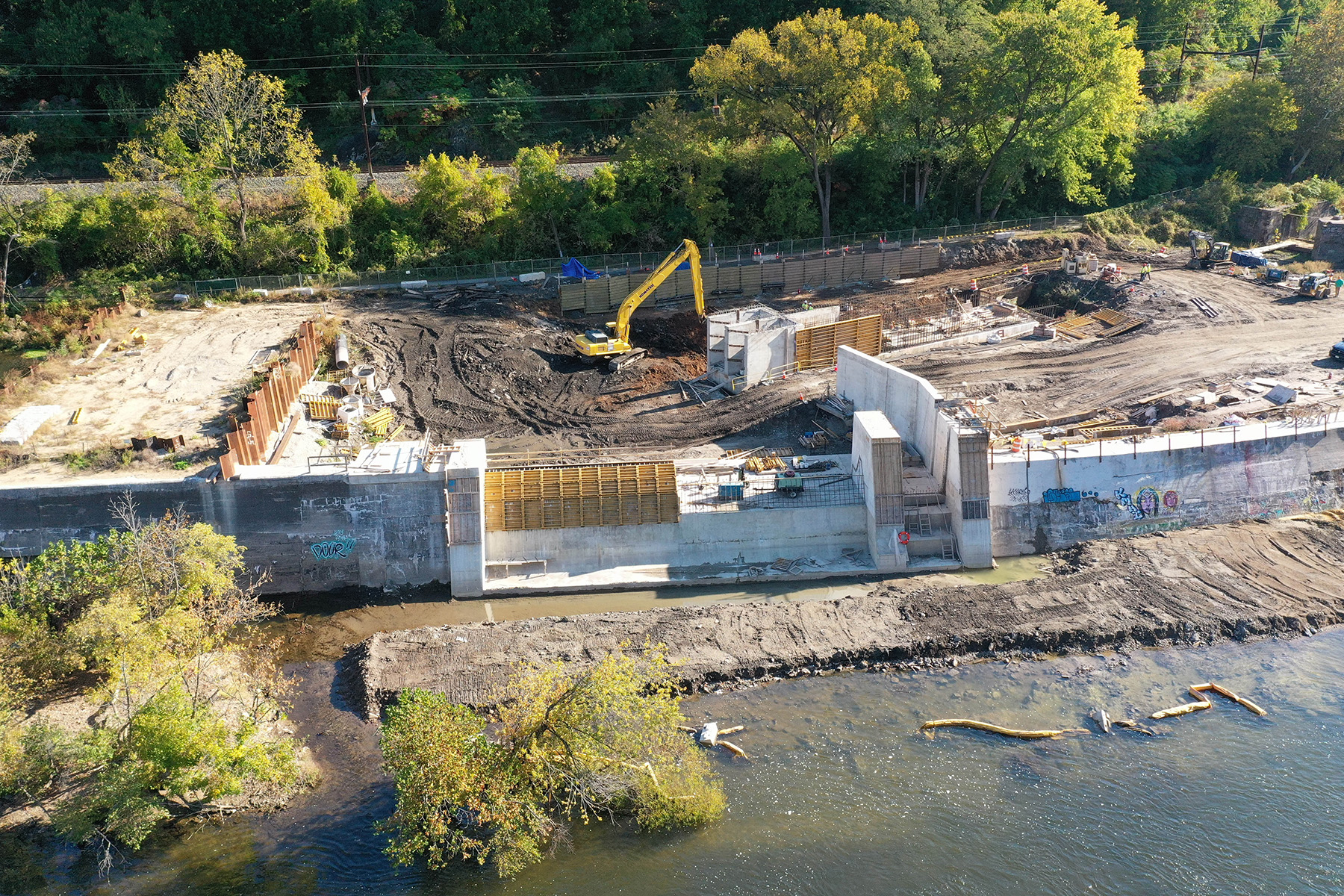
At the start of construction in March 2022, cofferdams in the upstream channel and downstream of the waste weir were installed. The cofferdams allowed the work area to be drained and construction to begin on the foundations of the waste weir and sluiceway. A phased construction approach at the waste weir and sluiceway gate protected the worksite from flooding during storm events that would have stopped work on-site. This phased approach focused on building the rear portion of the new waste weir while the existing structure remained in place.
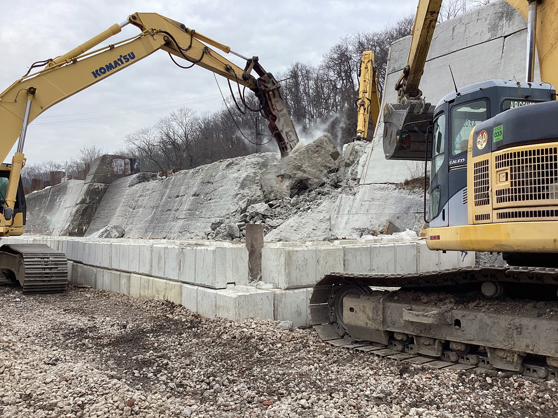
Once work crews reached the bedrock elevation, they installed post-tensioned rock anchors and placed the formwork, rebar, and concrete. The first concrete was placed in November 2022. Concurrently, work began on the foundations for the bulkhead wall and canal intake structure. Once the concrete foundations for the rear section of the waste weir were placed, the existing structure was demolished, and bedrock in the front section of the weir was prepared for post-tensioned rock anchor installation. The final concrete placement at the waste weir and sluiceway occurred in December 2023.
The excavation of more than 10,000 cu yd of accumulated sediment built up after the closure of the Manayunk Canal revealed that the bedrock elevation of the bulkhead wall and canal intake structure would need to be lowered. This in turn necessitated making the new bulkhead wall as much as 10 ft taller, which required additional post-tensioned rock anchors, rebar, and concrete. In addition to this permanent work, temporary adjustments were made to accommodate the deeper excavation at the bulkhead wall by using tie-back anchors.
In March 2024, concrete work at the bulkhead wall was completed. Once crews finished concrete placement, structural fill material was placed and compacted in lifts, which backfilled the downstream side of the bulkhead wall. Riprap was placed along the upstream slope along the trail.
The canal intake structure was redesigned with additional concrete and rebar to account for a deeper foundation. Following concrete work completion at the bulkhead wall, workers built the canal intake channel in quick succession; all concrete work at this location was finished by August 2024. Sections of the canal channel’s concrete foundations were placed, followed by its walls. Workers also installed the floating debris boom at this time. During construction, PWD installed five flow-monitoring gauges in the canal to help guide the opening and closing of the intake structure gates.
The gates were opened on April 14, 2025, officially reconnecting the Schuylkill River to the Manayunk Canal. Along with the initial opening, a testing period commenced to achieve the desired flow conditions for the canal, balancing flow requirements in the canal with limiting the risk of flooding along the canal. On May 20, 2025, the bicentennial of the opening of the Schuylkill Navigation, PWD hosted an event at the construction site inviting community members, history buffs, and fans of the current project. A public grand opening celebration was held on June 26, 2025.
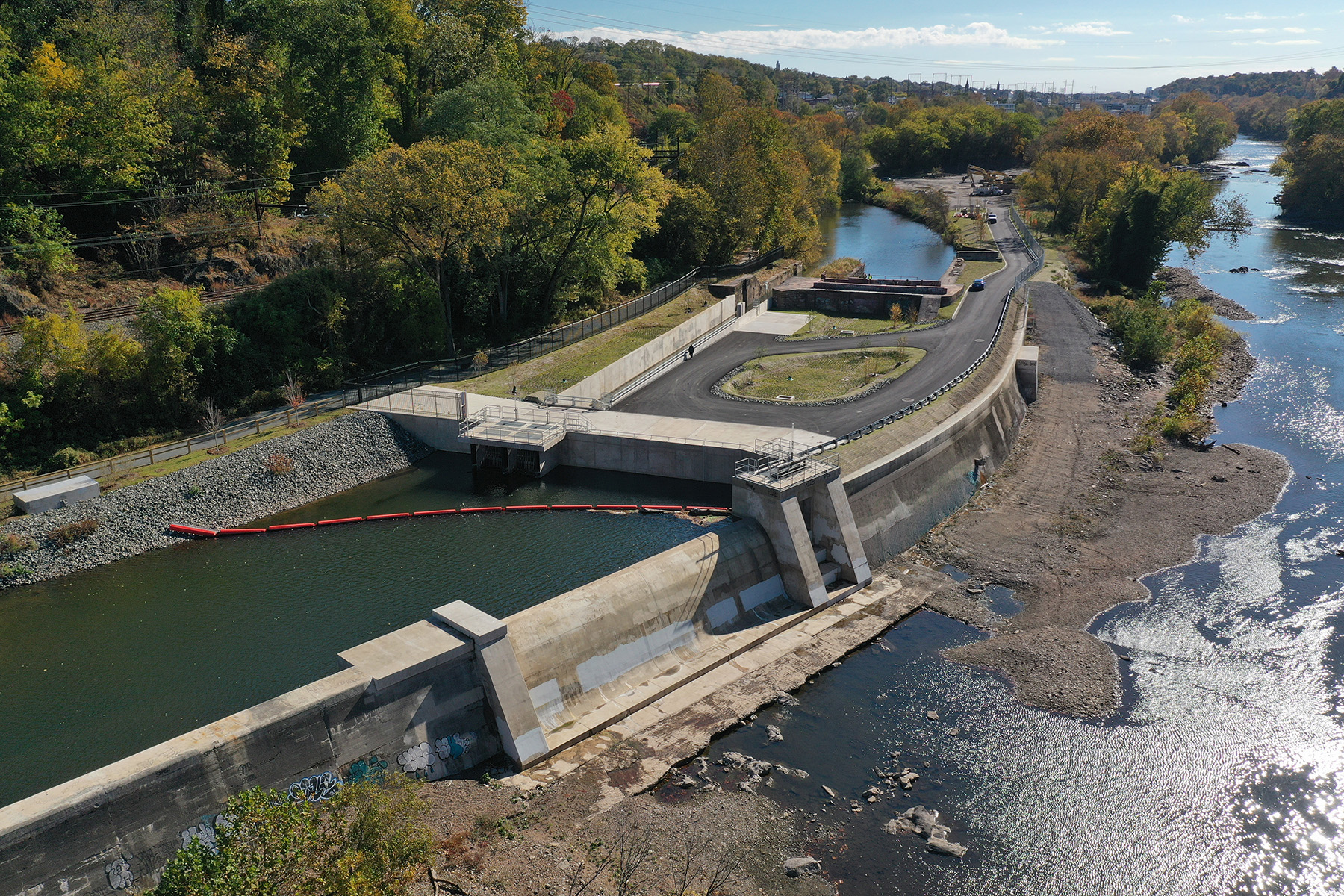
In total, more than 7,000 cu yd of concrete was placed for dam construction. Of that total, 4,000 cu yd of mass concrete was placed at the weir, intake, and bulkhead foundations. A total of 165 post-tensioned rock anchors were installed with design loads of 45 kip and 120 kip. Additionally, over 10,000 cu yd of structural fill was compacted on the downstream side of the bulkhead wall.
After that, three green stormwater infrastructure rain gardens were installed and planted with a selection of native grasses and trees. These stormwater infrastructure rain gardens have impervious liners that retain runoff, providing storage in a clean stone layer below the vegetated surface.
After completion of the basin planting, the access road to the new intake structure was paved. J&M Preservation Studio guided the work to stabilize and preserve the historic lock and gatehouse structure. Masonry portions of the structure were repointed, and mechanical gate operation artifacts were reinstalled on top of the stabilized structure representing their former functional uses. Recreational users on the trail can now view the historic gatehouse remnants and the lock.
Reconnecting the Manayunk Canal
Completed in September 2025, the Flat Rock Dam project achieved its four design goals. Following the reintroduction of river flows, water quality testing in the Manayunk Canal showed stabilized dissolved oxygen concentrations consistently exceeding the minimum limit, as well as improvements to pH and total suspended solids.
The new intake structure successfully restored the connection between the Schuylkill River and the Manayunk Canal, improving water quality and supporting the long-term reliability of the water supply. The original purpose of Flat Rock Dam is long gone, but through this revitalization project, more than 200 years of Philadelphia history lives on.
Ian H. McKane, P.E., M.ASCE, was the resident engineer for the Philadelphia Water Department for the Flat Rock Dam Betterment Project. He is now a dam safety engineer with AECOM.
Kevin Grim, P.E., M.ASCE, is a project manager, dams & waterfront, at Ramboll Americas Engineering Solutions Inc.
Project credits
Owner
Philadelphia Water Department
Engineer of record
Ramboll Americas Engineering Solutions Inc., Blue Bell, Pennsylvania
General contractor
A.P. Construction Inc., Blackwood, New Jersey
Special inspection services
Pennoni, King of Prussia, Pennsylvania
General inspection
JBC Associates Inc., King of Prussia, Pennsylvania
Preservation work
J&M Preservation Studio, Swarthmore, Pennsylvania
This article first appeared in the November/December 2026 issue of Civil Engineering as “Reconnecting History.”
The authors will be presenting on this topic at ASCE2027: The Infrastructure and Engineering Experience happening March 1-5, 2027, in Philadelphia. Find out more at experience.asce.org.


