 Spexi Geospatial Inc.
A new partnership between Spexi Geospatial Inc. and Niantic Spatial may help robots move more seamlessly through the human environment, including robots working in the architecture, engineering, construction, and operations industries.
The collaboration will combine Spexi’s trove of drone imagery with Niantic’s 3D modeling pipeline. According to Niantic’s announcement earlier this year, the resulting models will find uses in infrastructure inspection, insurance risk assessment, energy site analysis, and asset management.
Further reading:
- A new approach leverages AI to help find hidden bridge foundation damage
- AI, data centers drive surge in US energy demand as engineers work to keep up
- Engineering firms could add AI roles to organizational charts sooner than you think
“For physical AI to work in the real world, it needs a foundation grounded in reality,” Niantic CEO Inhi Cho Suh said in a statement. “Combining Spexi‘s capture network with our reconstruction technology and real-world models gets us significantly closer to that. … Until now, high-quality 3D reconstruction has largely operated at the scale of an object or building. This partnership takes it to city scale and more.”
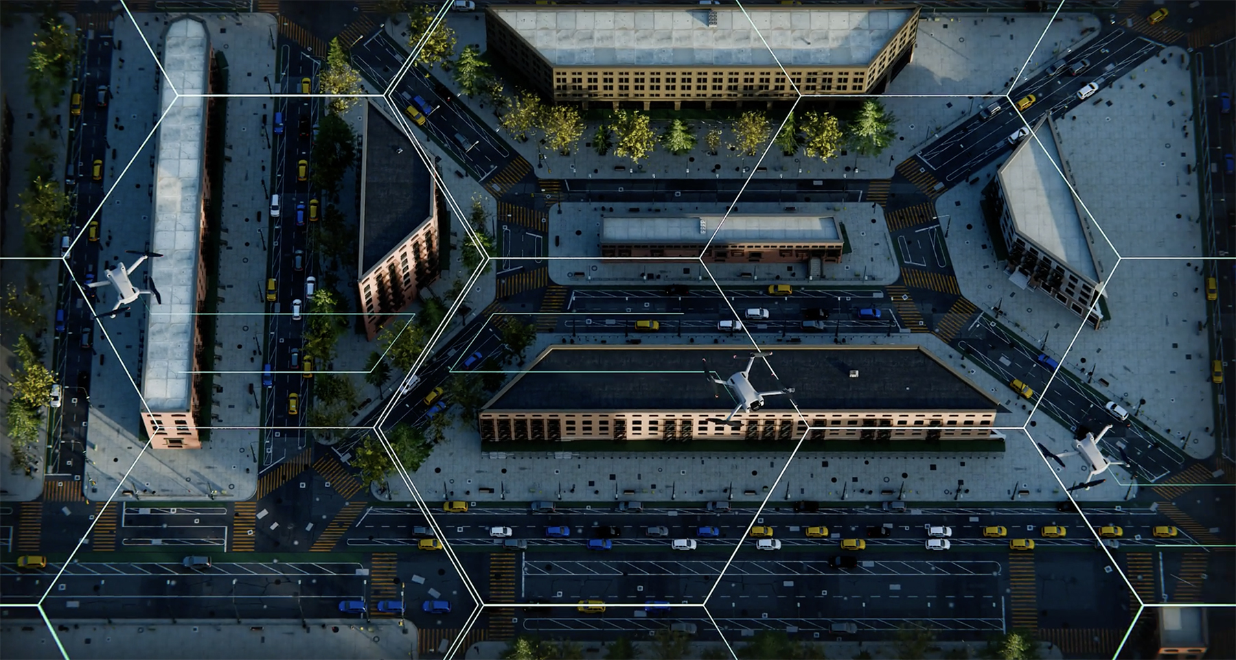
Spexi crowdsources consumer-drone pilots to collect standardized, low-altitude aerial imagery. The Vancouver-based company committed in January to return on-demand orthomosaic imagery – stitched, overlapping images corrected for distortions – within 24 hours. According to chief operating officer Alec Wilson, Spexi has covered some 6.7 million acres in 300 cities across North America at 2.8-centimeter resolution or better.
Compared with satellite or crewed-aircraft imagery, drones, because of their lower altitudes, offer higher-resolution photographs at lower cost. Spexi standardizes flights at 80 meters (about 260 feet). Meanwhile, crewed aircraft must generally fly at least 1,000 feet over populated areas.
“Drones can produce much better imagery than satellites or planes,” Wilson said. “But they’re distributed, and they’re not coordinated. We use software to distribute and coordinate people who have drones to contribute a standardized set of data across areas that the market needs.”
Niantic traces its roots to Keyhole, a satellite imagery viewer that gave rise to Google Earth and contributed to the development of Google Maps after Google acquired the company in 2004. A project called Niantic Labs, incubated within Google by Keyhole engineers, developed augmented reality games, notably Pokémon Go, before spinning out as its own company in 2015.
While game developer Scopely acquired Niantic’s game business in 2025, Niantic Spatial was formed to continue work on Niantic’s real-world modeling technology.
Splatting the world
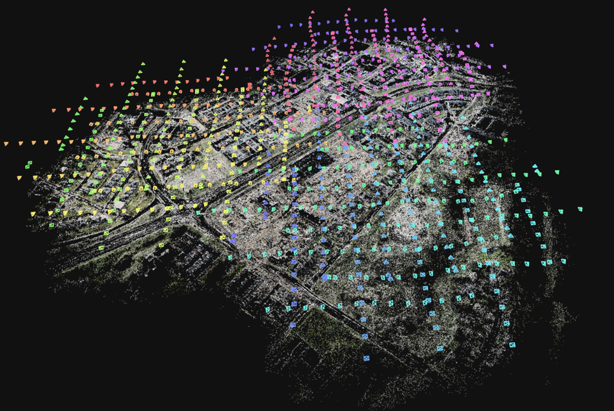
With the new partnership, Spexi imagery will feed Niantic’s modeling pipeline, which produces 3D reconstructions in the form of Gaussian splats.
Named after mathematician Carl Friedrich Gauss, Gaussian splats extend the bell curves of statistical analysis into 3D space. Sometimes visualized as floating fuzzy blobs, they represent a scene as a collection of volumetric elements, given a set of 2D input imagery.
Similar to a large language model under training, as more inputs inform a splat, the reconstruction more closely reflects reality. The results offer a level of photorealism distinct from other rendering techniques such as point clouds or meshes.
“In the robotic space, in particular, there’s a lot of discussion around trying to close the sim-to-real gap,” said Tory Smith, director of product management at Niantic. “For a long time, a lot of companies have tried to build models using synthetic data in the form of meshes. But it’s really difficult to do that without overtuning on generative environments that are just too perfect.
“It turns out the world’s a mess. There’s a lot of entropy, and using a highly decimated mesh model just doesn’t capture enough of what the real world is actually like: It’s blurry, it’s dark, it’s dusty. Splats capture that better than anything.”
From the point of view of a robot, Smith said, its sensors would ideally reference splat data while underlying mesh data would inform the physics of the robot’s understanding.
“If you toss a spoon onto a table, it looks like what’s happening is happening,” he continued. “And when it hits the table, it bounces, it makes a sound, it stops. Then, you would encode things like friction coefficients. Things like that would be encoded into the physics model separately from what the world looks like.”
Physical AI
Robots ranging from delivery couriers to self-driving cars to inspection drones will require a better understanding of their environment as they are granted more autonomy.
The Spexi-Niantic partnership hopes to build out physical AI, a term that bridges machine learning with hardware operating in real-world environments. Wilson paraphrased Niantic founder and executive chair John Hanke by describing software AI as book-smart and physical AI as street-smart.
Smith likens existing large language models to predictors of words. They make guesses based on large swaths of human-readable text. Using that analogy, he continued, physical AI models predict space based on collections of imagery.
“Where we are dabbling is full 3D, trying to turn a sparse set of 2D images into a faithful 3D reconstruction of the environment,” he said. “That can be for just visualization purposes. It could be for understanding purposes. And it could also be for understanding physics or making predictions about physical properties.”
 Niantic Spatial
Even without robotic ubiquity, such high-fidelity representations have piqued the interest of a variety of industries, according to Wilson.
Construction managers can have a photorealistic digital twin of their jobsites updated as frequently as every week. Such a model would allow virtual measurements down to a few centimeters and serve as a scaffold for annotations or other project communications. Similarly, city-level urban planning now has a lower bar for aerial imagery, while the insurance industry will have more insight into insured properties before and after disasters.
Zahra Ghorbani, Ph.D., M.ASCE, has studied the growing prevalence of digital twins in engineering and related industries. Defined by a regular frequency that synchronizes a digital representation with a physical entity, digital twin use cases span from project tracking during construction to energy optimizations during operations.
“Digital twins are a system of systems; it’s not just one application. It’s the integration of all those building systems,” Ghorbani said, adding that such integration grants visibility into the correlations between the systems. “You might be able to achieve each use case through a single system, but when you have the digital twin, it’s like you can deliver a stack of use cases. It makes everything more efficient.”
As adoption and modeling coverage builds, she sees a lot of promise integrating AI-powered robotics with digital twins.
“I think there’s a race to splat the world,” Smith said. “And we find ourselves together with Niantic in a really interesting place to do so.”
Feed Your Brain
Interested in keeping up with technologies like the ones referenced in this article? ASCE2027: The Infrastructure and Engineering Experience is a first-of-its-kind event bringing together subject-matter experts from all across the infrastructure space, March 1-5, 2027, in Philadelphia. So, yes, we know you’re excited about the Philly cheesesteaks, but ASCE2027 also is the perfect place to satisfy your appetite for learning.
Technical deep dives. Infrastructure expertise. Come feast!
Learn more about ASCE2027: The Infrastructure and Engineering Experience.