As the COVID-19 pandemic swept across the world during spring 2020, hundreds of millions of people found themselves sheltering in place: locked down in their homes, unable to go to their workplaces, and with few indoor sites open for entertainment, exercise, or other activities. At the same time, an innovative way of addressing the social challenges of this sudden change — while supporting the required social distancing between individuals — also began to spread to numerous cities in the United States and around the globe. Urban streets that were no longer filled with cars and trucks became much more welcoming to — and safe for — pedestrians, cyclists, and people who simply wanted to step outside of their houses or apartments.
Globally, news reports highlighted hundreds of miles of new bicycle and pedestrian lanes created from vehicular streets in Milan, Paris, and Mexico City. It was all part of a “shift from car-centric” cities to a new pedestrian focus in which “less traffic provides an opportunity for people to get out and be safe and secure in an urban environment,” says Gunnar Hubbard, FAIA, LEED Fellow, a principal and global sustainability practice leader, based in the Portland, Maine, office of Thornton Tomasetti.
In the United States, such cities as Oakland, California; San Francisco; and Seattle also converted portions of their streets to pedestrian and bicycle use during the pandemic.
Oakland
Oakland helped lead the way in this transition in April with a program dubbed Oakland Slow Streets. The effort was intended to “support safe physical activity and alleviate overcrowding in parks and on trails by discouraging through traffic on certain local streets,” according to a city of Oakland website on the program. Rolled out over a period of three months, the program installed barriers — such as traffic cones and signage — along more than 21 mi of streets throughout the city “for physically distant walking, wheelchair rolling, jogging, and biking.” The Oakland Department of Transportation is now considering “plans to create a new pop-up, request-based Slow Streets program in 2021,” according to the city’s website.
San Francisco
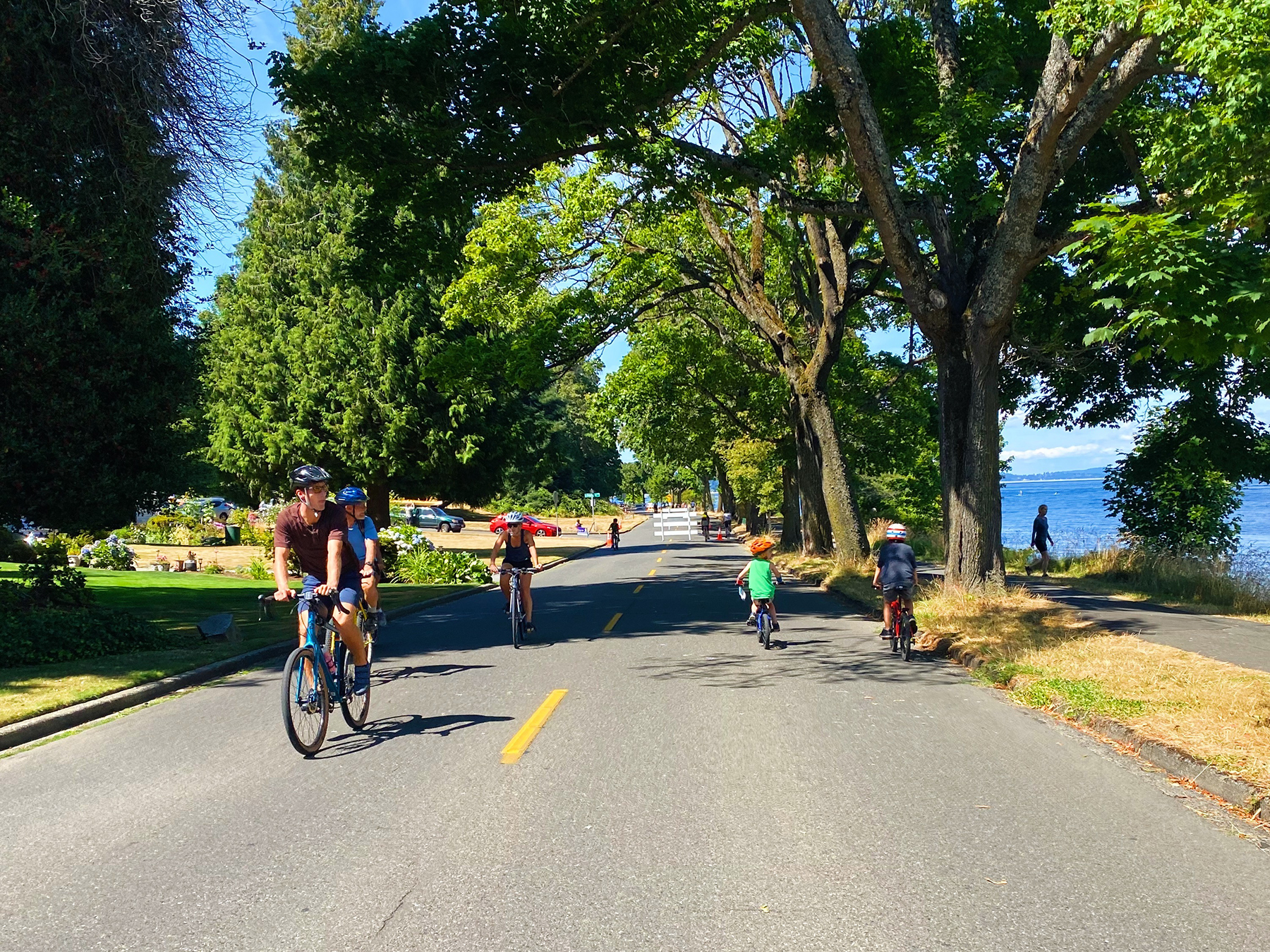
Inspired by Oakland’s actions, San Francisco enacted its own Slow Streets Program. It was launched, in part, to assist neighborhoods in which the city’s transit agency had reduced bus service because of the pandemic, says Kimberly Leung, P.E., T.E., an engineer in the San Francisco Municipal Transportation Agency’s Livable Streets subdivision and the original program manager of San Francisco’s slow streets effort. As with Oakland, the San Francisco streets are not closed to all vehicular traffic; local access and emergency vehicle access is being maintained. However, by limiting other traffic “what we’re trying to do is discourage cars from coming down these streets so that pedestrians and bicyclists have more room and are not just limited to the sidewalks,” Leung explains.
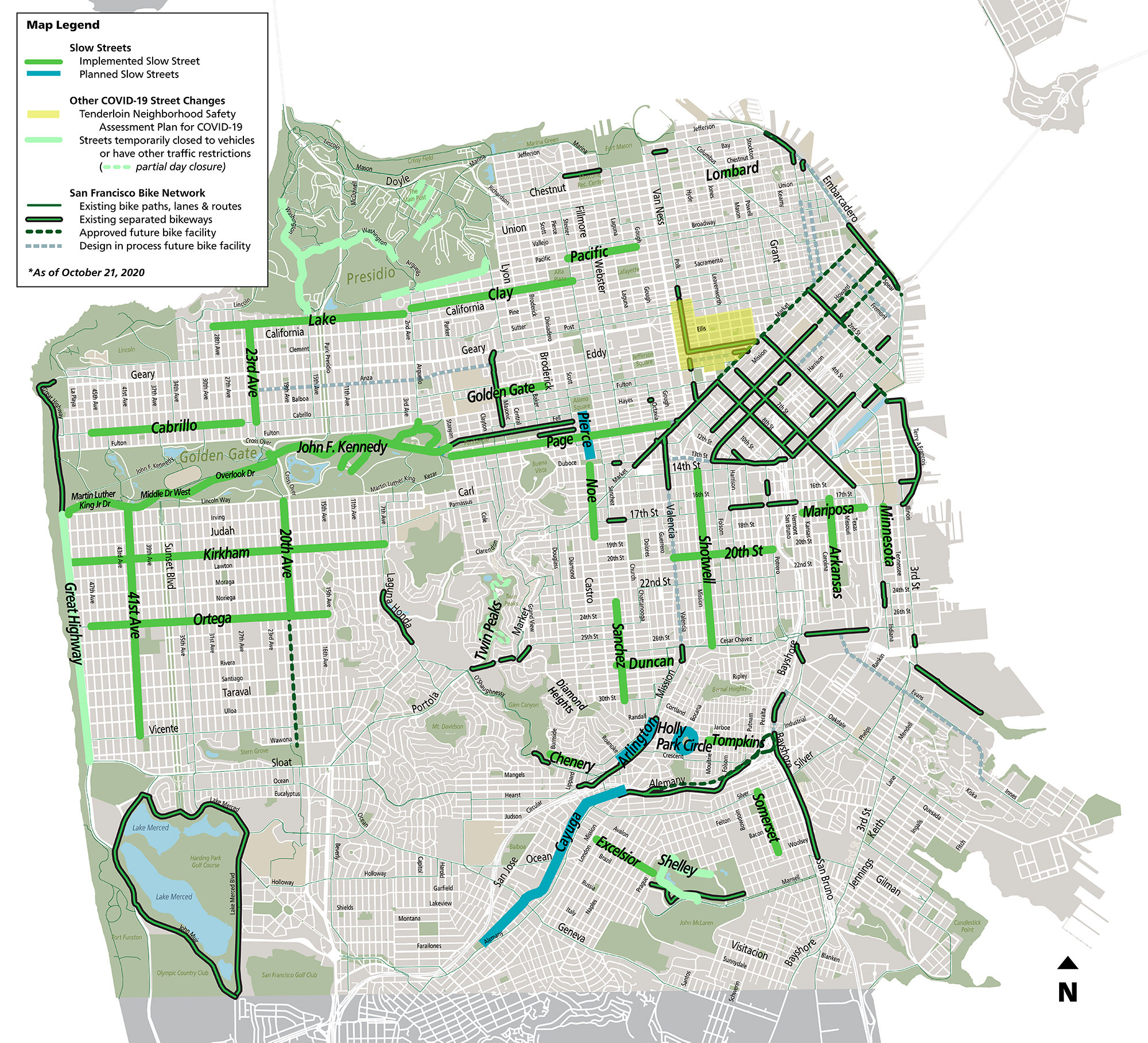
In some locations, the city is also making the sidewalks relatively wider by removing some parking spaces, which provides an additional 8 to 10 ft of space that people can walk on, Leung adds.
Focused primarily on residential neighborhoods, the program also considered the topography of the streets that were selected as slow streets — such as whether they had relatively flat terrain, good sightlines, and generally narrow rights of way so that cars were less likely to speed — and whether they had connection to the city’s existing bicycle network when selecting the best-suited corridors, says Shannon Hake, a team leader in the Livable Streets subdivision and the current Slow Streets Program manager in San Francisco. The program’s planners also checked for conflicts with police, fire, and ambulance routes and screened out streets that had intersections with complex geometries, Hake notes.
One-way streets that access couplet intersections were not strong candidates for the Slow Streets Program because of the potential complexity in how shifting traffic off those corridors might impact the overall traffic circulation network, Leung says. On the other hand, streets with traditional four-way stops were “perfect for the barricades because everyone has time to take a look and negotiate the situation at the intersection,” she adds.
Seattle
In Seattle, some 20 mi of city streets in largely residential neighborhoods have permanently become part of the city’s Stay Healthy Streets program, says Dongho Chang, P.E., Seattle’s city traffic engineer. As elsewhere, the streets remain open to the cars of residents and delivery or emergency vehicles. Still, the program has resulted in a roughly 75 percent increase in pedestrian volumes on the designated streets and a more than 50 percent increase in cycling volumes. There has also been a nearly 60 percent decrease in average daily trips for motor vehicles on these routes, with most vehicles traveling at less than 20 mph — which indicates to the city that the program is working as intended because people in cars are slowing down and avoiding using the Stay Healthy areas as traffic corridors.
Most of the selected streets already had traffic calming measures in place — including speed bumps and traffic circles — Chang says. The effort also benefited from the relatively narrow, non-arterial residential streets in Seattle, which often measure only about 25 ft wide rather than the more typical 32 to 36 ft wide streets in other cities, thus making it difficult for cars to gain too much speed, Chang says. In some locations, the program’s streets are in close proximity to parks, community centers, or schools, Chang adds, so closing off those routes can extend the existing amenities, create more space for children to play, and provide other community benefits. “In our profession as traffic engineers, we’re really thinking about how we serve the transportation and mobility needs of our community,” Chang says. “By providing other options of walking and biking, we reduce the need to drive and have a healthier option for people. ... This is a good opportunity for us to really respond back to what the community’s needs are.”
Over the summer and early fall, Seattle expanded and adapted its program in several ways, including the temporary designation of about 5 mi of roads as Keep Moving Streets near some of the city’s most popular public parks in order to create more room for recreation and social distancing.
How many of the streets in these various programs will remain largely closed to traffic once the pandemic ends is unclear. But the experience and these experiments provide engineers with “an opportunity to explore the possibilities and see how it’s working,” says Jim Quinn, P.E., LEED AP, ENV SP, a principal and lead civil engineer in the New York City office of Thornton Tomasetti.
Quinn, who helped transform New York’s Times Square into a pedestrian plaza in 2016, realizes that “when the pandemic is over, a lot of these streets will reopen to vehicles.” But he also points to the possibility of cities adopting street closures on a more limited or periodic basis. For years now, certain streets in Manhattan and the Bronx have regularly become pedestrian-only on weekends in the summer “when many people leave the city,” Quinn notes. This gives those who remain an opportunity “to walk on streets they typically can’t walk on,” he explains, and that could be a model for other cities to emulate.