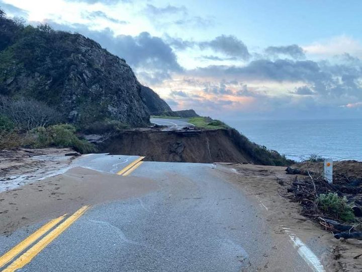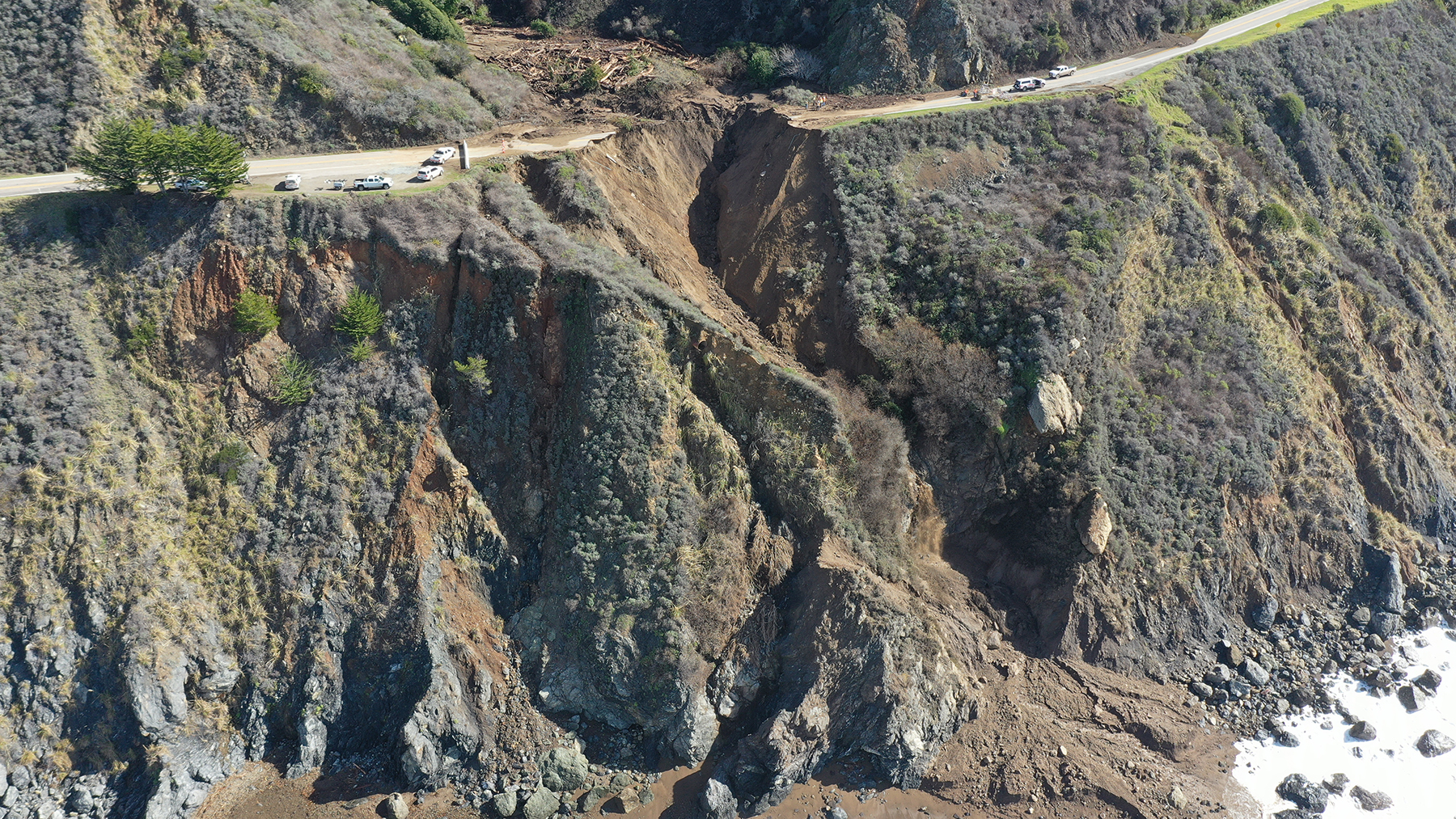
It was a dramatic event: the loss of a 150 ft section of the iconic Highway 1 along the Big Sur coast in California on Jan. 28. “A debris flow from the hillside above Rat Creek on Highway 1 on the Big Sur coast overwhelmed a drainage culvert, flowed across the highway, and eroded the road, resulting in the complete loss of a segment of Highway 1,” according to a news release from Caltrans, the state’s department of transportation. Two days before the event, a 44.6 mi section of the highway was closed and an evacuation order had been issued to residents in the Rat Creek area.
About 150 mi south of San Francisco, Big Sur comprises the 90 mi stretch of Highway 1 between the city of Carmel-by-the-Sea and the town of San Simeon. It’s a winding and treacherous highway with the Pacific Ocean on one side and the steep Santa Lucia Mountains on the other.
“The California coast is geologically young and therefore active; it's alive and moving,” says Gary Griggs, Ph.D., PG, EngGeol, distinguished professor of Earth and planetary sciences at the University of California, Santa Cruz. “(The) Big Sur coast in particular is characterized by complex and diverse geology, active faults, very steep topography, (and) frequent brush/forest fires. And (it) can get intense precipitation.”
Griggs says that the combination of the 128,000-acre Dolan fire in 2020, followed by the arrival of what is known as an atmospheric river — a narrow band of intense moisture — which dropped about 16 in. of rain on the mountains above the highway in January, created a perfect set of conditions for the highway collapse.
“Conditions were primed for the initiation of mud/debris flows, mixtures of soil, rock, water, and logs that came down the Rat Creek drainage and overwhelmed the culvert that normally would carry water under (the highway),” Griggs says. “The result was debris over the road and erosion of the fill supporting the roadway and then collapse.”
The Big Sur special
Kevin Schmidt, Ph.D., a research geologist with the U.S. Geological Survey agrees with Griggs. “The Big Sur coast is a bit of a natural landslide laboratory in that there's a variety of different materials that underlie the landscape,” Schmidt says. “It's been tectonically deformed into different parcels that have different slopes and catchments of water that flow through them. So the natural gravitational stresses from the land and the underlying strength of the rocks are quite different.”
The Big Sur coast is prone to both slow- and fast-moving landslides and accompanying debris flows. Then there’s the anthropogenic influence. “With Highway 1, there's a prominent notch in the (coastal) landscape from the construction of the highway, which changes the overall stability of the landscape. And then there's the drainage associated from the highway itself,” Schmidt says. In the Rat Creek example, the road happened to be in the way of the debris flow that was coming down, he points out.

The Dolan fire might have also changed the hydrologic response to the rainstorm because it destroyed all the vegetation in the area. “The amount of water coming off the landscape was accelerated because of the lack of the sponge of the vegetation to absorb water and the (lack of the) friction of plants on the ground to slow water transmission through the catchments,” Schmidt says. “So there was a lot of water coming through laden with char and ash and debris that then hit that (culvert under) Highway 1 and plugged it all up — and (then) the problems started.”
Then there’s the ocean. “The waves are slowly chewing away and moving the rocks and debris along the coast,” says Jonathan Warrick, Ph.D., a research geologist with the USGS.
Despite these conditions, it’s difficult to pinpoint any one factor as having contributed to Rat Creek, Schmidt says.
The possible role of climate change
It’s also difficult to say with certainty that any one incident we experience today is because of climate change. “But observations and climate models are in agreement that with a warming planet, summers will get hotter and drier (in California) with more droughts and fires, which we are seeing in recent years,” Griggs says. “Winters will see more concentrated rainfall and runoff, leading to more flooding, landslides, and debris flows.”
Because of these developments, even though the sole reason for the events cannot be said to be climate change, “it’s more accurate to say that (incidents like the debris flow) were more likely to occur and were moredestructive due to climate change,” Griggs says.
“There's a well-established connection between fire and accelerated erosion rates throughout the West Coast going all the way to the Rockies,” Schmidt says. “Landscapes will generate less water and sediment when there's established vegetation on them. When you burn the vegetation off, the response of that water and sediment is transferred through the drainage network much faster.” The cumulative effect of fires will be harder to pinpoint. “Whether or not repeated fires on the same landscape will generate the same magnitude of response over time is a more challenging question,” Schmidt says.
Recipes for the future
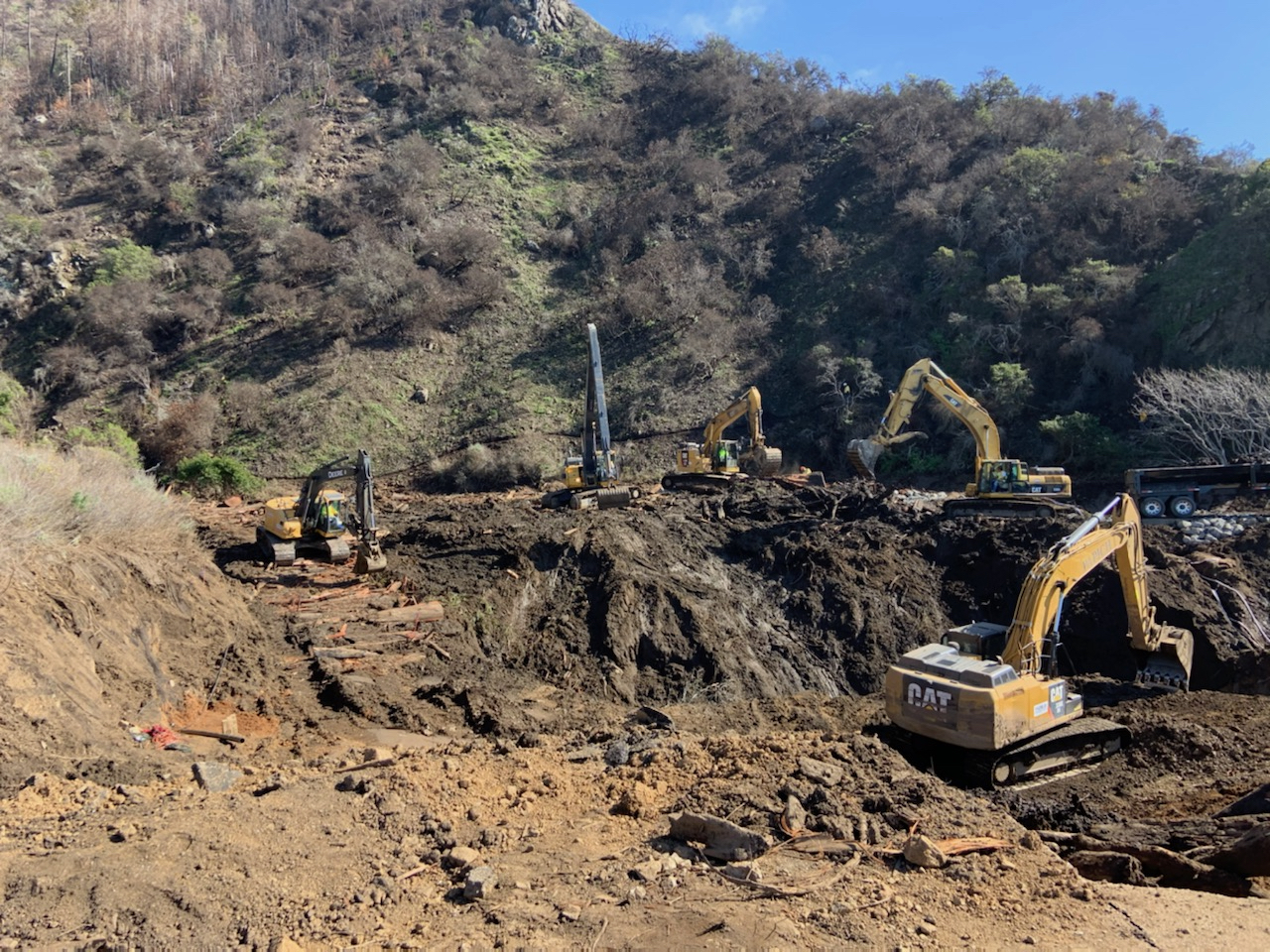
Caltrans announced that it would repair the Highway 1 stretch with an enhanced fill option and increase the capacity of the culverts to transport debris under the road.
“The enhanced fill option involves reintroducing dirt fill to connect the north and south sections and to pave the roadway on top of it, similar to how it was originally constructed,” according to a press release. “We will enhance this method with modern engineering design and significantly increase the capacity of the culvert system with redundancies designed to withstand future debris flow episodes.”

The main drainage system at Rat Creek will be replaced “with an oversized main culvert, a secondary culvert, and smaller overflow culverts closer to the highway grade. This will increase the capacity of the drainage system, add redundancies designed to withstand future debris flows, and enhance the resiliency and sustainability of the highway against rising sea level and coastal erosion,” according to another Caltrans press release.
“In general, we are looking to design in more resiliency to the highway system,” says Berkeley Lindt, P.E., a civil engineer at Caltrans.
If climate change is making these incidents more frequent, rigorous responses are called for, Griggs says. “Lots of existing engineered structures (highways, sea walls, high rises, storm drains, levees, etc.) will have to be analyzed and prioritized for replacement or repair or reconstruction, and any new structures will have to plan for future conditions rather than the design conditions of the past,” he says.
For existing structures, like the culverts underthe highwayat Big Sur, “this will obviously take time and money as well as political will, which we are often very short of,” Griggs adds.


