By Jay Landers
More than a century ago, the city of Toronto reconfigured the Don River, adding a 90-degree bend to the waterway near its mouth and directing it westward into the concrete-lined Keating Channel that empties into Toronto’s Inner Harbor, itself located on the north shore of Lake Ontario. Some 20 years later, portions of a bay and wetlands at the original mouth of the river were filled in to create the Canadian city’s Port Lands, a port and industrial area near downtown.
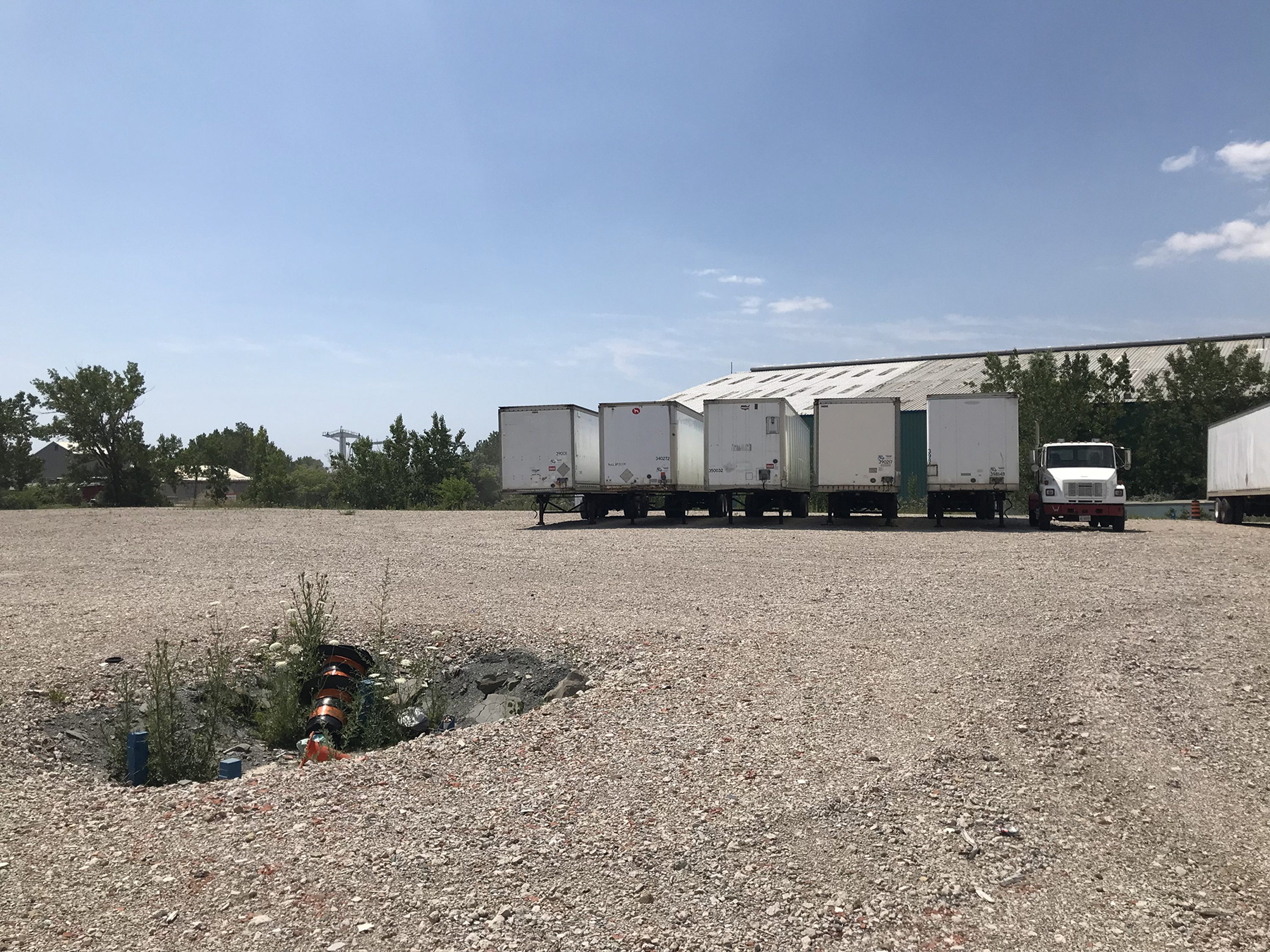
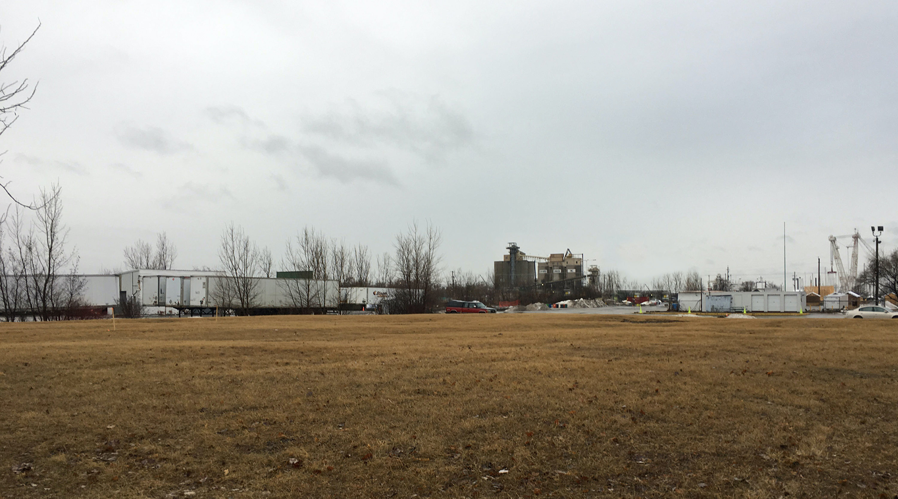
Fast-forward to present day: Much of the industrial activity departed the Port Lands decades ago, leaving a significant tract of underused or abandoned postindustrial properties near downtown Toronto. Although prime waterfront real estate, the Port Lands could not undergo revitalization because of concerns regarding flooding and the presence of industrial contamination.
As part of a nearly $991 million (CA$1.4 billion) project more than two decades in the making, Toronto is now addressing both problems through a unique combination of flood-risk reduction and large-scale environmental restoration.
Project construction began in December 2017 and is scheduled to be completed by the end of 2024.
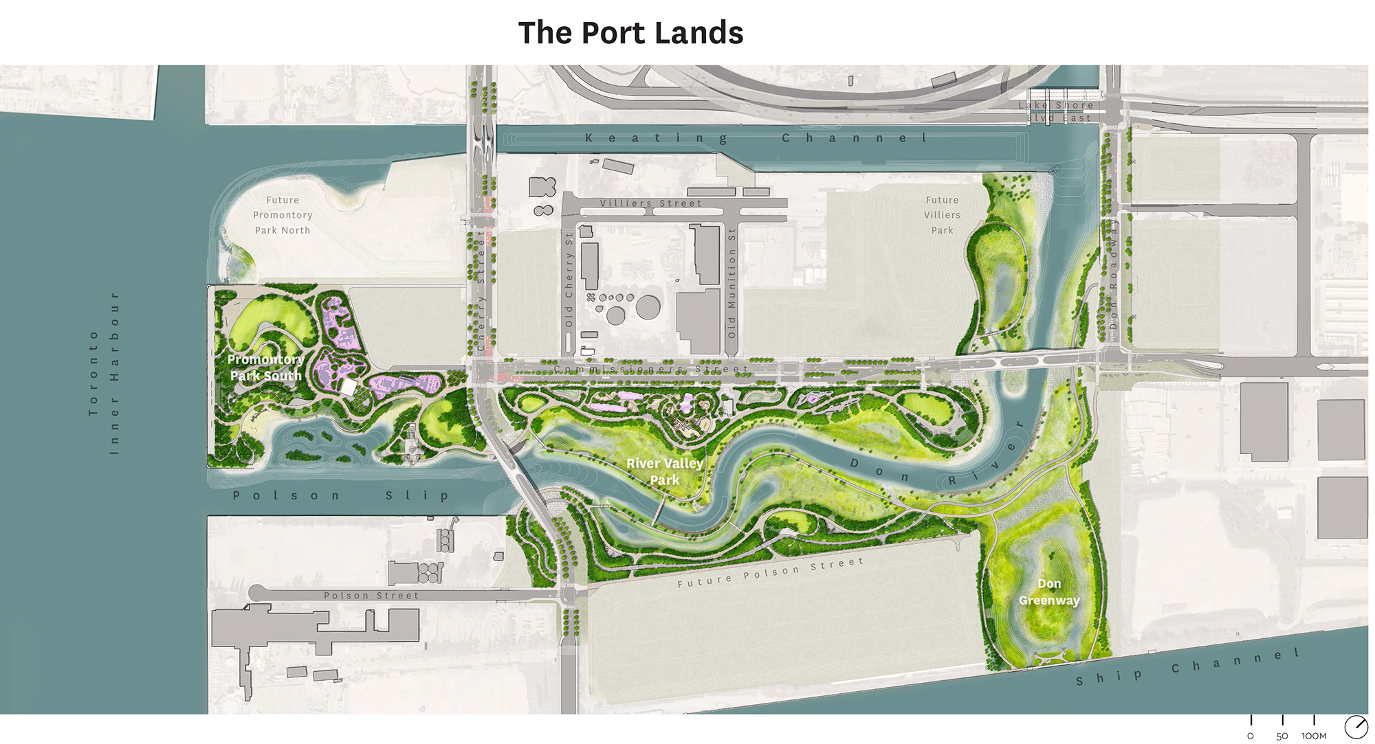
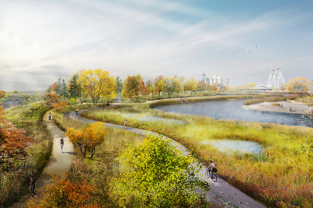
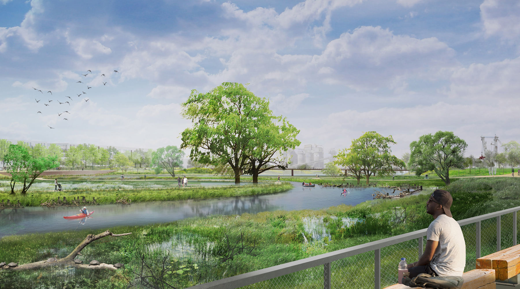
Along with new parks, roads, bridges, and utilities, the project includes the creation of a 1 km long naturalized river channel and valley with wetlands, meadows, and other types of habitat.
Past pollution
The Port Lands is part of a large swath of land in the southeastern section of downtown Toronto that lies within the 100-year floodplain of the Don River. The low-lying area was reclaimed with the placement of poor-quality fill within the original bay and what had been one of the largest wetlands on Lake Ontario.
Once home to Toronto’s port, an energy-generation facility, and a multitude of industrial operations, the Port Lands incurred significant environmental contamination over the years. Decades of industrial activity left their mark in the form of vast amounts of soil contaminated with varying concentrations of metals, polycyclic aromatic hydrocarbons, petroleum hydrocarbons, and volatile organic compounds.
Efforts to restore the Don River date to 1989, when a group of area residents demanded that the Toronto government act to improve the river’s health, says Ken Dion, the project director for the Port Lands Integration at Waterfront Toronto. The organization was formed in 2001 by the federal government, the provincial government, and the city of Toronto to facilitate the revitalization of the city’s waterfront area.
A citizen-led task force created to assess opportunities for improving the Don River watershed recommended several solutions, Dion says. Among the recommendations was the creation of a “new naturalized mouth” for the river, removal of the waterway from the Keating Channel, and wetlands restoration, he says. Meanwhile, a federal task force evaluating the future of Toronto’s waterfront identified flood control as a key requirement for economic development.
Dual functions
After collaborating, the two task forces identified the “dual objectives of naturalization and flood protection” as the key elements needed to underpin efforts to revitalize the Port Lands, Dion says.
Many years of planning and environmental assessments eventually led to the adoption of an ambitious plan to create the 1 km long naturalized low-flow channel with a new mouth for the Don River, the creation of wetlands and other natural habitats, and the addition of flood-risk-reduction measures.
“The ecological naturalization component greatly informed what we were going to do as part of the flood-protection solution,” Dion says. Ultimately, it was decided to create an entirely new river valley through the center of the Port Lands, complete with 25 hectares of accessible green space and parkland.
Varying in width from approximately 150 m to 200 m, the new river valley includes a permanently flooded channel that will have a width ranging from 40 m to 60 m. On average, the water column in the new channel will have a depth of 2-3 m.
“That dual function of flood protection and naturalization influenced the configuration of what the valley has to look like,” Dion says. “We needed enough space to be able to create new wetlands and a meandering, naturalized river channel system that looks like and functions similar to other coastal wetlands within the Toronto area coming into Lake Ontario.”
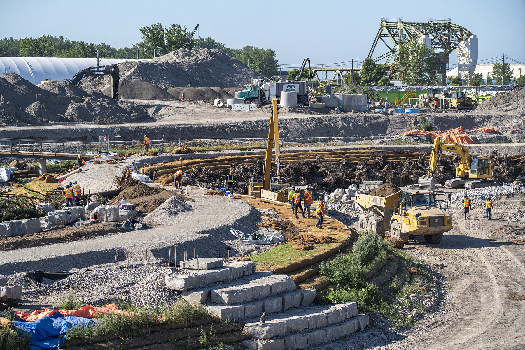
Channel construction
All told, approximately 1.5 million cu m of contaminated soil was removed from the site, Dion says. About 80% of the soil was treated so that it could be reused as part of the project for such purposes as raising grades along roads or in parks outside of the river valley.
The contaminated soil was remediated on-site by means of a process known as biopiling. The process uses natural microbes present in the soil to consume and biodegrade the contaminants, which are converted into less harmful compounds, carbon dioxide, water, and a small amount of inorganic salts. QM Environmental Services and Vertex Environmental Inc. developed the biopiling method used on the project.
To facilitate channel construction, a combination of secant pile walls, slurry walls, and diaphragm walls was extended as much as 3 m into underlying bedrock, which ranges in depth from 20 m to 45 m beneath the existing ground level. Channel construction required excavation of up to 7-8 m in some locations.
As part of the construction of the new river system, a liner was installed to provide a barrier between the remaining soil and the newly constructed valley. A system of drains and pipes was installed under the liner to remove groundwater during construction. The materials used to form the base of the river and the riverbanks were constructed on top of the liner.
Erosion-resistant clay levee cores were used to create the riverbanks. However, in river meanders and other areas with faster-moving water, the riverbanks include a crib-wall system to provide stability. The system consists of buried logs with their roots still attached and exposed to the river. Multiple layers of overlapping logs were anchored with large boulders and then mostly buried. The resulting structure resists erosion while also providing aquatic habitat.
In other locations, the riverbanks were formed in a stairlike formation by means of fiber-encapsulated-soil lifts that employ coconut-coir fabric to contain soil implanted with seeds. Over time, the roots of the resulting vegetation stabilize the soil and the fabric biodegrades.
Reduced flood risk
To accommodate high flows during flood events, a third river opening known as the Don Greenway is being constructed. A combination wetland and spillway, the opening will allow flood flows to enter an adjacent ship channel that empties into the Inner Harbor.
A raised wall feature to the east of the Don River will protect nearby areas from flooding. Ultimately, the project will reduce flood risks for 240 hectares of adjacent lands, enabling future public and private development nearby.
Parklands with more than 6 km of trails and other recreational features will flank both sides of the naturalized river valley. “By providing this extra green space and a range of different types of meadow, forest, and wetland habitats, we're filling a large gap in the suite of different ecological habitats that were previously not available,” Dion says.
Roadways added as part of the project include green infrastructure features intended to provide multiple benefits, including stormwater management and reduction of the urban heat island effect. “We're giving a lot of space available to green up the necessary transportation infrastructure within the area,” Dion says.
Landscape architecture firm Michael Van Valkenburgh Associates Inc. is the lead consultant on the project, which is jointly funded by the Canadian, Ontario, and Toronto governments.
The project also includes four new bridges, ranging in length from 57 m to 152 m, that were designed by consulting engineering firm Entuitive, architecture firm Grimshaw, and consulting design firm schlaich bergermann partner. WSP Canada served as the lead engineer for roads and sitewide municipal infrastructure.
This article is published by Civil Engineering Online.