In August, Google announced that its Android phones would be used like mini-seismometers, creating the world’s largest global earthquake detection network: the Android Earthquake Alerts System.
The system will collect data from phones about ground shaking during an earthquake, aggregate it, and share it with others located further away from the quake’s epicenter to provide early warning of an earthquake’s arrival.
The alert system was developed by Google in collaboration with global seismology and disaster experts Richard Allen, Ph.D., the director of the Berkeley Seismological Laboratory and the Class of 1954 Professor in the Department of Earth & Planetary Science at the University of California, Berkeley; Qingkai Kong, Ph.D., an assistant data science researcher at the same lab and the Berkeley Division of Data Sciences; and seismologist Lucy Jones, Ph.D., the founder and chief scientist for the Dr. Lucy Jones Center for Science and Society. Allen and Kong have been appointed as visiting faculty at Google for their work on the new technology.
The effort is being led by Marc Stogaitis, a principal software engineer for android safety at Google. Stogaitis works with the Android Safety Team, which develops systems to help prevent injuries and save Android users’ lives. The team’s previous efforts have included a car crash detection system that can automatically call 911 if the user remains unresponsive as well as an emergency location service that notifies emergency responders of a user’s location. “Earthquakes are kind of a natural extension (of this work),” Stogaitis says.
Google also launched in August an earthquake early warning system in a regionally specific collaboration with the United States Geological Survey and the California Governor’s Office of Emergency Services, according to Stogaitis. (This is a separate system from the Android Earthquake Alerts System that will gather data from phones that was announced that same month.) In the collaborative early warning system in California, Google sends alerts using existing data from ShakeAlert — a program launched by the USGS and the governor’s office — that aggregates data from a network of more than 700 seismometers in California.
Google is using the ShakeAlert data to notify Android users in the state if an earthquake occurs and is headed their way. The system, like other early warning systems, will provide up to 45 seconds of warning, depending on a person’s distance from the epicenter, that an impending earthquake will arrive. This is enough time, in most cases, to ensure that people engaged in high-risk activities can move to safety before the ground begins to shake in their location. Such activities could include a researcher using sensitive lab equipment or someone in a precarious location such as on a ladder or scaffolding.
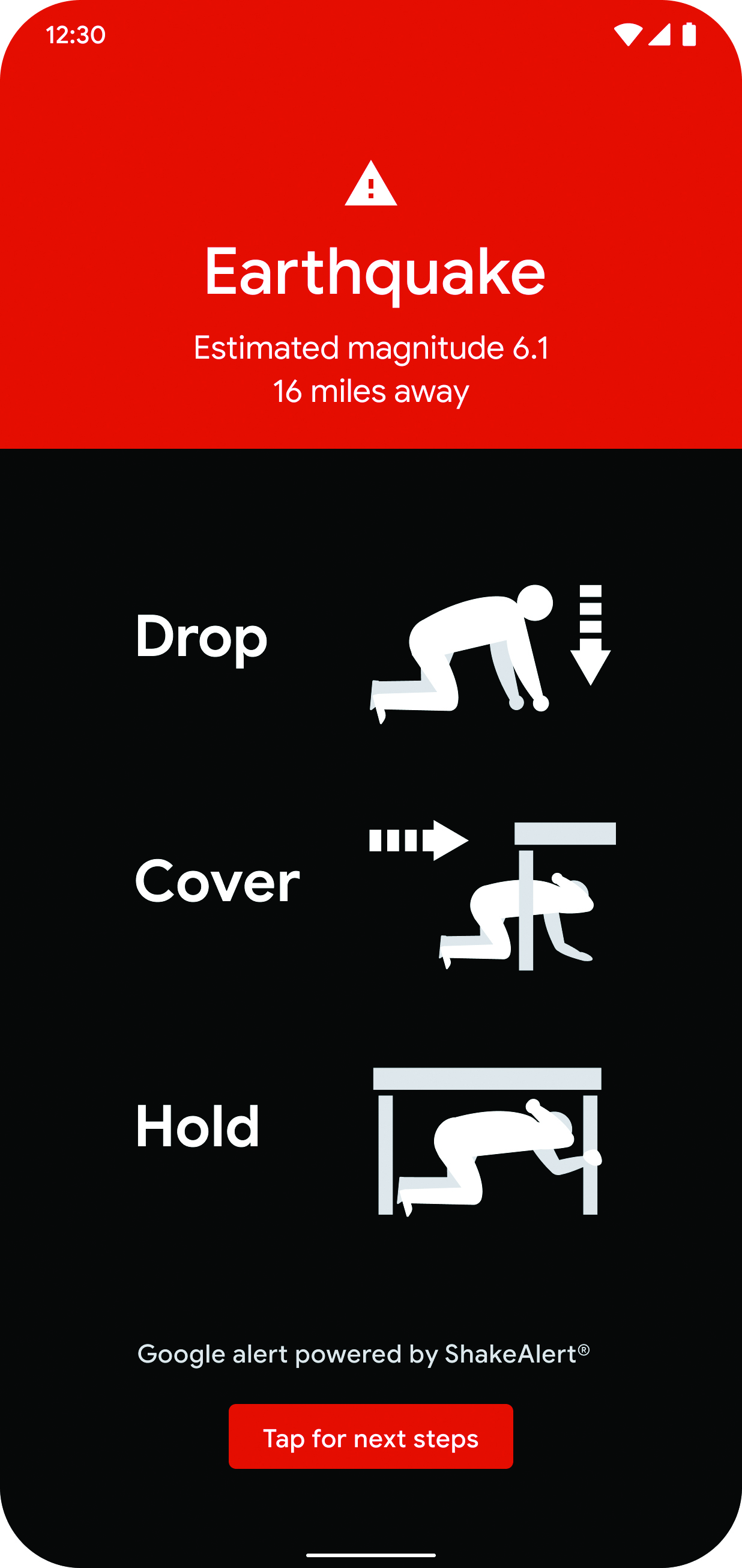
“In general there are two types of alerts that we send out,” Stogaitis says. “The first is called ‘take action,’ and that is when we expect really strong shaking. It’s this full-screen alert; it’s loud, (and) it gets your attention. The second alert is called ‘be aware,’ and that’s for when lighter shaking is expected, and it warns you in a softer way.” The former is any shaking that registers a moment magnitude 5 or more, while the latter is anything that registers between a moment magnitude 3 and 4.9. The designers took care, Stogaitis says, to make sure that if an earthquake of the latter type occurred when someone was asleep, the person would not be woken up by the alert.
Unlike the California-specific ShakeAlert-based program, the new Android Earthquake Alerts System has a global reach. And, rather than relying on the data collected by an official, existing seismic network, it instead uses the phones themselves as seismometers. “There are earthquakes that happen everywhere around the world, and not every place around the world is going to be able to install (a) dense seismic network like California,” Stogaitis says. For regions that do not have such networks already, “that’s where we’re using the scale of Android to help,” Stogaitis says. The Android-based early alert system will be rolled out region by region beginning early next year, with a preliminary launch in one yet-to-be-determined country.
The phones’ physical data collection system will be similar in concept to one that Allen and Kong established with the release of their MyShake smartphone app in 2016 at the Berkeley Seismological Lab.
In general, earthquakes can be measured using seismographs or accelerometers. The “beauty of smartphones,” Allen explains, is that they already contain accelerometers. What Allen and Kong established with their MyShake work was that they could “use the accelerometer in every smartphone to record ground motion in the exact same way that we would in a traditional seismic network,” Allen says.
While the first accelerometers were put in smartphones to determine whether a person was viewing the phone in portrait or landscape mode, their usefulness has significantly expanded to include a variety of fitness tracking options and other apps, which now includes ground motion tracking, according to Allen. Unlike the MyShake app that can be installed on any smartphone, however, the Google system is integrated into Android phones only.
The Android phones — like the smartphones used for the MyShake app — will collect ground motion data only when the phone is plugged in and stationary. This is so that the system does not deplete the phone’s battery, but it also has the benefit of typically meaning the phone is in a stationary, stable position that makes it easier to track earthquake waves, Stogaitis says.
The algorithms that Stogaitis and his team have developed are able to isolate earthquake waves from other types of movement waves, including those resulting from a wobbly piece of furniture that a phone might be resting on, a house shaking from the passage of a train, or even widespread shaking created by large thunderstorms.
“Developing a core earthquake detection algorithm was the biggest challenge, and making sure that it actually works and it’s not going to have too many false positives … was probably the hardest part,” Stogaitis says.
As just one example of how the team had to distinguish the types of waves captured, Stogaitis explains: “Thunder is just a wave propagating out from a specific area, and that’s what an earthquake is.” Both types of waves cause shaking, he says, in “almost a circular pattern around an area. It’s one of those things that we had to solve.”
The speed of sound is about 10 times slower than the speed of an earthquake, so it was easy to measure that difference within the algorithm once it had been spotted, he says. “Lucky for us, the physics on that one worked out pretty well.”
The team also had to determine how to alert every Android user in a specific region about an incoming earthquake very quickly, because seconds matter, and to do so in a manner that would not crash the entire network. Splitting the notifications between cellular and Wi-Fi, depending on how a phone is connected, was one way to make the system more reliable, Stogaitis explains.
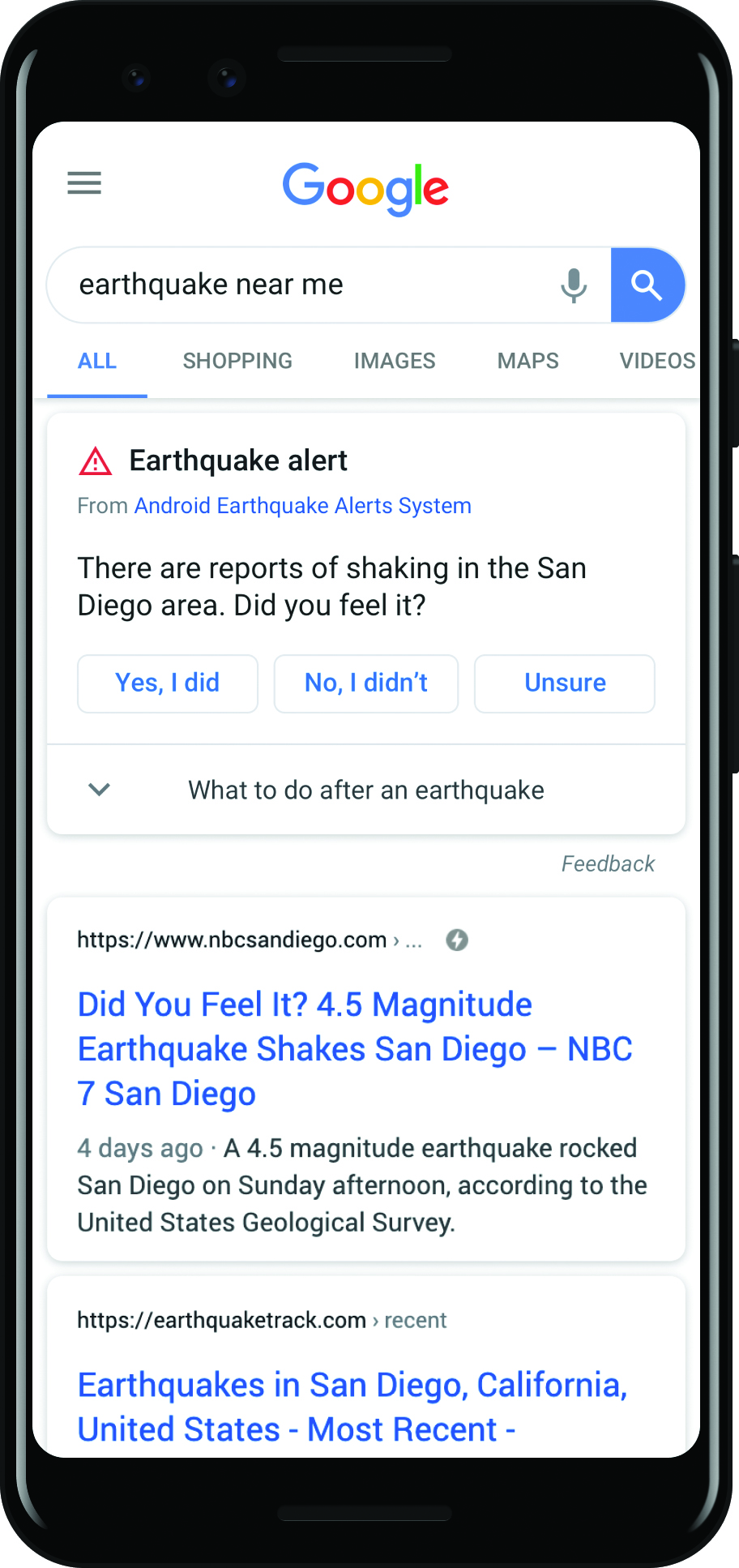
The data gathered by phones is also being used to increase the robustness of the Google search engine by populating it immediately with earthquake information.
In the long term, the Google team hopes to create shake maps that can help first responders and emergency managers better target their responses in the immediate aftermath of an earthquake. But they also hope to release the earthquake data as an app plug-in, which would work on all smartphones, so that third-party developers would be able to use the data for their own apps. “We’re hoping to enable an ecosystem of app developers,” Stogaitis says.
“Once you know an earthquake has happened, there is a lot of response that can be built on top of (the data) to help people — things like making sure that elevators stop at the next floor automatically and open doors, automatically turning off gas valves, having trains stop or slow down, having airplanes abort their landings, stopping medical procedures,” he says. “We can’t necessarily build all these things ourselves … but that’s another way where this can help more people.”
For Allen, the work that Google is doing with its Android phones and the academic research that he and his colleagues are conducting with MyShake are both necessary and distinct. “We’re living in a time where there are an expanding number of sensors — the standard Internet of Things is what everybody is talking about,” Allen says. “For me, what’s really exciting here is that we’ve figured out how to bring that to bear on seismology problems,” he says. “This is just such an incredibly powerful idea that we could use these distributed sensor networks to really understand earthquake processes better and, of course, provide the real-time mechanisms to reduce hazards (by) providing warning to people.
“It’s a very exciting time to be in seismology, and it’s very exciting that Google is engaged with this as well because that just brings it to a whole new level.”
This article first appeared in the December 2020 issue of Civil Engineering.