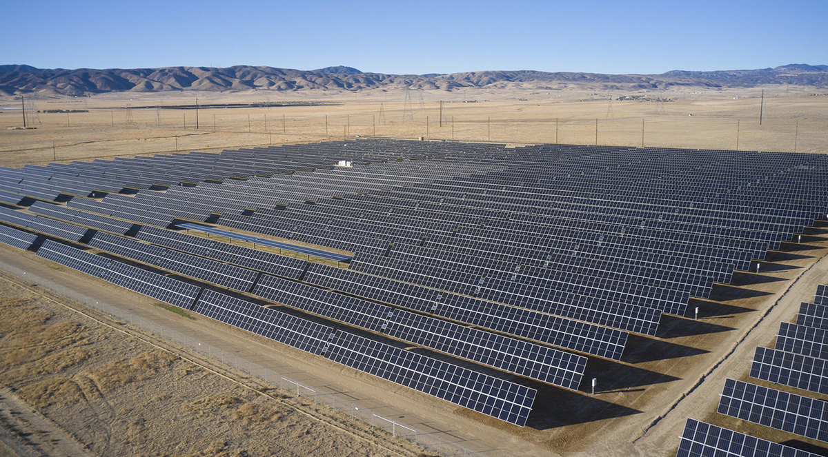
 @Cameron Davidson for Kimley-Horn
Civil engineering firms are increasingly capitalizing on the power of artificial intelligence tools in surveying and analyzing large sites.
“I think if you’re not already investing and utilizing it, you’re behind,” said James Stowell, RPLS, group manager of geomatics in the Dallas-Fort Worth office of McAdams, a full-service civil engineering firm that handles land planning, surveying, landscape architecture, water resources, transportation, and construction administration. “It’s progressing so fast, and it takes a while to learn how to really utilize it to its fullest. You need to start now, or you’re just going to get left behind.”
Further reading:
- Engineering firms could add AI roles to organizational charts sooner than you think
- AI in civil engineering: How practitioners are finding their roles in a shifting field
- Rethinking civil engineering education in the age of artificial intelligence
“We speak about how we’re leveraging AI as an extension of our engineers, planners, designers, and consultants,” added J. Nick Otto, chief technology officer at Raleigh, North Carolina-based Kimley-Horn, an engineering, planning, and design consultancy that does what Otto calls “everything horizontal” in the civil engineering space: development services, land development, traffic engineering, water and wastewater services, power transmission, and energy systems.
AI supercharging land survey work
McAdams surveys parcels of land ranging from a few acres to several thousand. AI tools expedite the analysis of property deeds.
“These AI readers will not only show you the picture of what it looks like, it gives you statistical information about it,” said James Armstrong, PLS, NCAT, Raleigh-based director of geomatics for McAdams. “And then we’ve internally started developing our own models to be able to do that as well. So they’ve allowed us to train our own team to develop some of that stuff in-house.”
He continued: “I can just drop a document that I pulled from my research that I got through (a geographic information system) tool, and now I’m in (computer-aided design) mapping. From an engineering perspective, we can build large base maps, and all the design critical information that typically took weeks or months can be in there in a matter of days. So there’s huge efficiency gains.”
Stowell says AI is helping McAdams analyze topographic data from drone flights. “We can take a drone flight and survey that we’ve prepared and upload an orthometric aerial to the program,” he said. “It’ll extract information from it, such as paving, striping, roadways, utilities in some cases – and really reduce that drafting time and let (McAdams’ teams) focus on more important things that the crews might be picking up in the field, like utilities and inverts (utility depths). And the highly detailed information saves a lot of time in the field and in the office.”
AI tools can also help firms better extract environmental information from data sets, including specific tree types.
“So now we’re looking at endangered species,” Armstrong said. “You have that, and then if you’ve got the low-level wetland vegetation, now you’re starting to develop environmentally sensitive areas, which also may be potential habitats for communities of endangered species.”
Similarly, Otto said AI can assist with the analysis of satellite imagery in the early phases of projects, including the extraction of feature lines.
“You can start getting an initial layout of what’s bare earth, what’s under deciduous cover, etc.,” he said. “If there’s a road, you can actually extract things like, ‘Is it a curbed road, non-curbed road, asphalt, concrete?’ and start building out the plan. And then from there, if you know what you’re going to build the site for (and) you know the requirements, you can mathematically start to do some of the initial site grading.
“You can bring in things like if it sits in a 500-year floodplain or a 1,000-year floodplain, you know the topography, you know the stormwater conditions.”
Time saving with custom AI tools
Kimley-Horn uses a lot of AI tools for automated site grading, which tends to be a meticulous, time-consuming process.
Typically, Otto notes, if you take a 2,000-acre site, you can start the initial design work with topographic maps or a lidar scan.
“A designer will spend a lot of time in the first 10% to 20% overlaying things and maybe extracting features and making some observations to try and get that initial layout done,” Otto said. “Then, they can start adapting the grading for the features that are going to be on the site.”
He used the example of a project type Kimley-Horn has a lot of experience in: solar farms. “There are known requirements and constraints in solar,” he said. “You’ve got to grade the site. You’ve got steel to mount the solar arrays. You’ve got a cost differential between moving dirt or adding steel. So if we can introduce AI in the automated grading world, we can accelerate maybe the first 10%, 20%, 30%, maybe even 40% of that work.”
Kimley-Horn has developed more than a dozen specific AI tools to help respond to particular demands of solar clients, including a solar analysis program called PV Tune. For large sites, the firm has built a tool that understands the relationship between grading and construction, which allows for the design of more efficient solar plants.
“Solar farms are incredibly expensive to build,” he said. “So if you can optimize the site design for earthworks versus structural steel engineering, (you get) better results for everyone and a win for the clients because it saves them money.”
AI is making coding these tools faster. Tools can be improved in near real time. Two years ago, if a client wanted an AI tool to consider electrical design components, building that out might have taken a few quarters. Now it takes weeks, maybe even days.
Toward higher-value work
AI systems can also analyze historical documentation to advise engineers about working in culturally sensitive areas. Armstrong mentioned one project McAdams worked on where the site was near Native American burial grounds in Arizona.
“People rarely encounter them, so there is not a specific training or education or familiarity centered around it,” Armstrong said. “When a team is working through a project, they collectively have to search out that information and may not find it.”
AI, he said, could access scanned archival records to “minimize issues and create awareness earlier in the design-entitlement process.”
Armstrong said that when he first started his career, he spent “many days in a courthouse basement looking up deeds and other records to help understand the history of the site.” But – in what has emerged as a theme when engineers discuss AI – the technology has the potential to preserve knowledge that might otherwise be lost.
“Twenty years ago, we started scanning historical structures to preserve them because they were at risk of being destroyed from development, erosion, or man-made disasters,” he said. “As a result, we can still enjoy them digitally. AI has the potential to ensure that knowledge is not lost, and we do not have to be in the right place opening the right file to find it.”
Both firms note that AI is enabling efficiency gains by directing engineers away from mundane tasks and toward higher-value work. But Otto notes that having a coherent AI policy is mandatory. He emphasized that it must be easily understood.
“Because if you write it like a compliance statement, then they’re just like, ‘All right, I’ll scroll and check the box,’” Otto said. “You actually want them to read it and know, ‘All right, here’s what we can do.’ And within that policy, we kind of define (that) if you’re doing this type of work, then you can work in this realm.
“If you’re doing research and you’re dealing with some public stuff, then you can use these other tools. We have the policy around acceptable use, and then we have guidelines to steer them to the right way to do work.”

Feed Your Brain
Interested in keeping up with the latest technology trends, including artificial intelligence? ASCE2027: The Infrastructure and Engineering Experience is a first-of-its-kind event bringing together subject-matter experts from all across the infrastructure space, March 1-5, 2027, in Philadelphia. So, yes, we know you’re excited about the Philly cheesesteaks, but ASCE2027 also is the perfect place to satisfy your appetite for learning.
Technical deep dives. Infrastructure expertise. Come feast!
Learn more about ASCE2027: The Infrastructure and Engineering Experience.