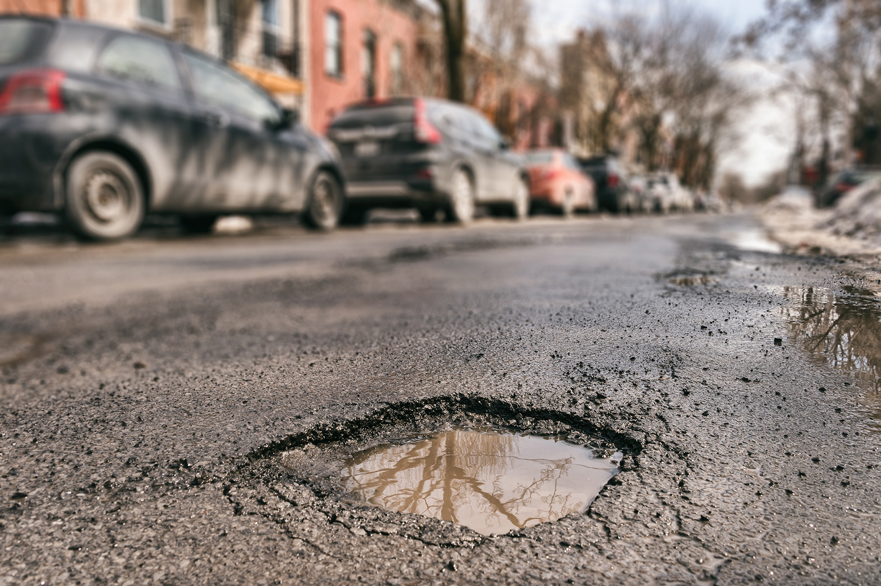
Accurate, efficient, and economical road assessment methods enable road and highway administrators to discover and repair small problems before they worsen. (Photograph courtesy of GettyImages.com/Marc Bruxelle)
By Kayt Sukel
Road and highway administrators strive to discover and repair small problems before they become larger, more costly ones. Heading these issues off requires accurate, efficient, and economical road assessment methods, said Jaime Hernandez, Ph.D., M.ASCE, assistant professor in the Department of Civil, Construction, and Environmental Engineering at Marquette University, and chair of ASCE’s Transportation & Development Institute’s Highway Pavement Committee.
Automated assessments, powered by artificial intelligence, may be the key to getting there.
“Today, there is quite a bit of human labor involved in road assessments, and it’s complicated to get the data you need to understand the condition of the roads in real time and at traffic speed,” Hernandez explained. “AI provides the potential to not only assess the road right now but also predict which parts of the road need to be prioritized when you are deciding what to fix.”
The manual (and-not-so-manual) approach
According to Mohammad Jahanshahi, Ph.D., associate professor of civil and construction engineering at Purdue University’s Lyles School of Civil and Construction Engineering, entities and organizations responsible for road maintenance and upkeep rely on two assessment standards. The Pavement Surface Evaluation and Rating system, developed at the University of Wisconsin-Madison Transportation Information Center, gives a simple quality rating between 1 and 10 (with 10 being the best). And ASTM’s Pavement Condition Index is a more comprehensive evaluation method that assigns a value between 0 and 100.
“Predominantly, municipalities will do what they call a windshield type of inspection,” Jahanshahi explained. “You have a driver and an assessor. The assessor sits next to the driver as they drive on the road, observes the road, and assigns a rating.”
Regardless of whether the assessor is using PASER or PCI, this approach is extremely time-consuming, said Jahanshahi. And there is often variability between two inspectors, even if they are using the same rating system. “Due to the amount of time and money it takes to do the assessments, most municipalities only do it once every two or three years,” he said.
AI to the rescue
There are already several semi-automated solutions on the market. Jahanshahi described an automated data collection van that is outfitted with cameras and sensors that collect road data for a human inspector to later evaluate, as well as new smartphone-based solutions that can collect data as someone drives. Yet both of these, he contended, have issues that can prevent accurate and timely assessment.
“Whether you have a windshield approach or hire this van, you are still looking at high costs, as well as a lot of manual processing,” he said. “With smartphones, you have issues with traffic or occlusions that might stop you from collecting the right data from the surface of the road.”
What’s more, he said, “Smartphone-based solutions project a 3D environment into a 2D image, causing the loss of critical depth information that is essential for accurately determining pavement distress and calculating PCI.”
To overcome these obstacles, Jahanshahi and his team created an AI-based technology that leverages advanced computer vision and algorithms to collect data and automatically assess road conditions without requiring expensive specialized vehicles.
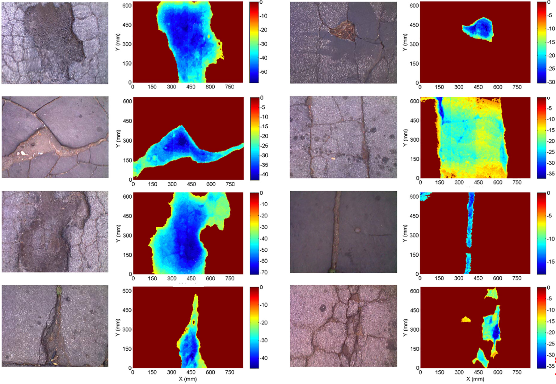
The technology, which is now being further developed by Jahanshahi’s startup PaveX, is designed to provide standardized and reproducible results at lower costs, with minimal training requirements. It involves a small hardware kit that can be added to any vehicle. And the system also offers users depth sensors, which use colors to visualize the depth of any crack or defect. For example, a dark reddish brown denotes no depth, but the color blue highlights a defect with a depth of 30 mm or more.
“For each pixel, we not only get the color but also get the distance between the sensor and the object,” Jahanshahi said. The depth information helps to determine the severity of the problem.
Jahanshahi and his colleagues have rigorously tested their system across Indiana. In one pilot comparing PaveX to human assessments, the results were comparable to an experienced human road evaluator. The algorithm yielded PCI results within ±5 points of humans. Plus, using AI overcame several challenges, including the amount of time it took to do a manual assessment, as well as the potential for human error, that municipalities may experience by relying on human inspectors to assess road conditions.
In addition, PaveX avoids individual subjectivity across multiple inspections.
Faster, more accurate assessments
Thanks to faster data collection and processing, lower costs, and accessibility, municipalities will be able to test roads more often, leading to improved preventive maintenance efforts and long-term cost savings, Jahanshahi said.
“As we developed this solution, we interviewed more than 150 road authorities and municipalities (who) are working with very limited budgets. They don’t have the ability to hire more people to do inspections for them or contract out for expensive vehicles to do it. They can use a system like this to stay on top of road conditions.”
In fact, Jahanshahi sees a future in which the PaveX system would be mounted not just on municipal fleets, but also on U.S. Postal Service vehicles, Amazon trucks, or even vehicles owned by volunteers from the community.
PaveX is not the only startup working on this kind of application. Other companies, including Vialytics and RoadVision AI, are looking to leverage AI to monitor and maintain roadways.
For his part, Hernandez is optimistic that these AI solutions promise incredible value for road authorities. But he said widespread adoption will take buy-in from all roadway stakeholders to ensure these systems are solving problems that will help municipalities and other road authorities do more proactive maintenance — even when they are dealing with leaner budgets.
Kayt Sukel is a science and technology writer based outside Houston.
This article first appeared in the January/February 2026 issue of Civil Engineering as “Automating Road Assessments.”