By Jay Landers
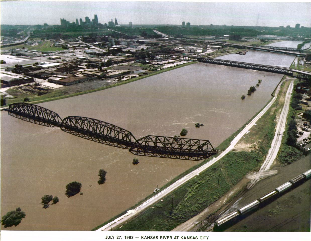
During the historic flooding of the Kansas City metro region in 1993, the area’s extensive system of levees and flood walls came within inches of overtopping, a nightmare scenario that could have caused catastrophic flooding for tens of thousands of people living and working behind the levees. Although the structures performed as designed, the U.S. Army Corps of Engineers and its nonfederal partners subsequently examined the system and determined that additional improvements to the levees were economically justified.
This finding began a long-term process of planning and developing multiple improvements, collectively known as the Kansas Citys Levees Project.
Critical test
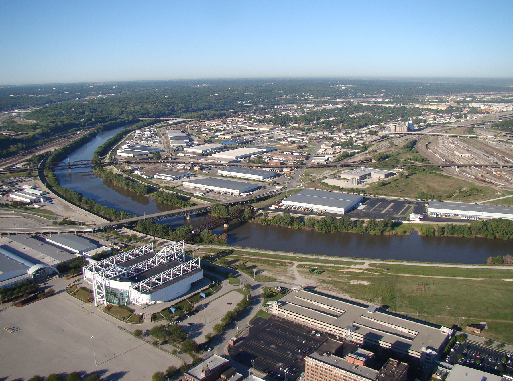
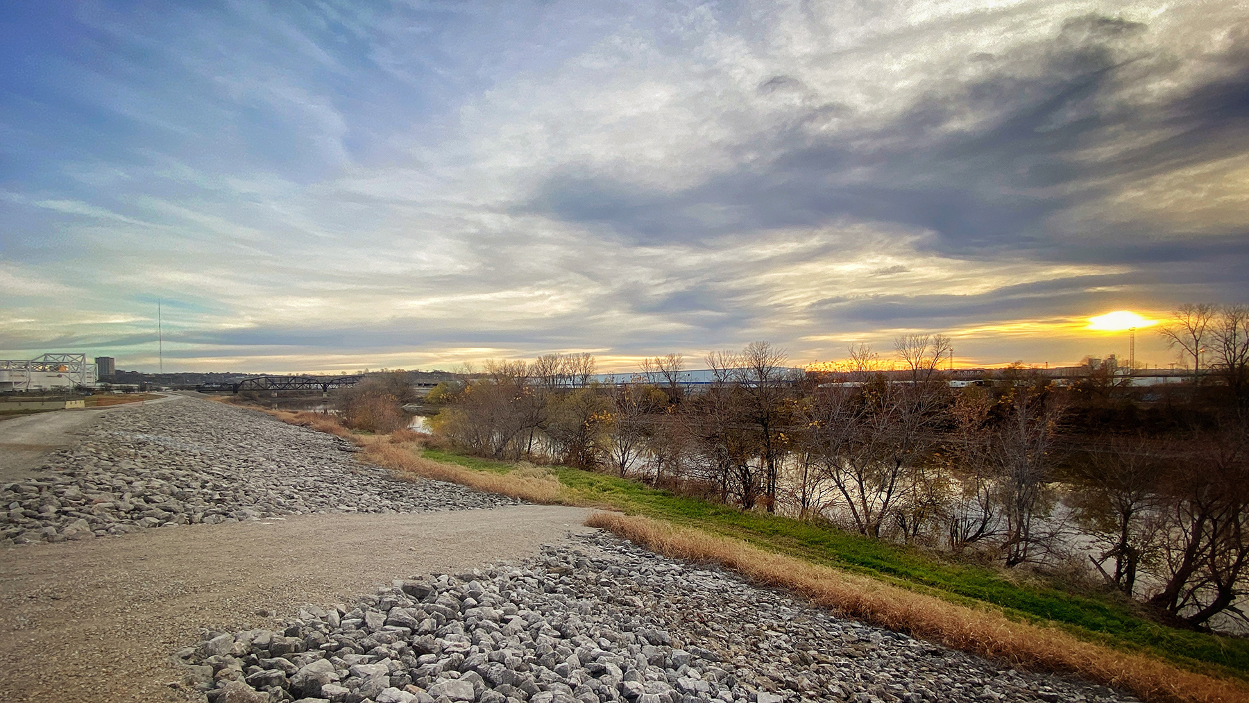
Approximately 60 mi of levees and flood walls extend along both banks of the Kansas and Missouri rivers in Kansas City, Kansas, and Kansas City, Missouri. Consisting of seven separate levee units, the system of levees and flood walls reduces the risk of flooding within a 32 sq mi area that includes industrial, commercial, and residential sections. A nationally critical hub of manufacturing, distribution, transportation, and warehousing, the area includes approximately 7,000 structures and $25 billion in investments, including one of the largest railroad networks in the nation.
In 1993, the area levees “performed as designed” although the flood levels nearly exceeded the system’s design capacity, says Scott Mensing, P.E., the program manager for the K.C. Levees Project within the Corps’ Kansas City District. “At the peak of the crest, the levees along the Kansas River had approximately 4 in. of freeboard at the lowest spot on the levee system,” Mensing says. “It was as close to a full loading as you could see,” he says.
Although the system withstood the dramatic test, portions of it required repairs in the wake of the flooding.
Meanwhile, the local sponsors that own and operate the individual units asked the Corps to evaluate whether improvements were needed to ensure the levee system’s continued successful performance during future floods. “Studies showed there was a justifiable project for us to raise the levees along the Missouri and Kansas rivers within the Kansas City metropolitan area,” Mensing says. “This was an opportunity to bring these levee units up to current USACE design and levee safety criteria, including underseepage, stability, and resiliency.”
Upgrading the levees
The Corps, with input from the local sponsors, evaluated dozens of alternatives, conducted environmental reviews, and submitted the preferred alternatives for review and approval. Once approved by the Corps, the improvements were authorized by Congress. Incremental federal funding during this period, combined with the need for sponsors to obtain matching funds, added to the time needed to complete the project, Mensing says.
About 15 years ago, construction began on improvements to the Fairfax–Jersey Creek, North Kansas City, and East Bottoms levee units along the Missouri River. Ultimately completed in 2018, these improvements took the form of relief wells, underseepage berms, flood wall modifications, and rock stabilization.
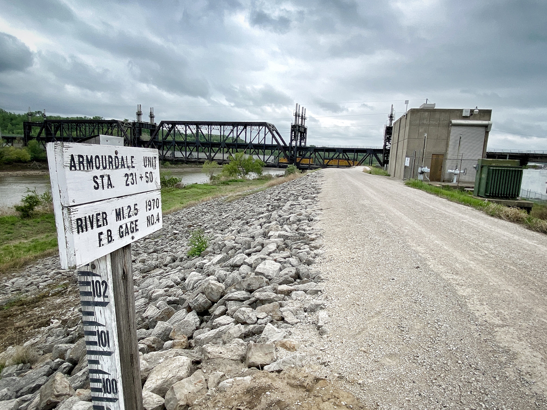
The final component of the K.C. Levees Project involves the Argentine, Armourdale, and Central Industrial District levee units along the Missouri and Kansas rivers. Comprising approximately 16 mi of levees and flood walls, the three levee units reduce the risk of flooding to about 27,000 people, approximately 2,700 businesses and structures, and nearly $10 billion of infrastructure.
Originally constructed by nonfederal entities in the early 1900s, the three levee units were added onto multiple times. Between the 1940s and the 1970s, the Corps assumed responsibility for designing and constructing expansions of the levees. Since then, operations and maintenance of the levees have been the responsibility of the following local sponsors: the Kaw Valley Drainage District; the Unified Government of Wyandotte County and Kansas City, Kansas; and the city of Kansas City, Missouri.
A $529 million project
The final component of the K.C. Levees Project entails major improvements to the Argentine, Armourdale, and Central Industrial District levee units. In general, the $529 million effort entails raising all 16 mi of levees and flood walls, replacing two existing pump stations on the Argentine levee unit, making structural modifications to 11 other pump stations, and modifying, relocating, or abandoning nearly 200 utilities.
Slightly more than 16 mi of levees and flood walls will be raised between 2 and 7 ft, with an average increase of 5 ft, Mensing says. To reduce the risk of underseepage along the levees, the Corps intends to construct clay berms and add 130 relief wells that extend down to bedrock. Sheet-pile cutoff walls will be used to control underseepage along flood walls and closures.
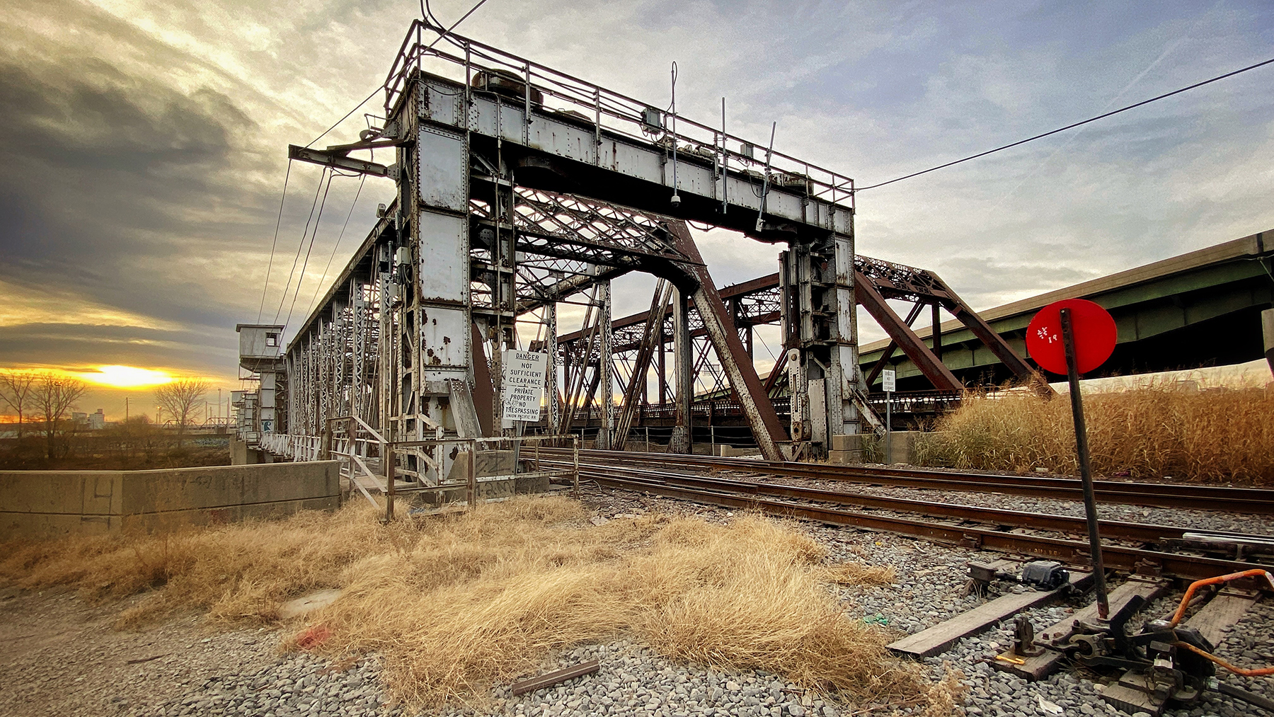
Twelve critical closure structures along high-traffic railroad lines that are used to seal off the openings for the rail track in instances of flooding also will be replaced in order to help reduce flood risk in “one of the largest rail hubs in the nation,” Mensing says. In addition to the rail hub, the leveed areas also contain a “nationally critical warehouse, distribution, and transportation center,” he says.
Full funding fuels aggressive schedule
Originally, the Corps estimated that design and construction of the improvements to the three levee units would take approximately 15 years, Mensing says. Fortunately, Congress provided upfront funding to enable the Corps to proceed much faster. As part of the Bipartisan Budget Act of 2018, Congress fully funded the $529 million needed to complete the K.C. Levees Project.
“Full federal funding upfront allowed us to be really aggressive with our schedule and allowed the team to deliver the project sooner to the community,” Mensing says. In fact, design work was completed in two years, rather than the originally anticipated five, and the project now is expected to be complete in only seven years, rather than 15.
Design work began in 2018 on the improvements to the three levee units along the Kansas River. Given the magnitude of the project and the push to deliver it as fast as possible, the Corps “reviewed every option available to build a collaborative team consisting of the most technically qualified staff and partners able to complete the effort,” Mensing says. Ultimately, the Corps teamed with more than 250 engineers, geologists, surveyors, specialists, construction managers, and project managers to complete the design in less than half the time originally planned.
Key participants during the design phase included Midland Surveying Inc., which conducted the existing conditions analysis and survey; Terracon, which performed drilling and geotechnical sampling and testing; and the HNTB Corp., which designed a large portion of the levee raising efforts. Affinis and HDR Inc. designed the pump station upgrades to be made on the Armourdale and Central Industrial District levee units. Strategic Value Solutions Inc. provided value engineering services, while RJH Consultants Inc. conducted external reviews.
‘200% reduction in flood risk’
In general, the existing levee units along the Kansas River were designed to accommodate an approximately 330-year flood event, Mensing says. As part of the project, the levees are now being raised to accommodate an approximately 650-year flood event. At the same time, the improvements pertaining to stability and underseepage and the pump station replacements and modifications will further reduce the risk of flooding. “In total, we’re estimating an approximately 200% reduction in flood risk,” Mensing says.
In April, the Corps awarded a $258 million construction contract, including future options, for the remaining levee and flood wall improvements to Lane Construction Corp., the U.S. subsidiary of Webuild S.p.A. The notice to proceed was issued in July, says Pablo Mattos, the project director for Lane. Construction is scheduled to conclude in 2026.
Separately, the Michels Corp. is fully replacing two pump stations on the Argentine levee unit and modifying a third pump station on the same levee unit. Michels is performing the work under the terms of a $33.3 million design-build contract awarded by the Corps in 2019. The work is underway and scheduled to be completed in late 2022. Meanwhile, Supplied Industrial Solutions Inc. is repairing and strengthening a total of 10 pump stations on the Armourdale and Central Industrial District levee units.