
 Freese and Nichols
In many communities, walking and cycling shape how residents move around and how places function. Increasingly, regions where motorists still dominate are recognizing that residents want other options for getting around.
Civil engineers can help achieve mobility that serves evolving expectations with intentional design, thoughtful infrastructure, and an understanding of how the public perceives safety.
Further reading:
- How infrastructure can support the growing US cycling movement
- Making our streets safer with proven highway safety countermeasures
- New York City pedestrian tunnel pushes engineering boundaries
Four projects in Oklahoma and Texas demonstrate how measures like medians, shared-use paths, protected intersections, and road diets can expand mobility while improving safety.
People are more likely to walk or bike when they feel protected and encouraged to use their transportation of choice. Design that creates environments where everyone feels safe produces more road sharing and active travel.
The importance of safety, both real and perceived, can’t be overstated. Pedestrians and cyclists feel safer when infrastructure protects them from cars and trucks and accommodates all transportation modes. The perception that bicycling or walking on certain roads is hazardous can be difficult to overcome.
That’s why planners should aim to visibly and functionally separate pedestrians and cyclists from vehicle traffic, particularly where conflicts are most likely. Data shows that about 7,000 pedestrians and 1,000 bicyclists die in collisions with motor vehicles each year in the U.S. Many of the fatalities happen at intersections.
Communities in regions where cars and trucks have long ruled the roads are doing more to adjust their transportation networks to support safe, connected, and people-centered mobility. These kinds of improvements don’t have to be major overhauls; a relatively small adjustment can have significant impact.
The following examples offer guidance for cities wanting to integrate pedestrian-friendly design into complex roadway projects.
Adding medians for safer mobility
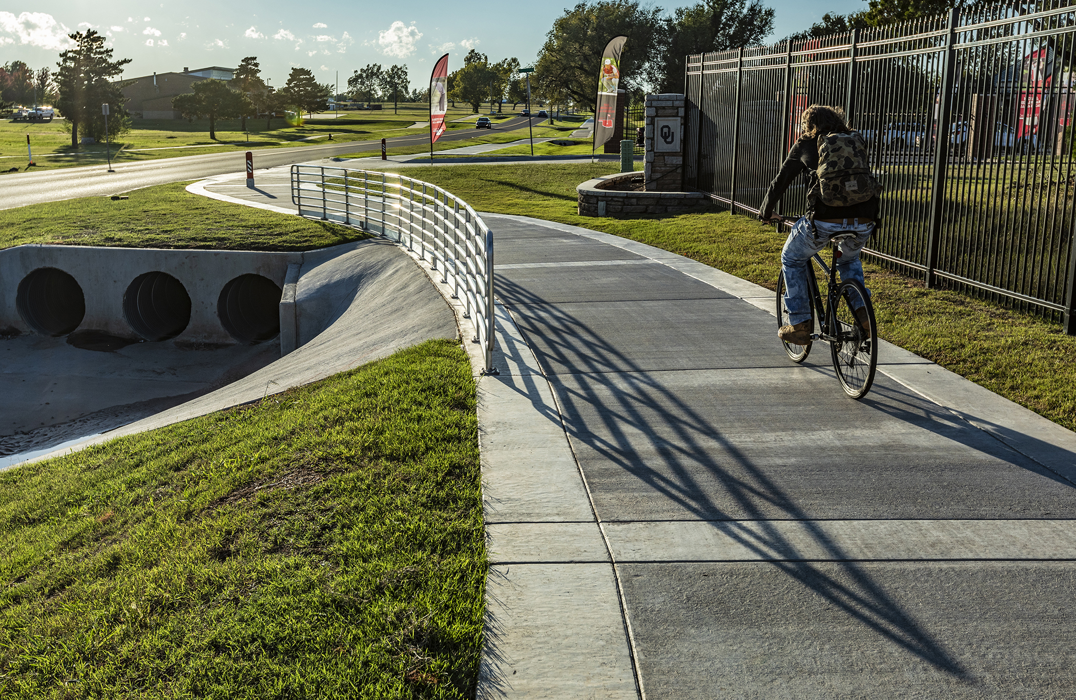
In Norman, Oklahoma, a thriving college town of about 132,000 residents that is 19 miles south of Oklahoma City, Jenkins Avenue plays a central role in moving people between the University of Oklahoma’s campus, athletic facilities, and surrounding park space. Along roughly 1 mile of the corridor, traffic operations and safety conditions were carefully evaluated, leading to the introduction of landscaped medians and dedicated multimodal facilities designed to improve safety while maintaining mobility.
The redesigned roadway maintains four travel lanes but organizes them with a raised median that varies from 11 to 15 feet wide. That adjustment significantly changes how the corridor functions.
The medians reduce midblock turning conflicts, discourage sudden lane changes, and lower speed variability between lanes. The changes improve predictability, particularly during peak and event conditions.
Mobility along Jenkins is not limited to vehicles.
A 10-foot, shared-use path on the east side and an 8-foot sidewalk on the west establish dedicated, separated space for pedestrians and bicyclists traveling between campus and adjacent facilities. Rather than sharing space with moving traffic, nonmotorized users now have defined facilities that align with the corridor’s high activity levels. Intersection modifications, including a roundabout and realigned side streets, further reduce vehicle conflict points while maintaining flow.
Once construction is complete, the corridor will continue to function efficiently for vehicles while providing clearer separation and safer infrastructure for multimodal travel.
Trading traffic lanes for a sidewalk trail
The improvements along Constitution Street in Norman complement the Jenkins Avenue changes by strengthening east-west mobility near the OU campus.
Corridor evaluations showed that portions of the existing four-lane roadway created long pedestrian crossings and multiple vehicle conflict points without delivering proportionate operational benefit. The planned conversion to a three-lane section with one lane in each direction and a 12-foot, two-way left-turn center lane should improve access management, create more predictable traffic flow, and shorten crossing distances.
 Freese and Nichols
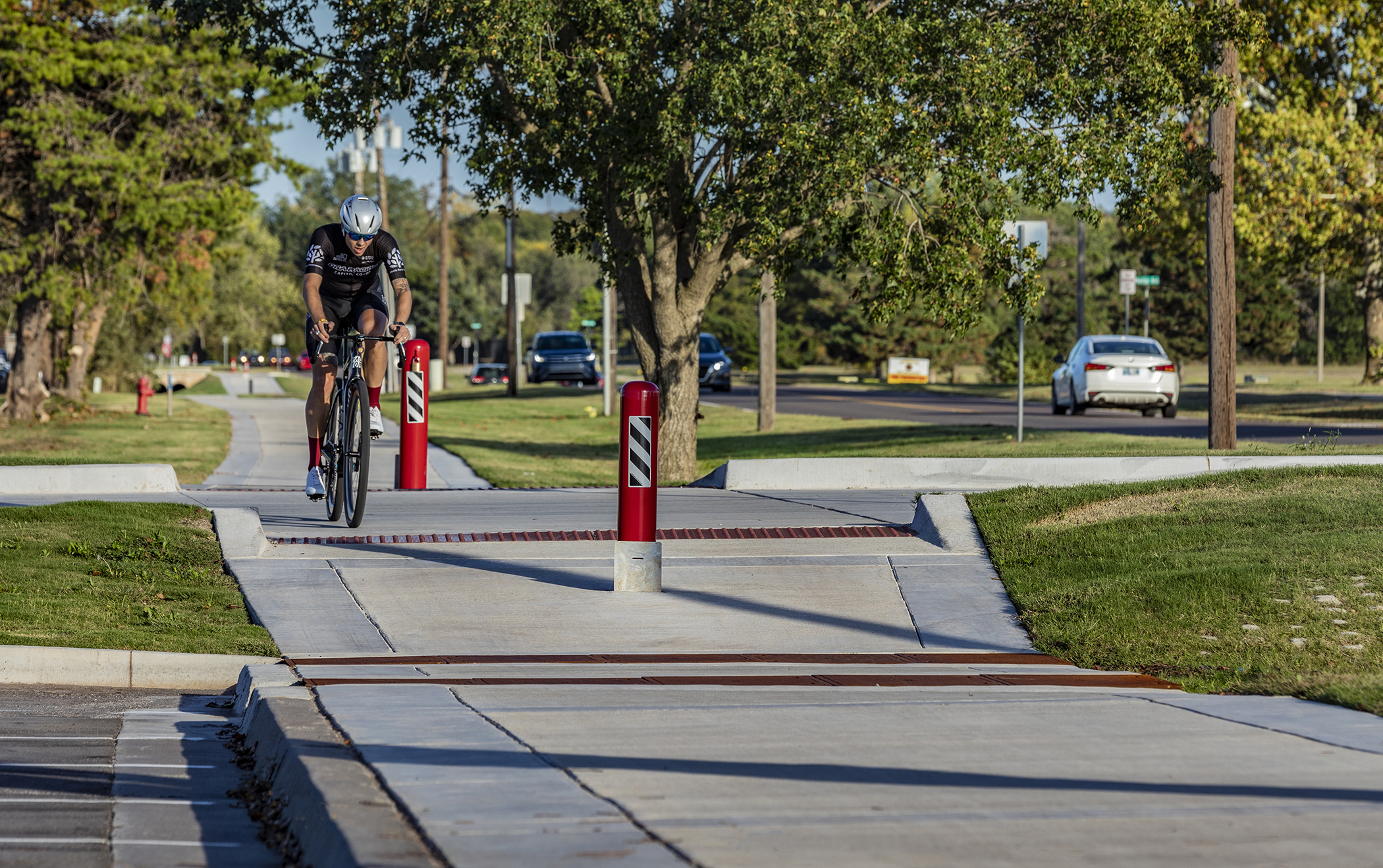
In advance of the full roadway reconstruction, a 10-foot, shared-use path was constructed along the north side of Constitution Street from Jenkins Avenue to Classen Boulevard. The new path replaced an undersized one that no longer accommodated the high pedestrian and bicycle volumes traveling between campus and surrounding residential areas.
The trail includes at-grade railroad crossing enhancements, drainage improvements, and careful evaluation of bridge crossing options to provide a continuous, accessible route. The shared-use path has been completed, while the remaining roadway improvements are being designed.
Federal Highway Administration studies show that reallocating road space in this manner leads to meaningful safety improvements, including fewer crashes and safer crossings for pedestrians, while strengthening connectivity and accessibility.
With the pairing of the completed trail with a planned three-lane roadway configuration, Constitution Street is evolving into a corridor that better balances vehicle operations with the mobility needs of pedestrians and bicyclists.
Making an old intersection bicycle-friendly
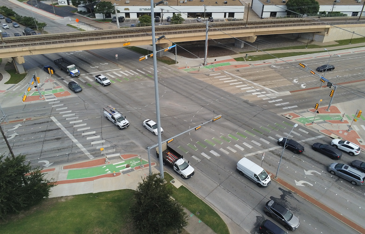
In Richardson, Texas, a growing suburb of 119,000 residents and home to the University of Texas at Dallas, Greenville Avenue, a major thoroughfare, had on-street buffered bike lanes, but they crossed over the vehicular right-turn lane to continue through the intersection with Arapaho Road, another major roadway.
Bicyclists and pedestrians faced challenging conditions because of an older design that resulted in poor visibility and turning conflicts. Because of the roadway’s width, vulnerable users had to cover long distances to cross the street.
The city updated the intersection with a series of protected intersection improvements consistent with guidelines from the National Association of City Transportation Officials and FHWA. The changes include:
- Corner refuge islands separating cyclists from turning vehicles
- Dedicated bicycle crossing markings through the intersection
- Americans with Disabilities Act-compliant curb ramps aligned with pedestrian crosswalks
- Modernized signal detection and control equipment
Designers bolstered safety without compromising functionality by reducing turning conflicts, making sight lines clearer, reinforcing separation and yielding at the corner islands, and making the signals more responsive for all users.
 Freese and Nichols
Putting a truck route on a road diet
A 1.5-mile stretch of Martin Luther King Jr. Boulevard running through southern Dallas is designated as a truck route. It also includes a city bus route and is used by motorists, pedestrians, and cyclists going to businesses and services along the corridor. The mix of locations on the boulevard includes significant cultural assets, such as the Dallas Civil Rights Museum, the historic Forest Theater, a library, community center, and high school.
The roadway also provides access to bustling Interstate 45, a bridge crossing the Trinity River, and the Texas State Fair grounds. But it needs community-focused improvements that encompass safer multimodal connectivity and calm traffic.
To achieve this, the city plans to narrow the overly wide arterial roadway to eliminate most of the continuous curbside parking and reallocate that space to a greatly improved pedestrian zone with shared-use paths, enhanced landscaping, and lighting. The design recommends truck-diversion strategies, including removing the truck route designation from part of the road along the predominantly residential and local business portion beyond the I-45 interchange.
Anticipated changes include a new traffic signal, two pedestrian hybrid beacons, and two lateral deflection central islands that would help calm traffic and improve pedestrian crossings. The redesign balances the needs of vehicles, cyclists, and pedestrians by implementing the city's Complete Streets program.
Given the multiple stakeholders with direct interests in this major corridor, the project involved continued community engagement about visions for improving the corridor. That local involvement helped achieve strong buy-in for the design, which will be useful in the next stages of attaining regulatory clearance for the changes.
Making communities more pedestrian-friendly
These projects and others like them point to consistent principles that help communities create safer, more effective walking and biking environments:
- Design for everyday trips, not just recreation.
- Prioritize safety and comfort, the strongest drivers of walking and biking.
- Apply context-sensitive design, recognizing differences among downtowns, neighborhoods, and corridors.
- Integrate active transportation early in planning and development because retrofitting can be costly and difficult.
- Consider the long-term physical, mental, environmental, and economic benefits to communities.


