For over a decade, the Utility Engineering & Surveying Institute (UESI) has brought together professionals across surveying, geomatics, pipelines, and utility engineering to advance the state of practice, strengthen professional communities, and shape the future of civil infrastructure.
Within this broad mission, the Surveying & Geomatics Division champions innovation, education, and technical leadership across the geospatial disciplines.
Today, the division continues to expand its reach through technical committee work, student programs, publications, conferences, and professional development opportunities that elevate the entire surveying and geomatics profession.
Advancing the profession through leadership and technical committees
UESI offers professionals working within the utility, pipeline engineering, and surveying/geomatics communities the opportunity to network with others and shape the future of the industry by participating in technical activities, conferences, and the development of internationally recognized standards.
The Surveying & Geomatics Division:
- Helps develop renowned publications and guidelines, including MOP 152: Surveying and Geomatics Engineering: Principles, Technologies, and Applications, and policy statements defining and advocating for surveying as a core competency of civil engineering
- Organizes educational content in the form of quarterly webinars
- Provides forums for practitioners to collaborate on emerging challenges in geospatial data, utility mapping, and engineering surveying
There are a number of ways to get involved in the division and contribute to the advancement of the industry, including through:
- The Surveying & Geomatics Division Executive Committee
- The Surveying & Geomatics Division Education Committee
- The Surveying Committee
- The Underwater Technologies Committee
A legacy of scholarship: The Journal of Surveying Engineering

Among UESI’s most influential contributions is stewardship of the Journal of Surveying Engineering (JSU), one of ASCE’s flagship journals and one of the oldest, most respected publications in the field. The journal covers the broad spectrum of surveying and mapping activities encountered in modern geomatics practice and includes traditional topics such as construction surveys, geodetic and control surveys, and photogrammetric mapping, as well as newer developments pertinent to the surveying engineering community such as 3D laser scanning/lidar, computer vision-enhanced photogrammetry, and advanced topographic and bathymetric mapping technologies, among others.
The JSU recently celebrated its 150th volume milestone, underscoring its long‑standing role in advancing research in surveying, geomatics, lidar, photogrammetry, geodesy, UAS, and spatial data science.
To commemorate the hard work of the community members that contribute to the journal, ASCE Publishing recently selected the 2025 Outstanding Reviewers, as well as the 2025 Best Paper Award for the journal.
The journal continues to serve as a platform for cutting-edge research and a bridge between academic innovation and professional practice, empowering the role of surveying engineering professionals in a geospatially empowered information society.
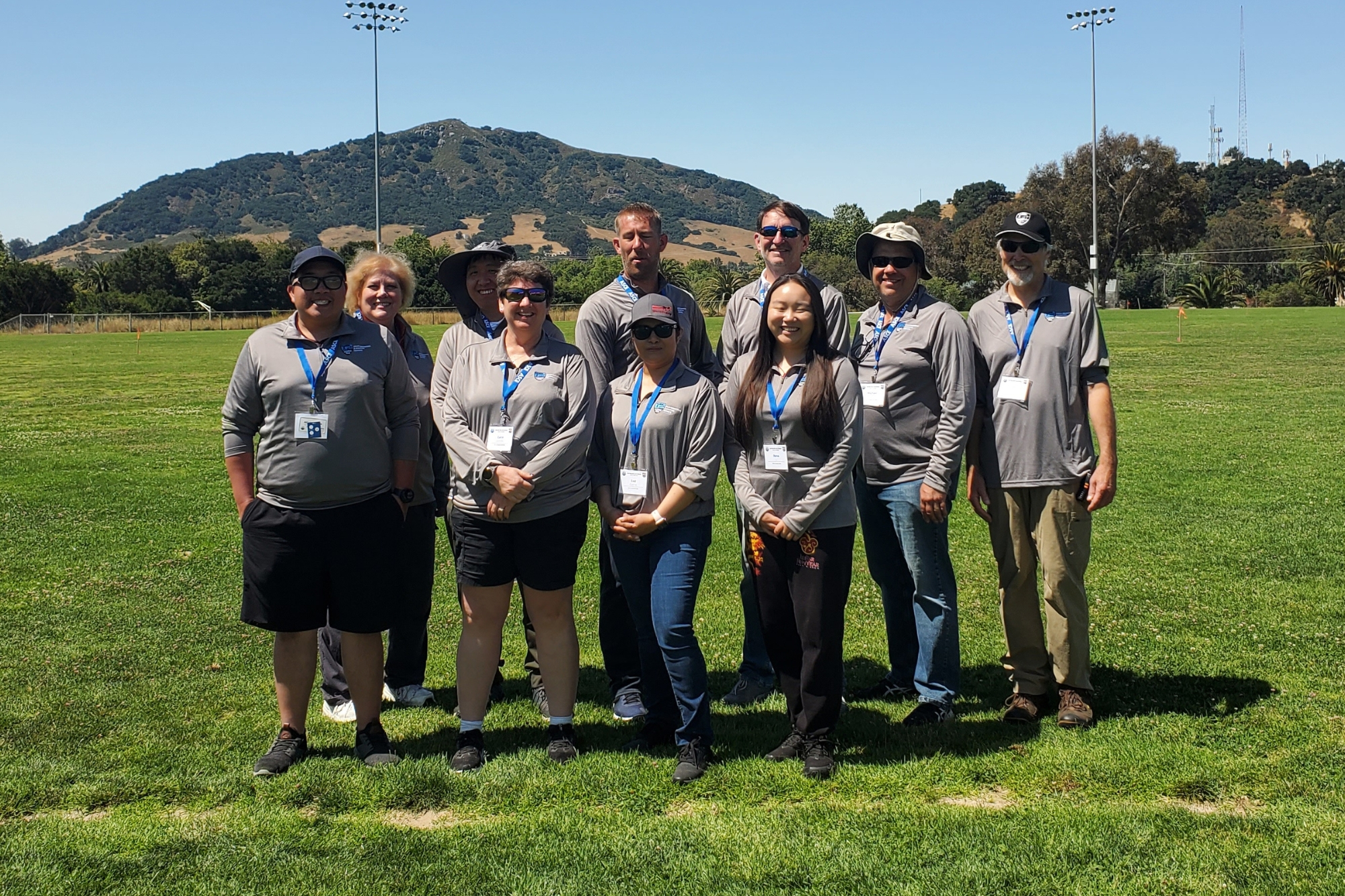
Inspiring the next generation: the ASCE UESI Student Surveying Championships
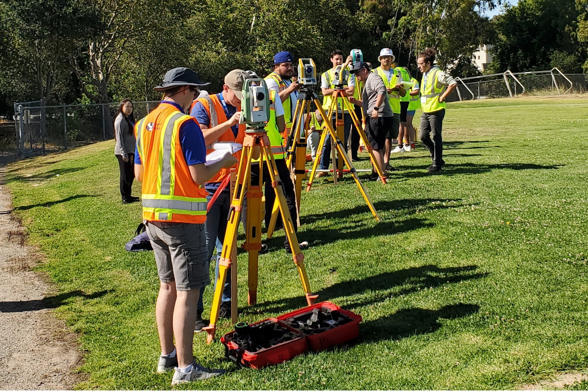
UESI’s commitment to education extends to the annual ASCE Student Symposia Competitions, where the ASCE UESI Student Surveying Competition challenges students to demonstrate practical skills across various civil engineering disciplines while showcasing teamwork and problem-solving abilities.
More than 90 student chapters come together to participate in the competition, describing the experience as a spirited mix of competition, camaraderie, and connection.
UESI is proud that these competitions help cultivate the next generation of surveying and geomatics professionals.
The Surveying Competition Championships will be held at the 2026 ASCE Civil Engineering Student Championships, taking place June 25-27, 2026, at Fairmont State University in Fairmont, West Virginia.
Here are the student teams competing in this year’s ASCE UESI Student Surveying Competition Championships:
- Auburn University
- California Baptist University
- Christian Brothers University
- Clemson University
- Colorado School of Mines
- Fairmont State University
- Oregon State University
- Penn State University
- Purdue University West Lafayette
- Southern Illinois University - Carbondale
- Stony Brook University
- The University of Akron
- University of Florida
- University of Illinois at Chicago
- Utah State University
- Vellore Institute of Technology
- West Texas A&M University
- West Virginia University
- Western New England University
A gathering of geospatial leaders: The UESI Surveying & Geomatics Conference
Every few years, the Surveying & Geomatics Division brings together practitioners, researchers, educators, and students for the UESI Surveying & Geomatics Conference.
The most recent conference, held in Corvallis, Oregon, June 2–4, 2024, offered:
- A theme centered on “Surveying: the Foundation for Geospatial Data Fusion”
- Thought-provoking technical sessions on remote sensing, UAS, geodetic control, lidar, and utility surveying, among others
- Up to 19 PDHs for attendees
- Collaboration with Oregon State University, the Surveying and Geomatics Educators Society (SaGES), and the American Association for Geodetic Surveying (AAGS)
Conference papers were later featured in a special collection of the Journal of Surveying Engineering, reinforcing the event’s role in advancing scholarly and professional knowledge.
A community moving forward
From its technical committees to its scholarly publications, from student competitions to national conferences, the Surveying & Geomatics Division continues to strengthen the geospatial profession and support the engineers, surveyors, and researchers who shape our understanding of the built and natural world.
As UESI looks toward its next decade of innovation, the Surveying & Geomatics Division remains at the forefront, advancing excellence, fostering community, and charting the future of geospatial engineering.