
Written by Lisa Dietrich, GHD, and published in the 2021 Winter Currents
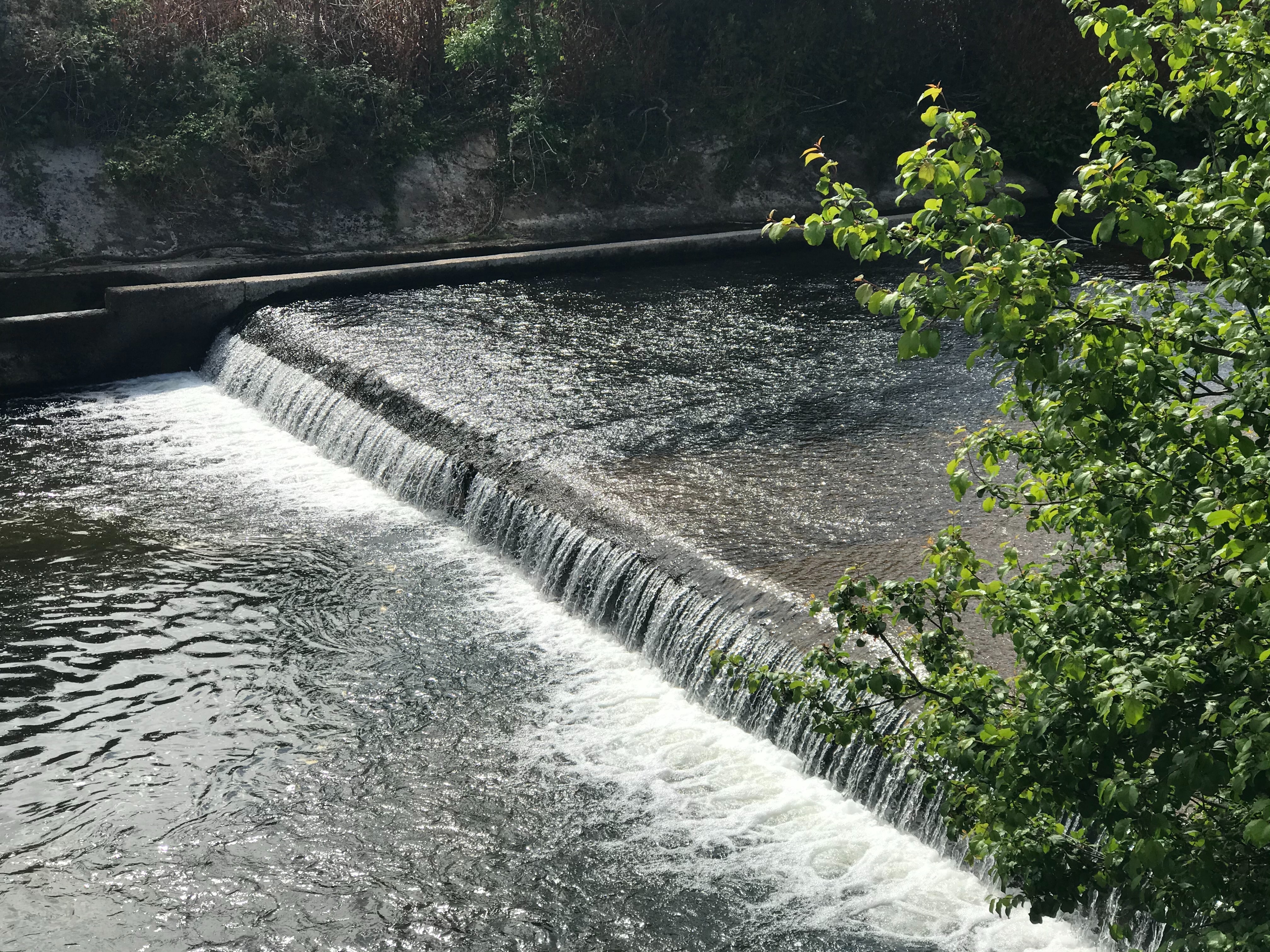
Low head dams are deceptively dangerous and pose a threat to outdoor enthusiasts no matter the level of experience when their location is unknown and unexpected. A calm stream of water can quickly become turbulent with powerful currents at a low head dam, as pictured above, causing devastating injuries and even fatalities. Though there has been a growing awareness about low head dams in recent years, there is no single source of all low head dam locations in the United States. Recognizing this gap of information, a group of multi-organizational professionals formed the National Low Head Dam Inventory Task Force headed by Professor Rollin Hotchkiss from BYU University, Manuela Johnson from Indiana Department of Homeland Security and Professor Brian Crookston from Utah State University. Within this group there are various subcommittees representing all aspects of the Civil Engineering profession from consulting, academia to government.
Of the various subcommittees in the task force, one is the development and testing of apps to collect field information on these low head dams. The intent is for users to easily document the coordinates and photo of a low head dam using their mobile device. The group is capturing locations through other means such as existing state inventories, Google Earth and machine learning techniques.
Currently there are two apps explored by the subcommittee – a web-based app and
Survey123 app. The web-based app is being piloted and can be accessed by using the QR code at the end of this article. The collected data is mapped as shown below,
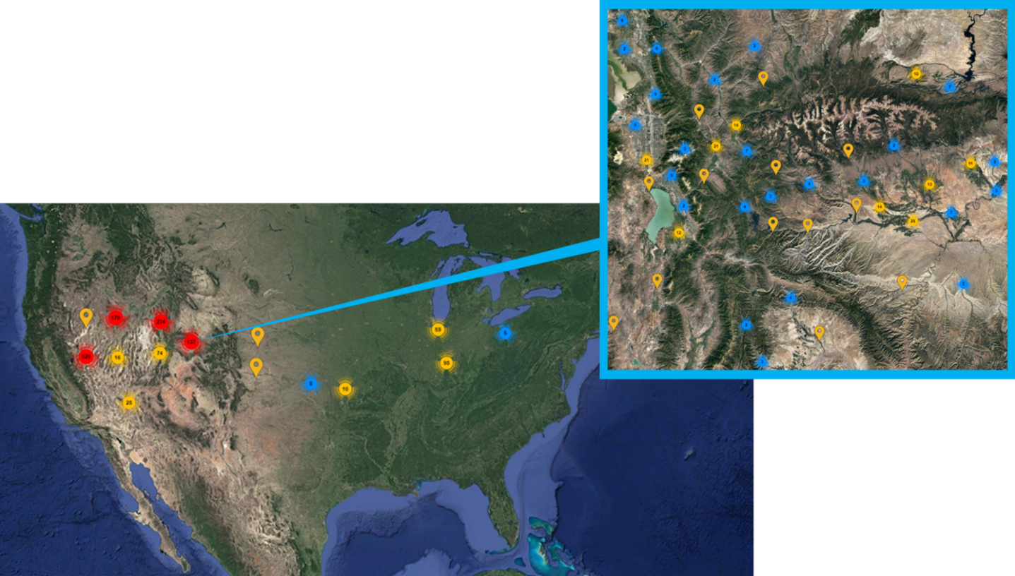

with location icons consolidated when looking at the entire country and individual locations visible with a closer look. Ultimately, the goal is to fill the entire map with all low head dam locations in the country to serve as a living tool for government entities, outdoor organizations, engineers, and the general public.
The importance of field verification and a recent, boots on the ground photo is understood by all engineers for informed decision making. Each entry on the app is a contribution towards greater low head dam safety. The condition and level of danger can be assessed through the submitted photo leading to action such as a warning sign. The subcommittee asks for your contribution by spreading the word about the opportunity to capture a low head dam using the QR code to make an entry. If your work or personal hobbies involves frequent encounters with low head dams, we are especially interested in your involvement to use the Survey123 app for collection. A few minutes taken to capture a low head dam is invaluable when it could lead to a difference of a life being saved because the location was known and appropriate corrective actions were taken to improve safety. With virtual collaboration at its height, the feat of this task force is possible and truly exciting to be a part of. Please reach out to Lisa Dietrich, [email protected], for further information or if you are able to support the pilot of the Survey123 app.

Scan this QR code with your phone to access the web-based low head dam inventory project.